Upton, Massachusetts
| Upton, Massachusetts | ||
|---|---|---|
| Town | ||
|
Upton Town Hall | ||
| ||
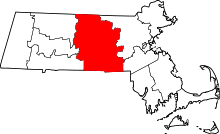
 Location in Worcester County and the state of Massachusetts. | ||
| Coordinates: 42°10′28″N 71°36′10″W / 42.17444°N 71.60278°WCoordinates: 42°10′28″N 71°36′10″W / 42.17444°N 71.60278°W | ||
| Country | United States | |
| State | Massachusetts | |
| County | Worcester | |
| Settled | 1728 | |
| Incorporated | 1735 | |
| Government | ||
| • Type | Open town meeting | |
| • Town Manager | Blythe C. Robinson | |
| • Board of Selectmen |
Robert J. Fleming Gary T. Daugherty,Jr. James A. Brochu | |
| Area | ||
| • Total | 21.7 sq mi (56.3 km2) | |
| • Land | 21.5 sq mi (55.7 km2) | |
| • Water | 0.2 sq mi (0.5 km2) | |
| Elevation | 301 ft (92 m) | |
| Population (2000) | ||
| • Total | 7,542 | |
| • Density | 262.2/sq mi (101.2/km2) | |
| Time zone | Eastern (UTC-5) | |
| • Summer (DST) | Eastern (UTC-4) | |
| ZIP code | 01568 | |
| Area code(s) | 508 / 774 | |
| FIPS code | 25-71480 | |
| GNIS feature ID | 0618386 | |
| Website | www.uptonma.gov/ | |


Upton is a town in Worcester County, Massachusetts, United States. It was first settled in 1728. The population was 7,542 at the 2010 census, with over 2,100 households.
For geographic and demographic information on the census-designated place Upton-West Upton, see: Upton-West Upton, Massachusetts.
History
Upton was originally the home of the Nipmuc, who inhabited most of central Massachusetts. The town was first settled in 1728 and was officially incorporated in 1735.
Upton was home to a number of members of the Taft family, including an American Revolutionary War soldier named Samuel Taft, who was born there.[1] Samuel Taft had 22 children and hosted President George Washington on his inaugural tour of New England in 1789.[2] Three-term mayor of Worcester, historian Judge Henry Chapin was born here on May 13, 1811.[2]
Between 1730 and 1850, Upton had many small shoe shops, called ten–footers. These operations were gradually merged into large assembly-line manufacturing companies. By 1837, Upton produced 21.7% of the boots made in Worcester County.[3]
William Knowlton founded what was to become the world’s largest women's hat factory: Knowlton Hat Factory was built in 1872 and added to the National Historic Register in 1982.[3]
Geography
According to the United States Census Bureau, the town has a total area of 21.7 square miles (56 km2), of which 21.5 square miles (56 km2) are land and 0.2-square-mile (0.52 km2) (0.97%) is water.
Adjacent towns
 |
Grafton | Westborough | Hopkinton | |
| |
Milford | |||
| ||||
| | ||||
| Northbridge | Mendon | Hopedale |
Demographics
| Historical population | ||
|---|---|---|
| Year | Pop. | ±% |
| 1850 | 2,023 | — |
| 1860 | 1,986 | −1.8% |
| 1870 | 1,989 | +0.2% |
| 1880 | 2,023 | +1.7% |
| 1890 | 1,878 | −7.2% |
| 1900 | 1,937 | +3.1% |
| 1910 | 2,071 | +6.9% |
| 1920 | 1,693 | −18.3% |
| 1930 | 2,026 | +19.7% |
| 1940 | 2,249 | +11.0% |
| 1950 | 2,656 | +18.1% |
| 1960 | 3,127 | +17.7% |
| 1970 | 3,484 | +11.4% |
| 1980 | 3,886 | +11.5% |
| 1990 | 4,677 | +20.4% |
| 2000 | 5,642 | +20.6% |
| 2010 | 7,542 | +33.7% |
Source: United States Census records and Population Estimates Program data.[4][5][6][7][8][9][10][11][12][13] | ||
By the 2010 census, the population had reached 7,542.
As of the census[14] of 2000, there were 5,642 people, 2,042 households, and 1,562 families residing in the town. The population density was 262.2 people per square mile (101.2/km²). There were 2,084 housing units at an average density of 96.9 per square mile (37.4/km²). The racial makeup of the town was 96.34% White, 3.46% African American, 0.07% Native American, 0.97% Asian, 0.30% from other races, and 0.83% from two or more races. Hispanic or Latino of any race were 0.73% of the population.
There were 2,042 households, out of which 42.1% had children under the age of 18 living with them, 67.9% were married couples living together, 6.7% had a female householder with no husband present, and 23.5% were non-families. 19.0% of all households were made up of individuals and 7.6% had someone living alone who was 65 years of age or older. The average household size was 2.74 and the average family size was 3.17.
In the town the population was spread out, with 29.1% under the age of 18, 4.3% from 18 to 24, 35.0% from 25 to 44, 22.2% from 45 to 64, and 9.5% who were 65 years of age or older. The median age was 37 years. For every 100 females there were 95.6 males. For every 100 females age 18 and over, there were 92.7 males.
The median income for a household in the town was $78,595, and the median income for a family was $89,251. Males had a median income of $66,734 versus $39,224 for females. The per capita income for the town was $34,924. About 1.8% of families and 3.5% of the population were below the poverty line, including 4.1% of those under age 18 and 4.7% of those age 65 or over.
Notable areas
The Upton Town Library was founded in March 1871.[15][16]
The Upton Fire Department was incorporated at Town Meeting on April 9, 1839, and has served Upton and its residents faithfully for 175 years.
There are three different schools in Upton. Memorial Elementary School and Nipmuc Regional High School are part of the public school system of the Mendon-Upton Regional School District. Blackstone Valley Regional Vocational Technical High School is a trade school open to the surrounding towns.
Government
| County-level state agency heads | |
|---|---|
| Clerk of Courts: | Dennis P. McManus (D) |
| District Attorney: | Joseph D. Early, Jr. (D) |
| Register of Deeds: | Anthony J. Vigliotti (D) |
| Register of Probate: | Stephanie K. Fattman (R) |
| County Sheriff: | Lew Evangelidis (R) |
| State government | |
| State Representative(s): | David Muradian (R) |
| State Senator(s): | Michael O. Moore (D) |
| Governor's Councilor(s): | Jen Caissie (R) |
| Federal government | |
| U.S. Representative(s): | 2nd District |
| U.S. Senators: | Elizabeth Warren (D), Ed Markey (D) |
References
- ↑ Mass., Uxbridge (1851). Vital Records of Uxbridge, Massachusetts to the Year 1850. Thomas Williams Baldwin. pp. 409,. Retrieved 2007-10-27.
- 1 2 Chapin, Judge Henry (1881). Address Delivered at the Unitarian Church in Uxbridge; 1864. Worcester, Mass.: Charles Hamilton Press (Harvard Library; from Google Books).
- 1 2 http://www.nps.gov/blac/planyourvisit/upload/Upton%20Tour-rev.pdf Upton, MA Walking Tour Archived November 6, 2012, at the Wayback Machine.
- ↑ "TOTAL POPULATION (P1), 2010 Census Summary File 1". American FactFinder, All County Subdivisions within Massachusetts. United States Census Bureau. 2010.
- ↑ "Massachusetts by Place and County Subdivision - GCT-T1. Population Estimates". United States Census Bureau. Retrieved July 12, 2011.
- ↑ "1990 Census of Population, General Population Characteristics: Massachusetts" (PDF). US Census Bureau. December 1990. Table 76: General Characteristics of Persons, Households, and Families: 1990. 1990 CP-1-23. Retrieved July 12, 2011.
- ↑ "1980 Census of the Population, Number of Inhabitants: Massachusetts" (PDF). US Census Bureau. December 1981. Table 4. Populations of County Subdivisions: 1960 to 1980. PC80-1-A23. Retrieved July 12, 2011.
- ↑ "1950 Census of Population" (PDF). Bureau of the Census. 1952. Section 6, Pages 21-10 and 21-11, Massachusetts Table 6. Population of Counties by Minor Civil Divisions: 1930 to 1950. Retrieved July 12, 2011.
- ↑ "1920 Census of Population" (PDF). Bureau of the Census. Number of Inhabitants, by Counties and Minor Civil Divisions. Pages 21-5 through 21-7. Massachusetts Table 2. Population of Counties by Minor Civil Divisions: 1920, 1910, and 1920. Retrieved July 12, 2011.
- ↑ "1890 Census of the Population" (PDF). Department of the Interior, Census Office. Pages 179 through 182. Massachusetts Table 5. Population of States and Territories by Minor Civil Divisions: 1880 and 1890. Retrieved July 12, 2011.
- ↑ "1870 Census of the Population" (PDF). Department of the Interior, Census Office. 1872. Pages 217 through 220. Table IX. Population of Minor Civil Divisions, &c. Massachusetts. Retrieved July 12, 2011.
- ↑ "1860 Census" (PDF). Department of the Interior, Census Office. 1864. Pages 220 through 226. State of Massachusetts Table No. 3. Populations of Cities, Towns, &c. Retrieved July 12, 2011.
- ↑ "1850 Census" (PDF). Department of the Interior, Census Office. 1854. Pages 338 through 393. Populations of Cities, Towns, &c. Retrieved July 12, 2011.
- ↑ "American FactFinder". United States Census Bureau. Retrieved 2008-01-31.
- ↑ C.B. Tillinghast. The free public libraries of Massachusetts. 1st Report of the Free Public Library Commission of Massachusetts. Boston: Wright & Potter, 1891.
- ↑ http://uptonlibrary.blogspot.com/ Retrieved 2010-11-10
External links
| Wikimedia Commons has media related to Upton, Massachusetts. |