Baldwinville, Massachusetts
| Baldwinville, Massachusetts | |
|---|---|
| CDP | |
|
Baldwinville Garage | |
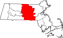
 Location in Worcester County and the state of Massachusetts. | |
| Coordinates: 42°36′37″N 72°4′31″W / 42.61028°N 72.07528°WCoordinates: 42°36′37″N 72°4′31″W / 42.61028°N 72.07528°W | |
| Country | United States |
| State | Massachusetts |
| County | Worcester |
| Area | |
| • Total | 2.5 sq mi (6.5 km2) |
| • Land | 2.5 sq mi (6.4 km2) |
| • Water | 0.0 sq mi (0.1 km2) |
| Elevation | 889 ft (271 m) |
| Population (2010) | |
| • Total | 2,028 |
| • Density | 810/sq mi (310/km2) |
| Time zone | Eastern (EST) (UTC-5) |
| • Summer (DST) | EDT (UTC-4) |
| ZIP code | 01436 |
| Area code(s) | 978 |
| FIPS code | 25-03355 |
| GNIS feature ID | 0609877 |

Baldwinville[1] is an unincorporated village and census-designated place (CDP) in the town of Templeton in Worcester County, Massachusetts, United States. The population was 2,028 at the 2010 census. The name also refers to the local post office or railroad station. Some people, perhaps confusing it with the place in New York, erroneously call it "Baldwinsville".
Geography
Baldwinville is located at 42°36′37″N 72°4′31″W / 42.61028°N 72.07528°W (42.610167, -72.075239).[2]
According to the United States Census Bureau, the CDP has a total area of 6.5 km² (2.5 mi²). 6.4 km² (2.5 mi²) of it is land and 0.1 km² (0.04 mi²) of it (0.80%) is water.
Demographics
As of the census[3] of 2000, there were 1,852 people, 677 households, and 465 families residing in the CDP. The population density was 288.3/km² (748.1/mi²). There were 700 housing units at an average density of 109.0/km² (282.8/mi²). The racial makeup of the CDP was 97.84% White, 0.16% Black or African American, 0.16% Native American, 0.49% Asian, 0.81% from other races, and 0.54% from two or more races. Hispanic or Latino of any race were 1.78% of the population.
There were 677 households out of which 33.8% had children under the age of 18 living with them, 51.4% were married couples living together, 11.1% had a female householder with no husband present, and 31.3% were non-families. 26.1% of all households were made up of individuals and 16.5% had someone living alone who was 65 years of age or older. The average household size was 2.58 and the average family size was 3.07.
In the CDP the population was spread out with 26.7% under the age of 18, 6.5% from 18 to 24, 29.5% from 25 to 44, 18.3% from 45 to 64, and 19.1% who were 65 years of age or older. The median age was 37 years. For every 100 females there were 89.0 males. For every 100 females age 18 and over, there were 83.6 males.
The median income for a household in the CDP was $41,771, and the median income for a family was $50,170. Males had a median income of $37,542 versus $25,551 for females. The per capita income for the CDP was $17,108. About 6.0% of families and 9.6% of the population were below the poverty line, including 9.3% of those under age 18 and 18.2% of those age 65 or over.
References
- ↑ CIS: Unincorporated and Unofficial Names of Massachusetts Communities
- ↑ "US Gazetteer files: 2010, 2000, and 1990". United States Census Bureau. 2011-02-12. Retrieved 2011-04-23.
- ↑ "American FactFinder". United States Census Bureau. Archived from the original on 2013-09-11. Retrieved 2008-01-31.