Monrovia, Maryland
| Monrovia, Maryland | |
|---|---|
| Census-designated place | |
 Monrovia  Monrovia Location in Maryland | |
| Coordinates: 39°21′37″N 77°16′9″W / 39.36028°N 77.26917°WCoordinates: 39°21′37″N 77°16′9″W / 39.36028°N 77.26917°W | |
| Country |
|
| State |
|
| County |
|
| Area | |
| • Total | 2.2 sq mi (5.8 km2) |
| • Land | 2.2 sq mi (5.8 km2) |
| • Water | 0.0 sq mi (0.0 km2) |
| Elevation | 520 ft (160 m) |
| Population (2010) | |
| • Total | 416 |
| • Density | 186/sq mi (71.8/km2) |
| Time zone | Eastern (EST) (UTC-5) |
| • Summer (DST) | EDT (UTC-4) |
| ZIP code | 21770 |
| Area code(s) | 301 and 240 |
| FIPS code | 24-53100 |
| GNIS feature ID | 2583659[1] |
Monrovia is an unincorporated community and census-designated place (CDP) in Frederick County, in the U.S. state of Maryland. As of the 2010 census it had a population of 416.[2] The ZIP code for the area is 21770.
Geography
The original unincorporated community of Monrovia is located along Maryland Route 75 in southeastern Frederick County, 1 mile (1.6 km) south of New Market. The Monrovia CDP extends south of the original Monrovia as far as Maryland Route 80 and west to include nearly all of Ed McClain Road. According to the U.S. Census Bureau, the Monrovia CDP has a total area of 2.2 square miles (5.8 km2), all of it land.[2]
Education
Monrovia is part of the Frederick County public school system. Children from the area attend Green Valley or Kemptown Elementary School, Windsor Knolls Middle School, and Urbana High School or Linganore High School, due to redistricting in the fall of 2010.
Transport
The two major roads in the area are Maryland Route 75 and Maryland Route 80. MD 80 leads west 4.5 miles (7.2 km) to Urbana and southeast 7 miles (11 km) to Damascus (via MD 27), while MD 75 leads north to New Market and south 5 miles (8 km) to Hyattstown.
Historical landmarks
The 75-80 dragway was established in 1964. The track closed in 2005, with no plans to resume races. The closing prompted a significant public response, and renovations to the dragway began in 2007. The track reopened on April 3, 2009. The track closed for the final time on September 28, 2013, and is planned to be replaced by a housing development.[3]
Notes
- ↑ U.S. Geological Survey Geographic Names Information System: Monrovia Census Designated Place
- 1 2 "Geographic Identifiers: 2010 Census Summary File 1 (G001), Monrovia CDP, Maryland". American FactFinder. U.S. Census Bureau. Retrieved June 2, 2016.
- ↑ Brown, Christian (April 9, 2009). "75-80 Dragway reopens". The Gazette. Retrieved May 18, 2013.
External links
Municipalities and communities of Frederick County, Maryland, United States | ||
|---|---|---|
| Cities | 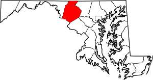 | |
| Towns | ||
| Village | ||
| CDPs | ||
| Other communities |
| |
| Footnotes | ‡This populated place also has portions in an adjacent county or counties | |