Laurel, Maryland
| Laurel, Maryland | |||
|---|---|---|---|
| City | |||
| City of Laurel | |||
|
The Laurel Museum in May 2007 | |||
| |||
|
Motto: "Progressio Per Populum" (English: Progress Through People) | |||
 Location of Laurel in Maryland | |||
| Coordinates: 39°5′45″N 76°51′35″W / 39.09583°N 76.85972°WCoordinates: 39°5′45″N 76°51′35″W / 39.09583°N 76.85972°W | |||
| Country |
| ||
| State |
| ||
| County |
| ||
| Incorporated | 1870 | ||
| Government | |||
| • Mayor | Craig A. Moe (2002–present) | ||
| • City Council[1] |
Ward 1: Valerie M. A. Nicholas | ||
| Area[2] | |||
| • Total | 4.33 sq mi (11.21 km2) | ||
| • Land | 4.30 sq mi (11.14 km2) | ||
| • Water | 0.03 sq mi (0.08 km2) | ||
| Elevation | 164 ft (50 m) | ||
| Population (2010)[3] | |||
| • Total | 25,115 | ||
| • Estimate (2012[4]) | 25,554 | ||
| • Density | 5,840.7/sq mi (2,255.1/km2) | ||
| Time zone | EST (UTC-5) | ||
| • Summer (DST) | EDT (UTC-4) | ||
| ZIP codes | 20707–20709, 20723–20729 | ||
| Area code(s) | 240, 301 | ||
| FIPS code | 24-45900 | ||
| GNIS feature ID | 0597667 | ||
| Website | cityoflaurel.org | ||


Laurel is a city in northern Prince George's County, Maryland, in the United States, located midway between Washington, D.C., and Baltimore on the Patuxent River.[5] Founded as a mill town in the early 19th century, the arrival of the Baltimore & Ohio Railroad in 1835 expanded local industry and later enabled the city to become an early commuter town for Washington and Baltimore workers. Largely residential today, the city maintains a historic district centered on its Main Street, highlighting its industrial past.
The Department of Defense is a prominent presence in the Laurel area today, with the Fort Meade Army base, the National Security Agency, and Johns Hopkins University's Applied Physics Laboratory all located nearby. Laurel Park, a thoroughbred horse racetrack, is located just outside city limits.
History
Natural history
Many dinosaur fossils from the Cretaceous Era are preserved in a 7.5-acre (3.0 ha) park in Laurel.[6] The site, which among other finds has yielded fossilized teeth from Astrodon and Priconodon species, has been called the most prolific in the eastern United States.[7] From the Late Glacial age in 10,700 B.C. to 8,500 B.C., Laurel's climate warmed and changed from a Spruce forest to a hardwood forest. In the Late Archaic period from 4,000 to 1,000 B.C., Laurel would have been covered primarily with an Oak and Hickory forest.[8]
Pre-20th century
Laurel was formed from land on the fall line of the Patuxent River patented by the Snowden family in 1658 as part of the 12,250-acre New Birmingham plantation, which included the later Montpelier.[9] The Washington Turnpike Road Company built Route 1 between 1796 and 1812, creating a major North-South land route with George Washington as a regular traveler. Milstead's Hotel halfway house was built in town to serve four stage lines a day in 1816.[10][11] Nicholas Snowden built a grist mill on the site circa 1811 which grew to a small cotton mill by the 1820s.[12] In 1828, a detailed survey was conducted to build a canal from Baltimore to Georgetown to connect to the proposed C&O canal. The route from Elkridge Landing to Bladensburg would have built a waterway roughly aligning with modern U.S. Route 1 and Kenilworth Avenue, with special consideration not to harm the water power for Savage Mill. The project did not go forward; the preference was to build a railroad, the B&O.[13] Nicholas Snowden died in 1831, and the mill properties transferred to Louisa Snowden and her husband Horace Capon in 1834. In 1835, coinciding with the opening of the Capital Subdivision rail line from Baltimore to Washington, the Patuxent Manufacturing Company was chartered by Horace Capon, Edward Snowden, Theodore Jenkins, W.C. Shaw, A.E. Hall, and O.C. Tiffany and the mill expanded greatly with the addition of the Avondale Mill building in 1844.[14] Mill president Horace Capron with his partners built housing for close to 300 workers, and a bigger cotton mill.[15] Cotton duck from the mill was shipped down what would become Laurel’s Main Street, then by rail to Baltimore.[16] A substantial dam was built in 1850.[17] As a mill town, Laurel was somewhat unique in Prince George’s County and was surrounded by agricultural endeavors.[15]
The community was originally known as "Laurel Factory" when Edward Snowden became the first postmaster in 1837 and was a true company town, with a school and shops, and many of the mill workers' homes owned until the 1860s by the company.[15] During the 1840s, three historic churches in the community—the Methodist Est. 1842,[18] St. Mary of the Mills (Roman Catholic) Est. 1845,[12] and St. Philip's (Episcopal) Est. 1839 [19]—established what are still vigorous congregations. During the Civil War, Laurel Factory, like much of Maryland, was a divided community, but with many Southern sympathizers. Union soldiers patrolled the railroad, and for a time there was also a Union hospital. During the latter half of the 19th century, while it still operated its factories, manufacturing played a less important role in the community. Laurel evolved into an early suburban town. Many of its residents commuted by rail to jobs in Washington or Baltimore. The town was incorporated in 1870 and reincorporated in 1890 to coincide with a new electric power plant and paved streets and boarded sidewalks. By this time, the town had grown to a population of 2,080, and the city banned livestock from the streets.[20]
In 1870, the Patuxent Bank of Laurel was founded on the corner of Main Street and Washington Avenue.[21] In 1874 a delegation was sent to Annapolis to introduce legislation to make Laurel its own county of 10,000 residents with land from Prince George’s, Howard, and Anne Arundel counties.[22] In 1879 Laurel Academy of Music was built along Route 1. The building was converted to a movie theatre in 1915, with a parking garage on the lower floor of the wood structure; it burned in 1917, and Academy Ford built on the same site in the late 1900s.[23] In 1888 inventor David J. Weems tested an unmanned electric train on a two-mile banked circular track near Laurel Station. The three-ton vehicle reached speeds of up to 120 mph for twenty minutes.[24][25]
In 1890, Citizens National Bank opened its doors on Main Street, as Prince George's County's first nationally chartered bank. Charles H. Stanley was the bank's first president, and it remained independently managed and with the same name until acquired by PNC Financial Services in 2007.[26][27][28] Branch services are still provided from the original building.
At the turn of the century, Louis Barret operated a hotel called the "Half Way House", later called the Milstead Hotel, which served as a stop for the four stage lines operating between Baltimore and Washington. In 1898, a stable fire spread to the 100-year-old hotel and burned adjacent buildings along Main Street. With only bucket brigades, Mayor Phelps telegraphed Baltimore to send a special train with fireman, horses, and engine number 10. One fireman was crushed by the rolling fire engine, and returned in a casket saved from the burning mortuary. The resulting losses inspired efforts to bring water and fire apparatus to the town.[29][30] The town was struck again by the great Laurel fire of December 14, 1899, when a twelve-building fire destroyed the Laurel Presbyterian Church (known then as Presbyterian Church at Laurel).[31]
Proposed in 1897, Laurel's seven-term mayor Edward Phelps succeeded in constructing the first high school in Prince George's County in 1899, despite several financial obstacles, by personally assuming the financial risks in doing so. The original building built for $5,000, now known as the Phelps Community Center, still stands at the northeast corner of Montgomery and Eighth Streets.[32] It was listed on the National Register of Historic Places in 1979.[33]
20th century
In 1902, the City and Suburban Railway with the City and Suburban and Washington, Berwyn, and Laurel railway started single line electric trolley service.[34]

The Laurel Sanitarium was built in 1905 on a 163-acre (0.66 km2) farm that comprised what is now Laurel Lakes. The facility's purpose was to care for people with nervous diseases, alcohol, and drug addiction. Five buildings that were joined to a central administration building included 8-, 14-, 30-, and 36-room facilities for men and women.[35]
Laurel Park Racecourse, a thoroughbred racetrack, opened in 1911 and remains in operation. In the book, Seabiscuit: An American Legend, Laurel is mentioned several times as an important horse racing venue. Laurel also hosted a horse trotter (harness racing) track named Freestate Raceway from 1948 to 1990;[36][37] it was located in Howard County on the west side of US Route 1, south of Savage in an area that now includes a CarMax dealership, Weis supermarket, and a strip mall.
In March 1912, the city agreed to take out $35,000 in loans to build its first sewer system with twelve miles of line that terminated by dumping into the Patuxent River.[38]
In February 1913, Laurel was a stopping point in the Suffrage hike led by Rosalie Gardiner Jones. She was joined by a Laurel-based colored women's suffrage group and sent a parcel with a flag and message ahead to President-elect Wilson.[39]

Board track racing came to Laurel in 1925 when a 1.125-mile (1.811 km) wood oval track was built by Jack Prince and featured 48-degree banked turns. The Washington-Baltimore automobile speedway was short-lived, with featured races of 16 drivers at a time.[40] Despite crowds of up to 30,000, receipts did not cover the $400,000 cost of building the tract on the 364-acre Avondale property which fell into receivership in 1926.[41]
Natural gas service was extended to the community in 1929.[42]
In 1931, "Angy Gerrin" built a 7,000-seat amphitheater next to the Duvall Farm between Laurel Park and Route One for an outdoor boxing venue. His company, Mid City Boxing Club Inc, held several events with low turnouts and receipts confiscated by local police. It was sold the same year to C.E. Cornell, who called it "Twin Cities Arena" or "Mid City Arena".[43] The arena was active through 1932 with the entire delegation of the National Boxing Association attending a fight with Governor Ritchie in attendance.[44] After watching the match and calling a fight to be halted in five rounds. The delegation announced efforts to drop junior lightweight and junior welterweight classes to discourage matches between young opponents.[45] Operations ceased by the end of the 1933 season in the peak of the depression.[46][47][48]
Prohibition in the United States was repealed in 1934. Wasting little time, the Prince Georges Brewing Company planned a $500,000 brewery on 100 acres next to Laurel Park, but did not follow through.[49]
In 1954, Johns Hopkins Applied Physics Laboratory built its campus west of Laurel in Howard County, using a Laurel address.[50]
By 1960, Laurel anticipated massive growth from Fort Meade and NSA. The town still used the Patuxent River to drain sewage, and filed urban grants for water and sewage infrastructure. 5,000 houses were planned in the adjacent 1,200-acre Maryland City development. City Planner Harry Susini anticipated the National Capitol Planning Commission would use clustered development to prevent tightly massed population in Laurel by the year 2000.[51]

In the late 1960s, the county was at the peak of racial tensions. The situation peaked in Laurel when four youths, affiliated with the KKK, burned a home in Laurel Grove in 1967, prompting protests and police blockades.[52] Due to cross-burning incidents, a Ku Klux Klan march, and several suspicious fires, police barricades were erected to prevent white residents from entering "The Grove" at night. In August 1967, it was announced that the city would re-purchase a privately owned swimming pool, which had been sold to a private club in 1949. The pool, which had only been available to white residents, was to be operated as an integrated public facility open to all.[53]
On May 15, 1972, Governor George Wallace of Alabama, running for the presidential nomination of the Democratic Party, was campaigning at a rally in the parking lot of Laurel Shopping Center, near what is today a Bank of America branch, when he was shot and paralyzed by Arthur Bremer, a disturbed, out-of-work janitor (see An Assassin's Diary).
On June 22, 1972, Laurel was impacted severely by Hurricane Agnes, which caused the greatest flooding ever recorded in Maryland.[54] Several bridges were destroyed and the nearby T. Howard Duckett Dam at Rocky Gorge Reservoir was at capacity and posed a huge threat.[55] In 1975, the city council passed ordinances to create a historic district around Main Street.[56]
In 1982, developer Kingdon Gould III bought 3,539 acres of Laurel property (539 in North Laurel) in two deals for $15 million. The largest parcel lies between Laurel and Beltsville to be developed under the name Konterra, buoyed by access to major highways via the construction of Maryland Route 200.[57]
A former 1840s mill workers' home on the northeast corner of 9th and Main Streets was renovated and opened as the Laurel Museum on May 1, 1996. The museum features exhibits that highlight the history of Laurel and its citizens. A gift shop is available, and museum admission is free. The museum's John Calder Brennan Library is open to researchers by appointment.[58]
21st century
On September 24, 2001, a tornado passed through Laurel and left F3 property damage, including significant roof damage to the Laurel High School and the historic Harrison-Beard building.[59]
Prior to the September 11, 2001, attacks, several of the hijackers of American Airlines Flight 77 (which crashed into the Pentagon) stayed at various motels in the Laurel area, including the Budget Host Valencia and Pin-Del motels in Howard County just north of the city limits.[60] The wing of the Valencia where they stayed was demolished, and a new Sleep Inn was constructed on the ground, which opened in April 2007. They accessed the Internet through public computers at a Kinko's just south of the city limits. They also prepared for the hijacking by working out at a Gold's Gym; a report by FBI Director Mueller states the gym was in Laurel,[61] while other sources list the location as Greenbelt, Maryland,[62][63] several miles to the south.
On August 29, 2005, Laurel adopted Laurel, Mississippi, as a sister city to help with Hurricane Katrina relief and recovery.[64] In the two years following adoption, "the government, businesses and residents of Laurel, Md. ... raised more than $20,000 for Laurel, Miss."[65]
Historic sites
The following is a list of historic sites in Laurel and vicinity identified by the Maryland-National Capital Park and Planning Commission and / or National Register of Historic Places:[66]
| Site name | Image | Location | M-NCPPC Inventory Number | Comment | |
|---|---|---|---|---|---|
| 1 | Avondale Mill (1844–1991) |  |
21 Avondale St. | n/a | Added to the National Register of Historic Places, September 20, 1979; destroyed 1991 |
| 2 | Duvall Bridge | Telegraph Road at Patuxent River, Patuxent Wildlife Research Center | 64-002 | Pratt truss bridge built in 1907 in place of a wooden bridge. Linked Dr. Charles Duvall's (1785–1863) mill plantation "Goodwood", later "Gladswood". Was once on the main route for Baltimore-Washington telegraphs.[67] | |
| 3 | Laurel High School (original building) / Phelps Community Center |  |
700 block of Montgomery St | n/a | Added to the National Register of Historic Places, June 27, 1979 |
| 4 | Laurel Railroad Station |  |
E. Main St | n/a | Designed for the Baltimore and Ohio Railroad by architect E. Francis Baldwin, built in 1884.[68] Added to the National Register of Historic Places, March 30, 1973 |
| 5 | Montpelier | 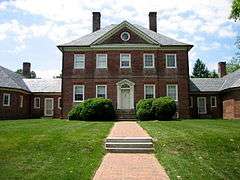 |
2.1 mi (3.4 km). S of Laurel on MD 197 | 62-006 | Added to the National Register of Historic Places, April 17, 1970 |
| 6 | Oaklands | 8314 Contee Road | 62-003 | ||
| 7 | Snow Hill |  |
S of Laurel off MD 197 | 62-004 | Added to the National Register of Historic Places, August 13, 1974 |
| 8 | Snowden Hall |  |
Building 16, Patuxent Wildlife Research Center | 64-001 |
Geography
Laurel is located at 39°5′45″N 76°51′35″W / 39.09583°N 76.85972°W. The city is situated on the bank of the Patuxent River, which was the power source for the cotton mills that were the early industry of the town.
The ZIP Codes for the community of Laurel are 20707 through 20709 and 20723 through 20729. Although served by the Laurel post office, Montpelier is not within the city limits; the same is true for the unincorporated communities of Scaggsville and Whiskey Bottom in Howard County, and Maryland City and Russett in Anne Arundel County.[69]
According to the United States Census Bureau, the city has a total area of 4.33 square miles (11.21 km2), of which, 4.30 square miles (11.14 km2) is land and 0.03 square miles (0.08 km2) is water.[2]
Climate
Typical of central Maryland, Laurel lies within the Humid subtropical climate zone, with hot humid summers and cool to mild winters with high annual precipitation. Laurel lies within USDA plant hardiness zones 7 and 8.[70]
| Climate data for Laurel, Maryland | |||||||||||||
|---|---|---|---|---|---|---|---|---|---|---|---|---|---|
| Month | Jan | Feb | Mar | Apr | May | Jun | Jul | Aug | Sep | Oct | Nov | Dec | Year |
| Average high °F (°C) | 42.4 (5.8) |
45.8 (7.7) |
54.7 (12.6) |
66.2 (19) |
75.2 (24) |
83.8 (28.8) |
88.3 (31.3) |
86.7 (30.4) |
79.3 (26.3) |
68.1 (20.1) |
57.5 (14.2) |
46.1 (7.8) |
66.2 (19) |
| Average low °F (°C) | 24.9 (−3.9) |
26.8 (−2.9) |
34.5 (1.4) |
44.1 (6.7) |
54.8 (12.7) |
63.8 (17.7) |
69.0 (20.6) |
67.5 (19.7) |
59.6 (15.3) |
48.2 (9) |
38.0 (3.3) |
29.4 (−1.4) |
46.7 (8.2) |
| Average precipitation inches (mm) | 3.16 (80.3) |
3.03 (77) |
4.10 (104.1) |
3.81 (96.8) |
4.56 (115.8) |
4.23 (107.4) |
4.05 (102.9) |
3.43 (87.1) |
4.60 (116.8) |
3.98 (101.1) |
4.21 (106.9) |
3.77 (95.8) |
46.93 (1,192) |
| Average snowfall inches (cm) | 2.1 (5.3) |
6.2 (15.7) |
.6 (1.5) |
0 (0) |
0 (0) |
0 (0) |
0 (0) |
0 (0) |
0 (0) |
0 (0) |
.8 (2) |
1.3 (3.3) |
11.0 (27.9) |
| Average precipitation days (≥ 0.01 in) | 8.9 | 8.2 | 9.6 | 9.4 | 10.5 | 9.3 | 9.1 | 7.4 | 8.3 | 7.6 | 8.2 | 8.7 | 105.2 |
| Average snowy days (≥ 0.1 in) | 1.0 | 1.0 | .3 | 0 | 0 | 0 | 0 | 0 | 0 | 0 | .1 | .4 | 2.8 |
| Source: NOAA[71] | |||||||||||||
Demographics
| Historical population | |||
|---|---|---|---|
| Census | Pop. | %± | |
| 1870 | 1,148 | — | |
| 1880 | 1,206 | 5.1% | |
| 1890 | 1,984 | 64.5% | |
| 1900 | 2,079 | 4.8% | |
| 1910 | 2,415 | 16.2% | |
| 1920 | 2,239 | −7.3% | |
| 1930 | 2,532 | 13.1% | |
| 1940 | 2,823 | 11.5% | |
| 1950 | 4,482 | 58.8% | |
| 1960 | 8,503 | 89.7% | |
| 1970 | 10,525 | 23.8% | |
| 1980 | 12,103 | 15.0% | |
| 1990 | 19,438 | 60.6% | |
| 2000 | 19,960 | 2.7% | |
| 2010 | 25,115 | 25.8% | |
| Est. 2015 | 26,215 | [72] | 4.4% |
For statistical reporting, the Census Bureau identifies four adjacent unincorporated areas:
- West Laurel (upper west)
- North Laurel
- Maryland City (to the east)
- South Laurel
2010 census
As of the census[3] of 2010, there were 25,115 people, 10,498 households, and 5,695 families residing in the city. The population density was 5,840.7 inhabitants per square mile (2,255.1/km2). There were 11,397 housing units at an average density of 2,650.5 per square mile (1,023.4/km2). The racial makeup of the city was 30.1% White, 48.9% African American, 0.4% Native American, 9.2% Asian, 0.1% Pacific Islander, 7.6% from other races, and 3.8% from two or more races. Hispanic or Latino of any race were 15.5% of the population.
There were 10,498 households of which 30.7% had children under the age of 18 living with them, 33.4% were married couples living together, 15.7% had a female householder with no husband present, 5.2% had a male householder with no wife present, and 45.8% were non-families. 37.6% of all households were made up of individuals and 6.1% had someone living alone who was 65 years of age or older. The average household size was 2.37 and the average family size was 3.19.
The median age in the city was 33.7 years. 22.6% of residents were under the age of 18; 9.5% were between the ages of 18 and 24; 37.2% were from 25 to 44; 23.8% were from 45 to 64; and 7% were 65 years of age or older. The gender makeup of the city was 47.7% male and 52.3% female.
2000 census
As of the census[74] of 2000, there were 19,960 people, 8,931 households, and 4,635 families residing in the city. The population density was 5,280.2 people per square mile (2,038.8/km²). There were 9,506 housing units at an average density of 2,514.7 per square mile (971.0/km²). The racial makeup of the city was 52.24% White, 34.50% African American, 0.38% Native American, 6.89% Asian, 0.21% Pacific Islander, 2.30% from other races, and 3.47% from two or more races. Hispanic or Latino of any race were 6.24% of the population.
There were 8,931 households, of which 26.7% have children under the age of 18, 33.9% were married couples living together, 13.3% had a female householder with no husband present, and 48.1% were non-families. 37.4% of all households were made up of individuals and 5.2% had someone living alone who was 65 years of age or older. The average household size was 2.22 and the average family size was 2.97.
In the city the population was spread out with 22.0% under the age of 18, 8.6% from 18 to 24, 42.9% from 25 to 44, 19.7% from 45 to 64, and 6.7% who were 65 years of age or older. The median age was 34 years. For every 100 females there were 93.2 males. For every 100 females age 18 and over, there were 90.3 males.
The median income for a household in the city was $49,415, and the median income for a family was $58,552. Males had a median income of $37,966 versus $35,614 for females. The per capita income for the city was $26,717. About 4.3% of families and 6.4% of the population were below the poverty line, including 7.8% of those under age 18 and 6.4% of those age 65 or over.
Transportation
.jpg)
Laurel is traversed from north to south by U.S. Route 1 (US 1), which links Key West, Florida with the Canada–US border in Maine. On the west, the city is bordered by Interstate 95, and beyond the eastern border lies the Baltimore-Washington Parkway. Crossing all of these highways is the east-west artery of Maryland Route 198 (MD 198), which intersects with US 1 in the heart of Laurel.
Other major state roads in Laurel are MD 216, which connects the city with southern Howard County, and MD 197, which runs from Laurel to Bowie. The eastern terminus of MD 200 (the Intercounty Connector) lies just south of the city limits and connects Laurel with Gaithersburg.
Suburban Airport, a general aviation airport, is located on Brock Bridge Road, just over the Anne Arundel County border. For decades the airport has provided general aviation access for medivac helicopters, flight training, business travelers, and serves as a relief airport for light traffic into and out of the two major regional airports. Baltimore-Washington International Thurgood Marshall Airport and Ronald Reagan Washington National Airport are both within about 25 miles (40 km) of Laurel.
- Public Transport
Two MARC train stations on the Camden Line to Baltimore and Washington, D.C. are located in Laurel: Laurel Station and Laurel Racetrack Station, the latter with minimal service. Laurel Station is a particularly notable example of the stations designed by E. Francis Baldwin for the Baltimore and Ohio Railroad.
The Washington Metropolitan Area Transit Authority (WMATA) Metrobus service provides four lines into Laurel, and local Connect-a-Ride and Howard Transit bus service is available. Several taxicab and shuttle services also support the region.
Emergency services
The Laurel Police Department and the Sixth District of the Prince George's County Police Department are the principal providers of the region's police officers. The Maryland State Police patrol US 1, MD 198, and Interstate 95, which pass through the area, and the United States Park Police patrol the Baltimore-Washington Parkway and its connectors.


The primary emergency services providers for the City of Laurel and surrounding parts of Prince George’s County are the Laurel Volunteer Fire Department (Company 10) and the Laurel Volunteer Rescue Squad (Company 49). Both companies are part of the Prince George’s County Fire/EMS Department.
The Laurel Volunteer Fire Department was formed in 1902. Today the department is located at 7411 Cherry Lane. Volunteer staffing is supplemented by four career personnel from 7:00am to 3:00pm Monday through Friday excluding holidays. The company operates three fire engines (Engine 101, Engine 103, and Engine 104); and an aerial tower (Tower 10). Ambulance service began December 11, 2006. A paramedic unit staffed by two career personnel is also assigned to Company 10.
The Laurel Volunteer Rescue Squad was formed in 1952. Today the department is located at 14910 Bowie Road. Volunteer staffing is supplemented by four career personnel from 7:00am to 3:00pm Monday through Friday excluding holidays. The company operates one heavy rescue squad, one rescue-engine, three basic life support ambulances, and a swiftwater rescue team.
Laurel Regional Hospital, built in 1978 as the Greater Laurel-Beltsville Hospital, and now managed by Dimensions Healthcare System, is located on Van Dusen Road.
Municipal government
Laurel is governed by a 5-member city council and a mayor. There are two political wards in the city. The first ward is generally the area north of Maryland Route 198 and the second ward is to the south.[75][76] Two council members are elected from each ward, and a council member is elected at large by residents of both wards. City Council candidates must reside in Laurel a year before their election and during their full term of office.[77] Similarly, mayoral candidates must reside in the city for at least two years prior to their election.[78]
Nonpartisan city-wide elections are held every two years on the first Tuesday in November of the odd year.[79] Phelps Senior Center on the corner of Montgomery Street and 8th Street/St. Mary's Place[80] is the polling place for Ward 1, and the Robert J. DiPietro Community Center on Cypress Road is the polling place for Ward 2 voters.[81] The next election, to select a mayor and city council members, will be held in November 2015 with elected individuals to take office at the second regular City Council meeting that follows.[82] Regular meetings are held on the second and fourth Mondays of each month.[83]
The council elects one of its members to serve as president. The president of the city council presides over council meetings and can act in a limited capacity as mayor if the mayor is unavailable. Council members serve for two years each term; the mayor serves for four years.
Media and culture
Stanley Memorial Library, the Laurel branch of the Prince George's County Memorial Library System, is located at the intersection of Seventh Street and Talbott Avenue. The "Maryland City at Russett" branch of the Anne Arundel County Public Library is also available to Laurel residents.
Media
Television arrived in Laurel with the establishment of the first TV broadcast stations in Washington in 1946. For decades, Laurel has been served by the VHF TV channels 4 (WRC-TV / NBC), 5 (WTTG / FOX), 7 (WJLA-TV / ABC), and 9 (WUSA / CBS) from Washington; channels 2 (WMAR-TV / ABC), 11 (WBAL-TV / NBC), and 13 (WJZ-TV / CBS) from Baltimore; plus Maryland Public Television from Annapolis and Baltimore. In addition, there are dozens of UHF TV stations from Washington, Baltimore, and Annapolis. From these three cities, scores of AM and FM radio stations reach Laurel.
Laurel has one local newspaper, the Laurel Leader, and one mediumwave AM radio station, WILC 900, with a conservative talk format.
With its location between Washington and Baltimore, Laurel is also served by their daily newspapers The Washington Post, The Washington Times and The Baltimore Sun. Many Laurel residents also read a free newspaper, the Washington Examiner.
Arts
Local performing arts outlets include the Venus Theatre, Laurel Mill Playhouse, Central Maryland Chorale (formerly Laurel Oratorio Society) and Montpelier Arts Center, which also features an art gallery. Another local exhibitor is the WSSC Art Gallery.
Events

The city government supports an annual LakeFest in May and Independence Day celebration each July. Since 1981, the Laurel Board of Trade has sponsored a Main Street Festival (held on Saturday of Mother's Day weekend) each May, and since 1995 a RiverFest each October. The Montpelier Mansion grounds have hosted an annual festival the first weekend in May since 1971, updated in 2007 to focus on an "herb, tea and arts" theme.[84]
Notable people
- Simon Cho – Olympic short track speed skater.[85]
- R. Orin Cornett – American physicist, university professor, and administrator. Dr. Cornett was the inventor of a literacy system for the deaf, known as Cued Speech.
- Future President and Mrs. Dwight D. Eisenhower lived at Mrs. Ray's Boarding House at 327 Montgomery Street in June 1919 during the couple's third year of marriage.[86]
- Marty Friedman – Former Megadeth lead guitarist attended Laurel High School in the 1970s.[87]
- Kathleen Hanna – Former Bikini Kill and current Le Tigre band member. Attended the (now) former O.W. Phair Elementary School in Laurel, as a child in the mid-to-late 1970s.[88]
- Biz Markie – Rap artist.[89]
- Andrew Maynard – an American boxer who won the Light Heavyweight Gold medal at the 1988 Summer Olympics, was born in Laurel, Maryland, April 8, 1964.
- Greg Merson – 2012 World Series of Poker Main Event winner.
- Visanthe Shiancoe – National Football League Tight End.
- Ron Turcotte – Hall of Fame race horse jockey who trained at Laurel Park race course in the late 1960s.
Education
Primary and secondary schools
Public schools within city limits
Prince George's County Public Schools serves residents within Laurel's city limits.
City residents are zoned to Laurel Elementary School or Scotchtown Hills Elementary School, both within the city limits.
Two public middle schools in the Laurel area, Dwight D. Eisenhower and Martin Luther King Jr. Middle Schools in Prince George's County, serve the actual city of Laurel.
Laurel High School serves the city of Laurel.
Public schools nearby
Nearby elementary schools serving areas outside of the Laurel city limits include Bond Mill, Deerfield Run, James H. Harrison, Montpelier, Oaklands, and Scotchtown Hills Elementary Schools in Prince George's County; Brock Bridge and Maryland City Elementary Schools in Anne Arundel County; and Forest Ridge, Gorman, Hammond, and Laurel Woods Elementary Schools in Howard County.
Areas near Laurel in adjacent counties are served by MacArthur and Meade Middle Schools in Anne Arundel County and Hammond and Murray Hill Middle Schools in Howard County.
Other public high schools which serve the adjacent areas outside Prince George's County include Meade High School in Anne Arundel County and Atholton, Hammond and Reservoir High Schools in Howard County. A notable magnet school in Prince George's County is Eleanor Roosevelt High School.
District of Columbia alternative school
District of Columbia Public Schools operates an alternative middle and high school near Laurel named Maya Angelou Academy.
Private schools
- Augsburg Academy – Christian Day School; age 4 through grade 9[90]
- Faith Baptist Christian School – Pre-K through grade 8
- First Baptist School of Laurel – Pre-K through grade 8
- Julia Brown Montesorri School – Pre-K through grade 3
- Kiddie Academy of Laurel – for ages 6 weeks through 12 years
- Kiddies Kollege Christian Center – for ages 2 years through 5 years
- Laurel Baptist Academy – kindergarten through grade 12
- Pallotti Day Care Center – Catholic kindergarten
- St. Mary of the Mills School – Catholic kindergarten through grade 8
- St. Vincent Pallotti High School – Catholic high school
Colleges, universities, and trade schools
Prince George's Community College and Howard Community College share a campus in Laurel called the Laurel College Center.[91]
Capitol College is located south of Laurel.
The Anne Arundel County section of Laurel hosts the Woodland Job Corps Center.
Sports and recreation
Laurel's Department of Parks & Recreation sponsors seasonal sports leagues for adults, with youth leagues in the area offered by Laurel Little League, Greater Laurel United Soccer Club (GLUSC), Laurel Soccer Club (LSC),[92] and the Laurel Boys and Girls Club.[93] Events are held among eleven city parks, three athletic fields, and three community centers. The city also operates a municipal swimming pool and tennis courts.[94] Four indoor facilities and seven outdoor facilities are available for private rental.[95]
The Fairland Sports and Athletic Complex on the grounds of the Fairland Regional Park, southwest of the city limits, is operated by the Maryland-National Capital Park and Planning Commission. These facilities offer a broad variety of activities including swimming, gymnastics, tennis, racquetball, weight training, child sitting, and massage therapy.[96]
Also located within Fairland Regional Park, The Gardens Ice House skating facility offers three rinks for ice skating lessons, public skating, figure skating, hockey, speed skating, and curling. Recent additional activities include basketball and lacrosse.[97] The Gardens Ice House is also home to the Washington Jr. Nationals Tier III Junior A ice hockey team, playing in the Atlantic Junior Hockey League, as well as the Maryland Reapers, an indoor football franchise of the American Indoor Football League.
The Laurel Roller Skating Center, just north of the city limits, provides a location for public roller skating,[98] and AMF Bowling Centers has a location in Laurel.
See also
References
- ↑ Dzwonchyk, Melanie (November 30, 2011). "Council members, mayor sworn in at Laurel City Council meeting". The Baltimore Sun. Retrieved December 14, 2011.
- 1 2 "US Gazetteer files 2010". United States Census Bureau. Archived from the original on 2012-01-24. Retrieved 2013-01-25.
- 1 2 "American FactFinder". United States Census Bureau. Retrieved 2013-01-25.
- ↑ "Population Estimates". United States Census Bureau. Archived from the original on 2013-06-17. Retrieved 2013-06-26.
- ↑ U.S. Geological Survey Geographic Names Information System: Laurel, Maryland
- ↑ "Dinosaur Park Officially Dedicated and Opened To the Public". pgparks.com. Prince George's County Department of Parks and Recreation. Retrieved October 28, 2009.
- ↑ Roylance, Frank D. (October 25, 2009). "Where dinosaurs once walked". baltimoresun.com. The Baltimore Sun. Retrieved October 28, 2009.
- ↑ Conrad Jay Bladey, Helen Curtis. Human Adaptation to the Fall Line Setting: A Framework for the Archeology of Laurel, Maryland.
- ↑ Conrad Jay Bladey, Helen Curtis. Human Adaptation to the Fall Line Setting: A Framework for the Archeology of Laurel, Maryland. p. 25.
- ↑ "City of Laurel Master Plan" (PDF). Retrieved June 20, 2012.
- ↑ Barbara Feaga. Howard's Roads to the Past. p. 65.
- 1 2 Compton, Elizabeth L.; Joanne Timchalk, Mary Mallonee, Lee Jacobs, Ron Jacobs, J.R. Compton, M.D. (1993). "St Mary of the Mills Parish History". St Mary of the Mills Parish. Retrieved July 21, 2007. Cite uses deprecated parameter
|coauthors=(help) - ↑ Canal—Baltimore to Contemplated Chesapeake & Ohio Canal. Gales & Seaton. 1828. Retrieved November 9, 2013.
- ↑ Mills, Kristie; Elsie Klumpner (Winter 2006). "ATHA's Featured Community: the City of Laurel" (PDF). ATHA Newsletter, Vol. 3, No. 2. Anacostia Trails Heritage Area. Retrieved July 21, 2007.
- 1 2 3 Chidester, Robert C. "A Historic Context for the Archaeology of Industrial Labor in the State of Maryland". Center for Heritage Resource Studies, Department of Anthropology, University of Maryland at College Park. Retrieved July 21, 2007.
- ↑ "Laurel Historical Society". The Laurel Historical Society. Archived from the original on June 25, 2007. Retrieved July 26, 2007.
- ↑ Ridgway, Whitman H. (February 13, 2003). "The Changing Face of the Heritage Area in the Nineteenth Century" (PDF). Interpretive Plan for the Anacostia Trails Heritage Area. Maryland Humanities Council. Archived from the original (PDF) on January 28, 2007. Retrieved July 21, 2007.
- ↑ "Our Church History". First United Methodist Church of Laurel. Retrieved July 26, 2007.
- ↑ "St. Philip's Parish History" (PDF). St. Philips Parish Profile. St. Philip's Episcopal Church. 2006. p. 4. Retrieved July 26, 2007.
- ↑ "Mayor Cull's Trials". The Sunday Herald. September 1, 1890.
- ↑ Howard County Historical Society. Images of America Howard County. p. 76.
- ↑ "New County Movement in Maryland.". The Evening Star. February 25, 1874. p. 4.
- ↑ Robert K. Headley (2008). Maryland's Motion Picture Theaters. Arcadia. p. 74. ISBN 978-0-7385-5384-9.
- ↑ "The Weems Electric Railway". Engineering News. September 14, 1889. Retrieved September 6, 2013.
- ↑ Federal Writers' Project (August 1940). Maryland: A Guide to the Old Line State. Work Projects Administration. p. 309. ISBN 9781623760199.
- ↑ The National Cyclopædia of American Biography: Being the History. p. 301.
- ↑ Gutherrez, Liza (September 6, 2007). "PNC banks on new branches' community ties". The Laurel Gazette. pp. A–24 – 25. Retrieved September 9, 2007.
- ↑ Glenn, Gwendolyn (August 16, 2007). "Display to honor bank's long history". Laurel Leader. Retrieved September 9, 2007.
- ↑ "Laurel Swept By Fire, Destructive Conflagration in the Pretty Little Town". The Washington Post. August 28, 1898.
- ↑ "Laurel to Have Water and Lights". The Washington Post. August 4, 1900.
- ↑ Rev C.W. Sommerville (December 27, 1899). Christian Observer: 11. Missing or empty
|title=(help) - ↑ "Laurel Asks for a High School". The Baltimore Sun. July 6, 1897.
- ↑ National Park Service (2008-04-15). "National Register Information System". National Register of Historic Places. National Park Service.
- ↑ "LAUREL LINE OPENED.: Guests of Road Make the First Trip Over the New Route.". The Washington Post. 21 September 1902.
- ↑ Hurd, Henry Mills; Drewry, William Francis; Dewey, Richard; Pilgrim, Charles Winfield; Blumer, George Adler; Burgess, Thomas Joseph Workmann (1916). The institutional care of the insane in the United States and Canada, Volume 2. American Medico-Psychological Association. pp. 579–580.
- ↑ "Freestate Raceway Is Sold for Planned Industrial Park", HighBeam Research Inc., partial text of Washington Post article from September 6, 1989. URL retrieved on November 27, 2006.
- ↑ "It's Final: Freestate Is No More; Commission Grants Request to Transfer '90 Dates to Rosecroft", HighBeam Research Inc., partial text of Washington Post article from January 31, 1990. URL retrieved on November 27, 2006.
- ↑ "Sewerage for Laurel". The Baltimore Sun. March 1, 1912. p. 10.
- ↑ "Suffrage Hikers send Wilson a Flag". New York Times. February 27, 1913.
- ↑ Laurel Auto Races, [Laurel, Md.], July 11, 25
- ↑ "LAUREL SPEEDWAY IN RECEIVERS' HANDS: Action Taken Following Filing Of Bill Of Complaint By Construction Finn OWES $28,250. IS CHARGE Corporation Owning Automobile Racing Truck Alleged To Be Insolvent". The Baltimore Sun. 2 June 1926.
- ↑ Department of Community Planning & Business Services (November 26, 2007). "Master Plan Comprehensive Amendment". City of Laurel, Maryland. Retrieved 2009-01-26.
- ↑ "DOUBLE BOXING CARD TONIGHT: Brown-Firpo Bout Feature At Carlin's--Twin City Matches". The Baltimore Sun. 14 September 1932.
- ↑ Jesse A. Linthicum (19 September 1932). "N. B. A., Meeting Here, Plans Amateur Boxing Clean-Up: Important Question To Come Before Delegates At Three-Day Convention Which Opens Here This Morning". The Baltimore Sun.
- ↑ "National Boxing Association Head Flays Exploitation Of Amateurs: CLINNIN URGES QUICK ACTION Tells Convention Mere Boys Are Becoming Punch-Drunk Wrecks SEEKS UNIFORM LAW Recommendation Presented To Drop Junior Title In Two Divisions". The Baltimore Sun. 20 September 1932.
- ↑ Jessie A. Linthicum (25 June 1933). "RING AND RASSLIN' RACKET". The Baltimore Sun.
- ↑ Kevin Leonard (2 October 2014). "Laurel's outdoor boxing arena met mysterious end". The Baltimore Sun.
- ↑ "Hunt And Weiner Win Bouts In New Arena At Laurel Before 2,000". The Baltimore Sun. 4 July 1931.
- ↑ "REALESTiTEDEALS AND BUILDING NEWS Plans For Construction Of Brewery At Laurel Are Announced". The Baltimore Sun. 28 February 1934.
- ↑ "Johns Hopkins Lets Contract in Md.". The Washington Post. 27 March 1955.
- ↑ "Laurel Prepares For Its New Era: Expected Growth". The Washington Post. September 5, 1960.
- ↑ "Nightly Blockade of Negro Section In Laurel Is Ordered Discontinued". The Washington Post. 21 July 1967.
- ↑ Pickett, Edward G (August 2, 1967). "Laurel to Buy, Integrate Pool for Public Use". The Sun.
- ↑ "USGS Water Supply Paper 2375 National Water Summary, Maryland and the District of Columbia Floods and Droughts". URL retrieved on November 27, 2006.
- ↑ Invitation to the Maryland Association of Floodplain and Stormwater Managers Second Annual Conference and General Membership Meeting, October 18–19, 2006. URL retrieved on November 27, 2006.
- ↑ Sarah K. Krim (4 September 1974). "Historic District". The Washington Post.
- ↑ "Gould buys 3,539 acres in two deals". The Baltimore Sun.
- ↑ Directions and Hours, Laurel Historical Society. URL retrieved on November 28, 2006.
- ↑ Bykowicz, Julie; Larry Carson (2001-09-26). "Laurel sustains millions in damages". The Baltimore Sun. Archived from the original on 2007-09-30. Retrieved 2007-06-18.
- ↑ Sellin, Erik (2016). The Preparation for Flight 77. Classic CD Books. ISBN 9781935513049.
- ↑ Robert S. Mueller III, FBI Director. "Statement for the Record", Joint Intelligence Committee Inquiry. September 26, 2002. URL retrieved on December 22, 2006.
- ↑ Thomas Frank, "Tracing Trail of Hijackers", Newsday, April 4, 2002. URL retrieved on December 22, 2006.
- ↑ Freedberg, Sydney P.; various others (September 27, 2001). "The Trail of the Terrorists". sptimes.com. St. Petersburg Times. Retrieved 12 January 2009.
- ↑ "Citizen and Student of the Month". City Council of Laurel, Maryland. November 2006. Archived from the original on 2007-09-27. Retrieved 2007-09-08.
- ↑ Early, Steve (2007-09-06). "Laurel namesake recovers from Hurricane Katrina". The Gazette (Laurel edition). p. A9. Retrieved 2007-09-08.
- ↑ M-NCPPC Illustrated Inventory of Historic Sites (Prince George's County, Maryland), 2006.
- ↑ "PG 64-2 Duvall Bridge" (PDF). Maryland State Archives. July 1987. Retrieved November 2, 2013.
- ↑ Avery, Carlos P. (2003). E. Francis Baldwin, Architect: The B&O, Baltimore, and Beyond. Baltimore, Maryland: Baltimore Architecture Foundation. pp. 33, 128. ISBN 0-9729743-0-X.
- ↑ "Real Estate Property Taxes". City of Laurel, Maryland. Retrieved February 27, 2016.
Properties with a 'Laurel' mailing address may not necessarily be located within the City limits. Properties in 'Laurel 20707 and 20708' may be outside the City limits in Prince George's County.... Properties in 'Laurel 20723' are always outside the City limits in Howard County.... Properties in 'Laurel 20724' are always outside the City limits in Anne Arundel County
- ↑ "What is my arborday.org Hardiness Zone?". The Arbor Day Foundation. Retrieved December 4, 2011.
- ↑ "Station Name: MD LAUREL 3W". National Oceanic and Atmospheric Administration. Retrieved 2013-06-18.
- ↑ "Annual Estimates of the Resident Population for Incorporated Places: April 1, 2010 to July 1, 2015". Retrieved July 2, 2016.
- ↑ "Census of Population and Housing". Census.gov. Archived from the original on May 11, 2015. Retrieved June 4, 2015.
- ↑ "American FactFinder". United States Census Bureau. Archived from the original on 2013-09-11. Retrieved 2008-01-31.
- ↑ "Laurel Voting Wards". City of Laurel, Maryland. Archived from the original on 2007-04-15. Retrieved 2007-07-15.
- ↑ "Laurel Voting Ward Map" (PDF). City of Laurel, Maryland. Retrieved 2011-04-28.
- ↑ Laurel Charter/Code, Article 300 (Government), Section 310 (City Council)
- ↑ Laurel Charter/Code, Article 300, Section 350 (Mayor)
- ↑ "Elections and Voter Registration". City of Laurel, Maryland. Retrieved 2011-04-28.
- ↑ "City Council of Laurel, Maryland". City of Laurel, Maryland. Archived from the original on 2008-02-08. Retrieved 2008-04-22.
- ↑ "Laurel Voting Ward Map". City of Laurel, Maryland. Retrieved 2011-04-28.
- ↑ Laurel Charter/Code, Article 600 (Registration and Elections), Section 605 (Election of Mayor and Councilmembers)
- ↑ "Meetings and Agendas". City of Laurel, Maryland. Retrieved 2010-04-28.
- ↑ Garnes, Kathy. "Montpelier herb, tea and art fest moves to May". Laurel Leader. Patuxent Publishing Co. April 19, 2007.
- ↑ "Simon Cho – Biography". NBC Universal. Retrieved 19 January 2010.
- ↑ "Eisenhower House (Mrs. Ray's Boarding House)" (PDF). www.msa.md.gov. Maryland State Archives. Retrieved November 24, 2011.
- ↑ "West Laurel barn razing". October 2002. Fan Questions and Answers. Marty Friedman Official Website. URL retrieved on December 20, 2006.
- ↑ "Facts". Le Tigre. Retrieved March 7, 2014.
In 4th grade ... I ended up being the co-lead in O.W. Phair elementary's production
- ↑ Morris, Mary. Biz Markie. Remix. February 1, 2004. URL retrieved on January 9, 2007.
- ↑ "Who We Are". augsburgacademy.net. Augsburg Academy. Retrieved November 6, 2009.
- ↑ "Laurel College Center Home Page". Laurel College Center. Retrieved 2007-07-20.
- ↑ "Laurel Soccer Club". Retrieved January 17, 2015.
- ↑ "Sports Programs", Department of Parks & Recreation, City of Laurel. URL retrieved on December 22, 2006.
- ↑ "Parks & Facilities Tour", Department of Parks & Recreation, City of Laurel. URL retrieved on December 22, 2006.
- ↑ "Facility Rentals", Department of Parks & Recreation, City of Laurel. URL retrieved on December 22, 2006.
- ↑ "M-NCPPC Specialized Sports Facilities", Department of Parks & Recreation, Prince George's County Maryland. URL retrieved on December 22, 2006.
- ↑ The Gardens Ice House, Laurel, Maryland. URL retrieved on December 22, 2006.
- ↑ Lane, Raymond M. "Getting up to speed on roller skating fun", The Washington Times, February 26, 2004. URL retrieved on December 22, 2006.
Further reading
- Bucklee, Sally Mitchell (2001). A church and its village: St. Philip's Episcopal Church, Laurel, Maryland. Baltimore, Md.: Gateway Press. OCLC 48085398. Describes local history.
External links
| Wikimedia Commons has media related to Laurel, Maryland. |
| Wikivoyage has a travel guide for Laurel (Maryland). |
- Official Website: City of Laurel, Maryland
- History of the City of Laurel, Maryland
- Laurel Boys and Girls Club

Annapolis (capital) | |
| Topics |
|
| Society | |
| Regions | |
| Cities | |
| Towns | |
| CDPs |
|
| Counties | |
Municipalities and communities of Prince George's County, Maryland, United States | ||
|---|---|---|
| Cities | 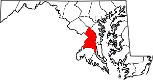 | |
| Towns | ||
| CDPs |
| |
| Other communities |
| |
| Ghost town | ||
| Footnotes | ‡This populated place also has portions in an adjacent county or counties | |