Sabillasville, Maryland
| Sabillasville, Maryland | |
|---|---|
| Census-designated place | |
 Sabillasville  Sabillasville Location in Maryland | |
| Coordinates: 39°42′5″N 77°27′28″W / 39.70139°N 77.45778°WCoordinates: 39°42′5″N 77°27′28″W / 39.70139°N 77.45778°W | |
| Country |
|
| State |
|
| County |
|
| Area | |
| • Total | 1.5 sq mi (3.9 km2) |
| • Land | 1.5 sq mi (3.9 km2) |
| • Water | 0.0 sq mi (0.0 km2) |
| Elevation | 1,108 ft (338 m) |
| Population (2010) | |
| • Total | 354 |
| • Density | 236/sq mi (91.3/km2) |
| Time zone | Eastern (EST) (UTC-5) |
| • Summer (DST) | EDT (UTC-4) |
| ZIP code | 21780 |
| Area code(s) | 301 and 240 |
| FIPS code | 24-69200 |
| GNIS feature ID | 0591206[1] |
Sabillasville is an unincorporated community and census-designated place in Frederick County, Maryland, United States.[2] As of the 2010 census it had a population of 354.[3]
Victor Cullen School Power House was listed on the National Register of Historic Places in 1987 and the Victor Cullen Center, Old Administration Building was listed in 1990.[4]
History
The first European settlers to arrive in the vicinity of Sabillasville were Swiss immigrants in the late-1750s.[5] Among the earliest settlers was Peter Zollinger (or Zullinger), who owned the land on which the present-day village is located. In 1813, the village was laid out by Andrew Smith and named Sabillasville in honor of Savilla Zollinger (wife of Peter).[6] In 1872, the Western Maryland Railroad reached Sabillasville on its line leading from Baltimore to Hagerstown and the surrounding area soon developed into a summer resort called Pen Mar (a portmanteau of Pennsylvania and Maryland).[7]
Geography
The town is located in the northwest corner of Frederick County at an elevation of 1,100 feet (340 m) above sea level, in the Harbaugh Valley, between South Mountain to the northwest and Wertenbaker Hill to the southeast. Maryland Route 550 passes through the town, leading northwest 2 miles (3 km) to Blue Ridge Summit, Pennsylvania, and southeast 7 miles (11 km) to Thurmont.
According to the U.S. Census Bureau, the Sabillasville CDP has an area of 1.5 square miles (3.9 km2), all of it land.[3]
References
- ↑ U.S. Geological Survey Geographic Names Information System: Sabillasville
- ↑ "Geographic Names Information System". Sabillasville (Populated Place). U.S. Geological Survey. 2009-01-29.
- 1 2 "Geographic Identifiers: 2010 Census Summary File 1 (G001), Sabillasville CDP, Maryland". American FactFinder. U.S. Census Bureau. Retrieved June 2, 2016.
- ↑ National Park Service (2008-04-15). "National Register Information System". National Register of Historic Places. National Park Service.
- ↑ Scharf, J. Thomas (1882). History of Western Maryland: Being a history of Frederick, Montgomery, Allegany, and Garrett Counties from the earliest period to the present day. Philadelphia: L.H. Everts. p. 612.
- ↑ Scharf, J. Thomas (1882). History of Western Maryland: Being a history of Frederick, Montgomery, Allegany, and Garrett Counties from the earliest period to the present day. Philadelphia: L.H. Everts. p. 614.
- ↑ "A Short History of Harbaugh Valley". Emmitsburg Area Historical Society.
Municipalities and communities of Frederick County, Maryland, United States | ||
|---|---|---|
| Cities | 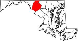 | |
| Towns | ||
| Village | ||
| CDPs | ||
| Other communities |
| |
| Footnotes | ‡This populated place also has portions in an adjacent county or counties | |