Minturn, California
| Minturn | |
|---|---|
| Unincorporated community | |
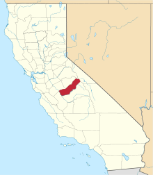
 Minturn  Minturn Location in California | |
| Coordinates: 37°08′23″N 120°16′28″W / 37.13972°N 120.27444°WCoordinates: 37°08′23″N 120°16′28″W / 37.13972°N 120.27444°W | |
| Country | United States |
| State | California |
| County | Madera County |
| Elevation[1] | 236 ft (72 m) |
Minturn is an unincorporated community in Madera County, California.[1] It is located on the Atchison, Topeka and Santa Fe Railroad and California State Route 99 1.5 miles (2 km) north-northwest of Chowchilla,[2] at an elevation of 236 feet (72 m).[1] Minturn is near the Geographic Center of California, between Madera and Merced.
A post office operated at Minturn from 1884 to 1922.[2] The name honors Jonas and Thomas Minturn, wheat farmers who had a railroad siding built at the place in 1872.[2] Jonas (April 4, 1819–August 1, 1884) and Abby West (March 8, 1820–May 19, 1899) Minturn (m. 1843), settled in the area in the 19th century and are buried nearby.[3]
The Minturn Nut Company is located nearby at 8800 S. Minturn Road, Le Grand.[4]
Related information
Jonas Minturn was a member of the same family that ran Grinnell, Minturn & Co.
Jonas and Abby West Minturn's children were Mary, Thomas, Gertrude, Madeline, and James.[5]
References
- 1 2 3 U.S. Geological Survey Geographic Names Information System: Minturn, California
- 1 2 3 Durham, David L. (1998). California's Geographic Names: A Gazetteer of Historic and Modern Names of the State. Clovis, Calif.: Word Dancer Press. p. 804. ISBN 1-884995-14-4.
- ↑ Madera County, California, GenWeb: Minturn Burial Ground.
- ↑ Minturn Nut Company; accessed 2016.02.08.
- ↑ John Russell Bartlett, History of the Wanton family of Newport, Rhode Island. 1878. p. 144.