Berenda, California
| Berenda | |
|---|---|
| Unincorporated community | |
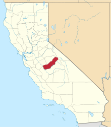
 Berenda  Berenda Location in California | |
| Coordinates: 37°02′25″N 120°09′13″W / 37.04028°N 120.15361°WCoordinates: 37°02′25″N 120°09′13″W / 37.04028°N 120.15361°W | |
| Country | United States |
| State | California |
| County | Madera County |
| Elevation[1] | 253 ft (77 m) |
Berenda (Berrenda is Spanish for "female antelope"; formerly, Berendo, Berrenda, and Berrendo) is an unincorporated community in Madera County, California.[1] It is located on the north bank of Berenda Creek 3.3 miles (5.3 km) southeast of Fairmead and 7 miles (11 km) northwest of Madera, at an elevation of 253 feet (77 m).[1] Berenda is located on the Southern Pacific Railroad.[2]
The Berendo post office opened in 1873, closed for a period in 1881, changed its name to Berenda in 1919, and closed in 1935.[2]
References
This article is issued from Wikipedia - version of the 7/5/2016. The text is available under the Creative Commons Attribution/Share Alike but additional terms may apply for the media files.