Bonadelle Ranchos-Madera Ranchos, California
| Bonadelle Ranchos- Madera Ranchos, California | |
|---|---|
| census-designated place | |
| Nickname(s): The Chos' | |
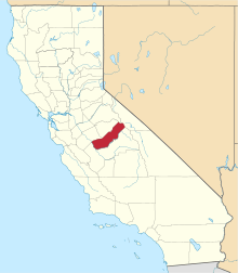
 Location in Madera County and the state of California | |
 Bonadelle Ranchos- Madera Ranchos, California Location in the United States | |
| Coordinates: 36°56′11″N 119°53′12″W / 36.93639°N 119.88667°WCoordinates: 36°56′11″N 119°53′12″W / 36.93639°N 119.88667°W | |
| Country |
|
| State |
|
| County | Madera |
| Area[1] | |
| • Total | 11.585 sq mi (30.005 km2) |
| • Land | 11.585 sq mi (30.005 km2) |
| • Water | 0 sq mi (0 km2) 0% |
| Elevation | 311-422 ft (182 m) |
| Population (2010) | |
| • Total | 8,569 |
| • Density | 740/sq mi (290/km2) |
| Time zone | Pacific (PST) (UTC-8) |
| • Summer (DST) | PDT (UTC-7) |
| ZIP code | 93636 |
| Area code(s) | 559 |
| FIPS code | 06-07379 |
| GNIS feature ID | 2407879 |
Bonadelle Ranchos-Madera Ranchos is a census-designated place (CDP) in Madera County, California, United States. It is part of the Madera–Chowchilla Metropolitan Statistical Area. The population was 8,569 at the 2010 census, up from 7,300 at the 2000 census.
Geography
Bonadelle Ranchos-Madera Ranchos is located at 36°56′11″N 119°53′12″W / 36.93639°N 119.88667°W (36.936378, -119.886723).[2]
According to the United States Census Bureau, the CDP has a total area of 11.6 square miles (30 km2), all of it land.
Environment
The Bonadelle Ranchos is often regarded as a Valley-Foothill transitional zone, because its elevation is higher than average for valley but slightly too low to be considered part of the Sierra foothills. Immediately Northeast lies the rugged foothills of the Sierra Nevada range. Its environment corresponds, showing qualities of a transition zone. The Northeast portion of the area is the highest in elevation,and small tabletop hills are present: most notably Adobe Hill, which lies at an elevation of 640 feet. All throughout the area, there is large, rolling hills. Multiple creeks run through the area, but none are large enough to bring constant flow. The creeks include Little Dry Creek, Bonadelle Creek, Cottonwood Creek, and Root Creek. Many of these waterways flow in the winter months, when rainfall and snow filter down from the nearby foothills. There are many seasonal ponds in the area, however most are too small and short-lived to offer recreational activities. Many of the wildlife is typical for this type of environment. Mammals include foxes, ground squirrels, coyotes, raccoons, skunks and occasionally bobcats and mountain lions. Dove, crows, ravens, ducks, Scrub jays, California woodpeckers, egrets, red tailed hawks, turkey vultures, and geese can be found as well.
Climate
The climate in this area is noticeably different than the nearby cities, often become 3-10 degrees cooler during the winter months. Because of the vast openness of the surrounding area, wind can often become a temperature factor because of wind chill.
The climate in the area varies drastically throughout the year. Spring in the area is generally very warm. Spring starts in March and ends in May. Temperatures generally reach the high 60s (in March). April-Mays highs reach the 70s and 80s, and nightly lows can still be in the mid 30s (in April), however the lows average around 45-50 degrees. Many trees often begin to bloom early, sometimes as early as March.
Summer in the area is very hot and starts in June and lasts until early October. Temperatures regularly reach over 100 degrees. Sun is constant with essentially no clouds. Nightly lows in the area generally are in the high 50s and 60s, although some extremes have even reached the high 40s. Because of the vitual absence of rainfall, drought is constant through summer, and the risk of fire is high.
Fall in the area is mild, with highs in the 60s and 70s (°F), although some late fall patterns have highs still in the 80s. Fall is usually short lived, only encompassing mid-October until the end of November. That is typically when winter weather starts to move in. Nightly lows can greatly vary this time of year. Lows are generally 35–50° F, but in some cases can reach as low as 32°.
Winters are generally mild. The area experiences thick Tule Fog, which is extremely dense fog that limits visibility to 500 feet in some cases. Tule fog can last all day, however this isn't a very common occurrence. The area generally experiences rain from November to March. Snow is generally never present in any measurable amount. In few cases, precipitation and temperature can coincide and bring flurries, but they are short and nearly impactless. Winter lows can dip down quite low for California standards, as lows have been known to drop down to the high teens and 20s, although most winter lows are in the 30s and frost is quite prevalent. Highs in winter are in the 40s–50s, and most days are sunny with high-altitude clouds. Very windy days are present every winter, and these patterns may last for weeks at a time.
History
The Bonadelle Ranchos has a relatively long history however not much is known about it. John Bonadelle, basically the founder of the area, was a landowner and owned most of the properties in the area. Many of the street names were named by him. Street names were often sold to people in Hollywood, who sometimes named them after themselves. Settlement began as early as 1940, but the movement trend really boomed in the 1970s and continued on.
Demographics
2010
The 2010 United States Census[3] reported that Bonadelle Ranchos-Madera Ranchos had a population of 8,569. The population density was 739.7 people per square mile (285.6/km²). The racial makeup of Bonadelle Ranchos-Madera Ranchos was 7,034 (82.1%) White, 114 (1.3%) African American, 120 (1.4%) Native American, 207 (2.4%) Asian, 4 (0.0%) Pacific Islander, 811 (9.5%) from other races, and 279 (3.3%) from two or more races. Hispanic or Latino of any race were 2,305 persons (26.9%).
The Census reported that 8,564 people (99.9% of the population) lived in households, 5 (0.1%) lived in non-institutionalized group quarters, and 0 (0%) were institutionalized.
There were 2,804 households, out of which 1,076 (38.4%) had children under the age of 18 living in them, 2,034 (72.5%) were opposite-sex married couples living together, 218 (7.8%) had a female householder with no husband present, 141 (5.0%) had a male householder with no wife present. There were 107 (3.8%) unmarried opposite-sex partnerships, and 14 (0.5%) same-sex married couples or partnerships. 318 households (11.3%) were made up of individuals and 120 (4.3%) had someone living alone who was 65 years of age or older. The average household size was 3.05. There were 2,393 families (85.3% of all households); the average family size was 3.27.
The population was spread out with 2,126 people (24.8%) under the age of 18, 737 people (8.6%) aged 18 to 24, 1,841 people (21.5%) aged 25 to 44, 2,862 people (33.4%) aged 45 to 64, and 1,003 people (11.7%) who were 65 years of age or older. The median age was 41.5 years. For every 100 females there were 102.1 males. For every 100 females age 18 and over, there were 100.4 males.
There were 2,937 housing units at an average density of 253.5 per square mile (97.9/km²), of which 2,521 (89.9%) were owner-occupied, and 283 (10.1%) were occupied by renters. The homeowner vacancy rate was 1.7%; the rental vacancy rate was 5.0%. 7,564 people (88.3% of the population) lived in owner-occupied housing units and 1,000 people (11.7%) lived in rental housing units.
2000
As of the census[4] of 2000, there were 7,300 people, 2,327 households, and 2,047 families residing in the CDP. The population density was 627.6 people per square mile (242.4/km²). There were 2,381 housing units at an average density of 204.7 per square mile (79.0/km²). The racial makeup of the CDP was 85.42% White, 1.40% Black or African American, 1.19% Native American, 1.14% Asian, 0.08% Pacific Islander, 7.67% from other races, and 3.10% from two or more races. 18.85% of the population were Hispanic or Latino of any race.
There were 2,327 households out of which 41.9% had children under the age of 18 living with them, 77.6% were married couples living together, 6.5% had a female householder with no husband present, and 12.0% were non-families. 8.3% of all households were made up of individuals and 2.4% had someone living alone who was 65 years of age or older. The average household size was 3.13 and the average family size was 3.30.
In the CDP the population was spread out with 29.1% under the age of 18, 7.3% from 18 to 24, 27.2% from 25 to 44, 28.8% from 45 to 64, and 7.7% who were 65 years of age or older. The median age was 38 years. For every 100 females there were 102.2 males. For every 100 females age 18 and over, there were 98.4 males.
The median income for a household in the CDP was $58,764, and the median income for a family was $60,793. Males had a median income of $41,220 versus $31,011 for females. The per capita income for the CDP was $21,478. About 2.7% of families and 3.9% of the population were below the poverty line, including 3.6% of those under age 18 and 6.5% of those age 65 or over.
Community
The Bonadelle Ranchos-Madera Ranchos community is considered rural. There are two different areas in the Bonadelle Ranchos-Madera Ranchos. The first area is the Madera Ranchos, which is considered the business and urban area of the community. The community spans roughly 6.5 miles in length from Kensington Drive north to Highway 145. There are three gas stations, as well as the Madera Ranchos Market, a primary shopping location and business for the local populations. A local library, daycare and several other small shops and stores are also present in the community. Homes in the area are generally on 1/2-1 acre, and are on a local community well. The second area is the Bonadelle Ranchos, which spans roughly from Avenue 13 North to Highway 145. This is the most rural part of the community. The majority of the homes in this area are on 2+ acres and all have their own wells for water. The Bonadelle 9 Volunteer Fire Station is also located in this area, and serves as the main fire fighting force in the community.
School System
The Bonadelle/Madera Ranchos has a great school system, with accomidations for all ages and needs. There are two K-6 schools, in both the North and South portions of the community. Webster school, which has been serving the community since the 1970s, is still going strong today. Their mascot is the Wolverines. They are located in the Southern section, and have a large and robust campus. Sierra View Elementary, while smaller, offers great education for K-6 students in the Northern section. Their mascot is the Panthers.
Ranchos Middle School, with its large and new campus built in 2009, serves the South section. They are the home of the Mustangs. It is near the Liberty High School, home of the Hawks.
Government
In the California State Legislature, Bonadelle Ranchos-Madera Ranchos is in the 12th Senate District, represented by Republican Anthony Cannella, and the 5th Assembly District, represented by Republican Frank Bigelow.[5]
In the United States House of Representatives, Bondadelle Ranchos-Madera Ranchos is in California's 16th congressional district, represented by Democrat Jim Costa.[6]
References
- ↑ "2010 Census Gazetteer Files - Places - California". United States Census Bureau. Retrieved March 26, 2015.
- ↑ "US Gazetteer files: 2010, 2000, and 1990". United States Census Bureau. 2011-02-12. Retrieved 2011-04-23.
- ↑ "2010 Census Interactive Population Search: CA - Bonadelle Ranchos-Madera Ranchos CDP". U.S. Census Bureau. Retrieved July 12, 2014.
- ↑ "American FactFinder". United States Census Bureau. Archived from the original on 2013-09-11. Retrieved 2008-01-31.
- ↑ "Statewide Database". Regents of the University of California. Retrieved March 26, 2015.
- ↑ "California's 16th Congressional District - Representatives & District Map". Civic Impulse, LLC.