Mespuits
| Mespuits | |
|---|---|
|
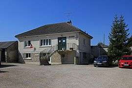
The town hall in Mespuits | |
 Mespuits | |
|
Location within Île-de-France region  Mespuits | |
| Coordinates: 48°21′22″N 2°16′18″E / 48.356°N 2.2717°ECoordinates: 48°21′22″N 2°16′18″E / 48.356°N 2.2717°E | |
| Country | France |
| Region | Île-de-France |
| Department | Essonne |
| Arrondissement | Étampes |
| Canton | Méréville |
| Intercommunality | Étampois |
| Government | |
| • Mayor (2008–2014) | Gérard Baudet |
| Area1 | 9.95 km2 (3.84 sq mi) |
| Population (2006)2 | 179 |
| • Density | 18/km2 (47/sq mi) |
| Time zone | CET (UTC+1) |
| • Summer (DST) | CEST (UTC+2) |
| INSEE/Postal code | 91399 / 91150 |
| Elevation | 93–145 m (305–476 ft) |
|
1 French Land Register data, which excludes lakes, ponds, glaciers > 1 km² (0.386 sq mi or 247 acres) and river estuaries. 2 Population without double counting: residents of multiple communes (e.g., students and military personnel) only counted once. | |
Mespuits is a commune in the Essonne department in Île-de-France in northern France.
Inhabitants of Mespuits are known as Mespuitsiens.
See also
References
- INSEE
- Mayors of Essonne Association (French)
External links
| Wikimedia Commons has media related to Mespuits. |
- Mérimée database - Cultural heritage (French)
- Land use (IAURIF) (English)
This article is issued from Wikipedia - version of the 2/11/2016. The text is available under the Creative Commons Attribution/Share Alike but additional terms may apply for the media files.