Morangis, Essonne
| Morangis | ||
|---|---|---|
|
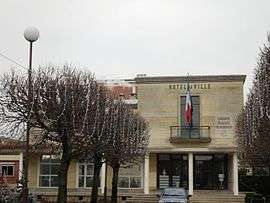
The town hall in Morangis | ||
| ||
 Morangis | ||
|
Location within Île-de-France region  Morangis | ||
| Coordinates: 48°42′20″N 2°19′57″E / 48.7055°N 2.3326°ECoordinates: 48°42′20″N 2°19′57″E / 48.7055°N 2.3326°E | ||
| Country | France | |
| Region | Île-de-France | |
| Department | Essonne | |
| Arrondissement | Palaiseau | |
| Canton | Chilly-Mazarin | |
| Intercommunality | Europ'Essonne | |
| Government | ||
| • Mayor (2008–2014) | Pascal Noury | |
| Area1 | 4.80 km2 (1.85 sq mi) | |
| Population (2006)2 | 11,577 | |
| • Density | 2,400/km2 (6,200/sq mi) | |
| Time zone | CET (UTC+1) | |
| • Summer (DST) | CEST (UTC+2) | |
| INSEE/Postal code | 91432 / 91420 | |
| Elevation | 47–100 m (154–328 ft) | |
|
1 French Land Register data, which excludes lakes, ponds, glaciers > 1 km² (0.386 sq mi or 247 acres) and river estuaries. 2 Population without double counting: residents of multiple communes (e.g., students and military personnel) only counted once. | ||
.svg.png)
Morangis is a commune in the Essonne department in the southern suburbs of Paris, France. It is located 18 kilometres from the center of Paris. A portion of Paris Orly Airport is in Morangis.[1]
Inhabitants of Morangis are known as Morangissois.
Transport
Morangis is served by stations on Paris RER line C:
There is also Highway A6 exit and Paris - Orly Airport nearby.
Education
Public primary schools include:[2]
- Ecole maternelle Les Acacias (preschool)
- Ecole maternelle Les Hirondelles (preschool)
- Ecole élémentaire Edouard Herriot
- Ecole élémentaire Louis Moreau
- Ecole primaire Nelson Mandela
There is a public junior high school, Collège Michel Vignaud; a public senior high school/sixth-form college, Lycée Marguerite Yourcenar; and a private school, Ecole privée Saint-Joseph.[2]
Twins cities
- Plaidt, in Germany
- Chard, Somerset, in England
See also
References
- INSEE
- Mayors of Essonne Association (French)
- ↑ "Plan." Morangis. Retrieved on 6 October 2009.
- 1 2 "Etablissements scolaires de Morangis." Morangis. Retrieved on September 3, 2016.
External links
| Wikimedia Commons has media related to Morangis (Essonne). |
- Morangis website (French)
- Land use (IAURIF) (English)
This article is issued from Wikipedia - version of the 9/3/2016. The text is available under the Creative Commons Attribution/Share Alike but additional terms may apply for the media files.