Chilly-Mazarin
| Chilly-Mazarin | ||
|---|---|---|
|
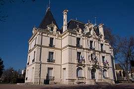
The town hall of Chilly-Mazarin | ||
| ||
 Location (in red) within Paris inner and outer suburbs | ||
| Coordinates: 48°42′09″N 2°18′45″E / 48.7025°N 2.3125°ECoordinates: 48°42′09″N 2°18′45″E / 48.7025°N 2.3125°E | ||
| Country | France | |
| Region | Île-de-France | |
| Department | Essonne | |
| Arrondissement | Palaiseau | |
| Canton | Chilly-Mazarin | |
| Intercommunality | Europ'Essonne | |
| Government | ||
| • Mayor (2008–2014) | Gérard Funès | |
| Area1 | 5.57 km2 (2.15 sq mi) | |
| Population (2006)2 | 18,698 | |
| • Density | 3,400/km2 (8,700/sq mi) | |
| Time zone | CET (UTC+1) | |
| • Summer (DST) | CEST (UTC+2) | |
| INSEE/Postal code | 91161 / 91380 | |
| Elevation | 42–101 m (138–331 ft) | |
|
1 French Land Register data, which excludes lakes, ponds, glaciers > 1 km² (0.386 sq mi or 247 acres) and river estuaries. 2 Population without double counting: residents of multiple communes (e.g., students and military personnel) only counted once. | ||
.svg.png)
Chilly-Mazarin is a commune in the southern suburbs of Paris, France. It is located 16.9 km (10.5 mi) from the center of Paris.
A small part of Orly International Airport lies on the territory of the commune of Chilly-Mazarin.[1]
Inhabitants of Chilly-Mazarin are known as Chiroquois.
Transport
Chilly-Mazarin is served by Chilly-Mazarin station on Paris RER line C.
Education
There are:[2]
- Seven preschools (écoles maternelles): du Centre, du Château, Les Roseaux, Les Saules, Pasteur, and Pauline Kergomard
- Four elementary schools: du Château, Jean-de-la-Fontaine, Pasteur, and Pierre et Marie Curie
There is a junior high school, Collège les Dînes Chiens, which opened in 1968.[3]
Area high schools include:[4]
- Lycée Marguerite-Yourcenar - Morangis
- Lycée Jacques-Prévert - Longjumeau
- Lycée des Métiers Jean-Perrin – Longjumeau
See also
References
- INSEE
- Mayors of Essonne Association (French)
- ↑ "Plan interactif." Chilly-Mazarin. Retrieved on 6 October 2009.
- ↑ "Annuaire des équipements ." Chilly-Mazarin. Retrieved on September 3, 2016.
- ↑ Home page. Collège les Dînes Chiens. Retrieved on September 3, 2016.
- ↑ "Aller au lycée." Chilly-Mazarin. Retrieved on September 3, 2016.
External links
| Wikimedia Commons has media related to Chilly-Mazarin. |
- Official website (French)
- Mérimée database - Cultural heritage (French)
- Land use (IAURIF) (English)
This article is issued from Wikipedia - version of the 10/13/2016. The text is available under the Creative Commons Attribution/Share Alike but additional terms may apply for the media files.