Leach Highway
| Leach Highway Western Australia | |
|---|---|
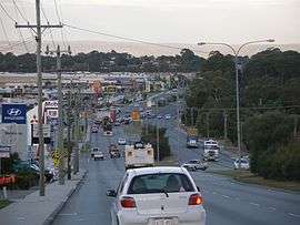 | |
| Leach Highway in Melville | |
| General information | |
| Type | Highway |
| Length | 23 km (14 mi) |
| Route number(s) |
|
| Major junctions | |
| East end | Airport Drive , Kewdale |
| |
| West end |
|
| Location(s) | |
| Major suburbs | Welshpool, Wilson, Rossmoyne, Winthrop, Melville |
| Highway system | |
|
Highways in Australia National Highway • Freeways in Australia Highways in Western Australia | |
| |
Leach Highway is a 23-kilometre (14 mi) east-west arterial highway in the southern suburbs of Perth, Western Australia, primarily linking Kewdale and Perth Airport with the city of Fremantle.
It is allocated State Route 7 and is a dual carriageway for its entire length. Leach Highway varies in width between 4 and 6 lanes, and in speed limit between 70 km/h (43 mph) and 80 km/h (50 mph).
Route description
Leach Highway is one of the state's most important heavy vehicle routes. It links the major industrial areas of Kewdale and Welshpool with Western Australia's major container port at Fremantle.[1]
Although Leach Highway's western terminus is at Carrington Street in Palmyra, High Street continues for a further 1.5 km (0.9 mi) into Fremantle, and connects Leach Highway to Stirling Highway.
History
Leach Highway is named for J.D. "Digby" Leach, former Commissioner of Main Roads Western Australia. In 1972 the first section was opened between its present western terminus at Carrington Street, Melville (now Palmyra), and High Road in Canning (now Willetton).
It was soon extended eastward from High Road through to Manning Road, utilising the old timber Riverton Bridge over the Canning River via Barbican St East and what is now Fern Rd and Grayson Ct.[2] In 1976 it was further extended from Manning Road to Orrong Road, including bridges over Albany Highway in Bentley and the Armadale railway line in Welshpool. Then in 1978 the 4-lane concrete Shelley Bridge over Canning River opened, with Riverton Bridge retained for local traffic.[2]
In the early 1980s the highway was extended further eastward, first to Hardey Road and, soon thereafter, to the new Beechboro-Gosnells Highway (now called Tonkin Highway) which remains as the highway's present eastern terminus.
Also around that time a number of intersections were built to coincide with new roads being built around Leach Highway. A parclo interchange was constructed at the newly extended Kwinana Freeway, and an intersection was constructed for the new Centenary Avenue in Wilson to improve access to the Western Australian Institute of Technology (WAIT), now called Curtin University. New at-grade intersections were built at Murdoch Drive and Winthrop Drive to service the new suburbs of Bateman and Winthrop.
Although not strictly Leach Highway, in 1985 Stirling Highway was extended southwards from its then terminus at Canning Highway to a new terminus at High Street (an extension of Leach Highway). This marked the final piece of an improved freight link between the Port of Fremantle and Perth's major industrial areas around Kewdale.
Apart from minor modifications, the Leach Highway remained largely unchanged until 2005/2006 when work on projects at Kwinana Freeway and Orrong Road commenced.
Orrong Road interchange
In November 2005, the state government announced plans for the construction of a diamond interchange at the intersection of Leach Highway and Orrong Road in Welshpool. Orrong Road, which is a continuation of Graham Farmer Freeway has experienced increased in traffic by approximately 40% since the freeway was completed in 2000. The new bridge will bring Leach Highway over Orrong Road. The intersection was formerly Perth's worst blackspot. Approximately 70,000 vehicles, including substantial numbers of trucks, use the intersection daily. Funding for the project was made available through the sale of land reserved for the Fremantle Eastern Bypass. The interchange has since been completed and traffic flow has improved vastly.
Bull Creek railway station
Bull Creek railway station was built at the interchange of Leach Highway and Kwinana Freeway for the new Perth-Mandurah railway. A new bridge was built immediately south of the present highway bridge to cater for bus access to the railway station. Alterations to the Kwinana Freeway on and off ramps to Leach Highway have also been undertaken, entailing modifications to the layout of the parclo interchange
Gateway WA
As part of the Gateway WA project, which commenced in 2013 and was completed in March 2016, Leach Highway was upgraded[3] to a controlled access four lane expressway from Orrong Road into the future consolidated Perth Airport complex. This will involve a full freeway to freeway interchange with Tonkin Highway and a compact diamond interchange with Abernethy Road.[3] The ultimate design plan makes provision for this road to be upgraded to four lanes before 2031.
Future upgrades
High Street upgrade
The section of High Street between Carrington Street and Stirling Highway is due for upgrade.[4] Upon completion, this section is to be known as Leach Highway,[4] extending Leach Highway to Stirling Highway. The T junction at Stirling Highway is part of the main freight access for vehicles accessing the Port of Fremantle, and is a very busy intersection for trucks.
Major interchanges and exits
As Leach Highway is not limited access, a large number of the roads that Leach Highway are connected to are not controlled. Major intersections are at-grade and controlled. Exceptions are the Albany Highway, Orrong Road and Abernethy Road, which are grade separated in favour of Leach Highway. The first two are diamond interchanges, while the latter is a SPUI interchange. Although also grade-separated, the Centenary Avenue interchange is controlled by traffic lights on the westbound side of the highway,
Signed as ![]() State Route 7:
State Route 7:
-
 Tonkin Highway (State Route 4), Kewdale and Cloverdale
 -
 Abernethy Road (State Route 55), Kewdale and Cloverdale
 -
 Orrong Road (State Route 8), Kewdale, Carlisle and Welshpool
 - Welshpool Road, Welshpool
-
 Albany Highway (State Route 30), Bentley
 -
 Manning Road (State Route 26), Bentley
 - Bungaree Road, Wilson
- Centenary Avenue, Wilson
- Vahland Avenue/Barbican Street East, Shelley
-
 High Road (State Route 27), Shelley, Riverton and Willetton
 - Karel Avenue, Rossmoyne and Willetton
- Webb Street, Rossmoyne
- Bull Creek Drive, Bull Creek
-

 Kwinana Freeway (State Route 2 / National Route 1 north), Brentwood and Bull Creek
Signed as ![]()
![]() State Route 7 / National Route 1:
State Route 7 / National Route 1:
- Moolyeen Road, Brentwood
- Murdoch Drive, Bateman and Winthrop
- Riseley Street, Booragoon
- North Lake Road, Myaree, Willagee and Winthrop
- Stock Road (National Route 1), Melville, Palmyra and Willagee
Signed as ![]() State Route 7:
State Route 7:
- Carrington Street, Palmyra and White Gum Valley
Leach Highway then continues as ![]() High Street (State Route 7)
High Street (State Route 7)
See also
- Highways in Australia
- Highways in Western Australia
- Freeways in Australia
- Freeways in Western Australia
References
- Notes
- ↑ "High Street Upgrading Study" (PDF). Estill and Associates. Retrieved 13 September 2014.
- 1 2 Lester Durbin (October 2004), "History of Riverton Bridge" (PDF), Wilson Residents & Ratepayers' Association Newsletter, Wilson Residents & Ratepayers' Association, p. 3, retrieved 13 September 2014 External link in
|publisher=(help) - 1 2 "Gateway WA - Project Master Plan" (PDF). Gateway Vision. April 2012. Retrieved 13 September 2014.
- 1 2 "Fact Sheet: Leach Highway Fremantle Upgrade Project" (PDF). Main Road. Retrieved 13 September 2014.
- Bibliography
- Edmonds, Leigh (1997). The vital link: a history of Main Roads Western Australia 1926-1996. Nedlands, Western Australia: University of Western Australia Press. ISBN 1-875560-87-4.
- StreetSmart Perth 2003 Street Directory. Midland, Western Australia: Department of Land Administration and West Australian Newspapers Ltd. 2002. ISBN 0-909699-87-9.
- Main Roads WA, Gateway WA Project Master Plan, Page 7
External links
Road infrastructure in Western Australia | ||
|---|---|---|
| Freeways | ||
| Metropolitan highways | ||
| Highways and major roads |
| |
| Outback tracks | ||
| ||||||
| National Highways | ||||||
| National Routes | ||||||
| State Routes | ||||||
| Tourist Drives | ||||||