Brookton Highway
| Brookton Highway Western Australia | |
|---|---|
| General information | |
| Type | Highway |
| Length | 112 km (70 mi)[1] |
| Route number(s) |
|
| Major junctions | |
| West end |
|
| |
| East end |
|
| Location(s) | |
| Major settlements | Roleystone, Karragullen, Westdale, Brookton |
| Highway system | |
|
Highways in Australia National Highway • Freeways in Australia Highways in Western Australia | |
| |
Brookton Highway is a 112 kilometre long undivided single carriageway highway in Western Australia, running from the southern Perth suburb of Kelmscott, through Westdale, to the southern Wheatbelt town of Brookton. It is signposted as State Route 40, however the route and highway continues on far past Brookton, passing through Corrigin, Kondinin, Hyden, Lake King, and finishing at South Coast Highway, just west of Ravensthorpe.
Route description
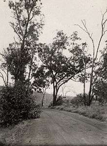
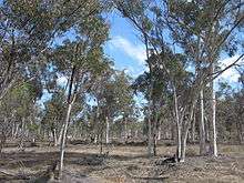
Near its western terminus, the road passes through thick jarrah forest in the Darling Scarp; however further east, the landscape soon becomes flat, passing through wheat farming regions and wandoo woodlands
until reaching Brookton.
The highway is a part of the route linking Perth to Esperance and is identified as a strategic freight and tourist route.[2] For most of the road it is able to cater for heavy vehicle combinations up to 36.5m in length which generally carry grain and livestock. Tourism traffic, particularly to Wave Rock, is also prevalent along the western stretch of the road.
History
The bushfire in Kelmscott and Roleystone on 6 February 2011 destroyed the Buckingham Bridge. The bridge had originally been built from timber in 1935.[3] A temporary bridge over the Canning River was opened on 4 March 2011 and was constructed using 400 tonnes of rock, 250 tonnes of crushed limestone and 4500 tonnes of fill material. Heavy vehilcles were unable to use the structure and had to detour at Welshpool Road. This part of the highway is used by up to 4,000 vehicles per day.[4]
The Buckingham Bridge was replaced with a permanent concrete and steel bridge.[5][6][7] The bridge is to be constructed to south of the temporary crossing, so that traffic will not be disturbed.[5][6][7] It is expected to be finished in the middle of 2013.[5][6][7]
See also
![]() Australian Roads portal
Australian Roads portal
References
- ↑ Google (20 June 2013). "Brookton Highway" (Map). Google Maps. Google. Retrieved 20 June 2013.
- ↑ "Roads 2025 Regional Road Development Strategy" (PDF). 2007. Retrieved 2011-04-16.
- ↑ "Brookton Highway reconnected through Kelmscott/Roleystone". 2011. Retrieved 2011-04-16.
- ↑ "Brookton Highway bridge reopens". 2011. Retrieved 2011-04-16.
- 1 2 3 "$7million Buckingham Bridge replacement works commencing soon". News. Main Roads Western Australia. 5 November 2012. Retrieved 13 November 2012.
- 1 2 3 "$7million for Buckingham Bridge replacement". Ministerial Media Statements. Government of Western Australia. 5 November 2012. Retrieved 13 November 2012.
- 1 2 3 Shurmer, Jaime (1 November 2012). "Permanent replacement for bridge destroyed in Kelmscott/Roleystone bushfire". Comment News. Retrieved 13 November 2012.
Road infrastructure in Western Australia | ||
|---|---|---|
| Freeways | ||
| Metropolitan highways | ||
| Highways and major roads |
| |
| Outback tracks | ||
| ||||
| National Highways | ||||
| National Routes | ||||
| State Routes | ||||
| Tourist Drives | ||||