Innisfail, Alberta
| Innisfail | ||
|---|---|---|
| Town | ||
| Town of Innisfail | ||
|
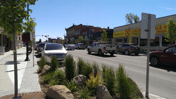
Mainstreet Innisfail | ||
| ||
 Innisfail Location of Innisfail in Alberta | ||
| Coordinates: 52°01′41″N 113°57′00″W / 52.02806°N 113.95000°W | ||
| Country |
| |
| Province |
| |
| Region | Central Alberta | |
| Census division | 8 | |
| Municipal district | Red Deer County | |
| Incorporated[1] | ||
| • Village | December 15, 1899 | |
| • Town | November 20, 1903 | |
| Government[2] | ||
| • Mayor | Brian Spiller | |
| • Governing body |
Innisfail Town Council
| |
| • CAO | Helen Dietz | |
| • MP | Earl Dreeshen | |
| Area (2011)[3] | ||
| • Total | 19.53 km2 (7.54 sq mi) | |
| Elevation[4] | 945 m (3,100 ft) | |
| Population (2011)[3] | ||
| • Total | 7,876 | |
| • Density | 403.2/km2 (1,044/sq mi) | |
| Time zone | MST (UTC-7) | |
| Postal code span | T4G | |
| Highways |
Highway 2 Highway 54 | |
| Waterways |
Gleniffer Lake Red Deer River | |
| Website | Official website | |

Innisfail /ˈɪnᵻsfeɪl/ is a town in central Alberta, Canada. It is located in the Calgary-Edmonton Corridor, south of Red Deer at the junction of Highway 2 and Highway 54.
History

The town's name comes from an Irish-language epithet for Ireland, Inis Fáil, "Isle of Destiny". Before this name was adopted, the town was often referred to as "Poplar Grove".[5] Sandy Fraser, Napoleon Remillard, Arthur Content and Bill Kemp settled in the area from 1884-1887. These were Innisfail’s first settlers. Dr. Henry George was an important physician and coroner for Calgary and Central Alberta. He settled in Innisfail and built a house he called “Lindum Lodge” (this is where the Dr. George/Kemp house is today). Later the house was occupied by Bill Kemp and Kate Jane Kemp, who ran it as a boarding house until the 1960s.[6] More people continued to move to the Innisfail area. The construction of the railroad attracted more settlers and business. One of the first businessmen in the area was G. W. West. He is very important to Innisfail’s past as he ran a general store, meat market, and grocery store. He was Innisfail’s first proprietor when he moved here in 1891. By the 1900s, Innisfail was a village. Some of the early businesses included the Union Bank, the Murray Hotel, Hotel Alberta, the New York Café, the Modern Café, the Paris Café, the Opera House and the West Store.[7]
Demographics
The Town of Innisfail's 2015 municipal census counted a population of 7,922, a 0.1% increase over its 2012 municipal census population of 7,922.[8] Males made up 42 per cent of the total population, while females made up 43 per cent (13 per cent of the population did not indicate their gender).[8] The three largest five-year age categories within Innisfail's population were between 75 and over, 50 to 54 years of age, and 55 to 59 years of age. Combined, these three categories accounted for 21 per cent of the town's total population.[8]
In the 2011 Census, the Town of Innisfail had a population of 7,876 living in 3,118 of its 3,323 total dwellings, a 7.4% change from its 2006 adjusted population of 7,331. With a land area of 19.53 km2 (7.54 sq mi), it had a population density of 403.3/km2 (1,044.5/sq mi) in 2011.[3]
Arts and culture
Innisfail is home to the Daines Pro Rodeo, Anthony Henday Campground, Dr. George / Kemp House Museum, a beautiful historic downtown with unique stores, and the Historical Village museum.
Education
According to the National Household Survey conducted by Statistics Canada in 2011, Innisfail has a comparatively high ratio of residents with no certificate, diploma or degree (based on total population aged 25 to 64).[9] In particular, 1 in 5 males (20.2%) between the ages of 25 and 64 do not possess a certificate, diploma or degree at any level of education. In comparison to other communities in Central Alberta, males aged 25 to 64 in Ponoka, Olds and Sylvan Lake had rates of 11.9%,[10] 14.1%[11] and 14.9%,[12] respectively. The province of Alberta ratio for males aged 25 to 64 with no certificate, diploma or degree is 13.2%.[13] This puts Innisfail 53% above the provincial average for males.
Infrastructure
Transportation
Innisfail is served by the Innisfail Aerodrome, which is located northwest of the town.
Notable people
- Garry Bauman, former professional hockey player
- Sharon Christian, artist
- Shane Gaalaas, drummer/multi-instrumentalist
- Dallas Gaume, former professional hockey player
- Rebecca Jenkins, actress/singer
- Matthew Yeats, former professional hockey player
Facilities
The Royal Canadian Mounted Police (RCMP) dog training facility is located 2 km south of Innisfail. Napoleon Trails Gravesite is also nearby.
See also
References
- ↑ "Location and History Profile: Town of Innisfail" (PDF). Alberta Municipal Affairs. June 17, 2016. p. 337. Retrieved June 20, 2016.
- ↑ "Municipal Officials Search". Alberta Municipal Affairs. November 18, 2016. Retrieved November 21, 2016.
- 1 2 3 "Population and dwelling counts, for Canada, provinces and territories, and census subdivisions (municipalities), 2011 and 2006 censuses (Alberta)". Statistics Canada. 2012-02-08. Retrieved 2012-02-08.
- ↑ "Alberta Private Sewage Systems 2009 Standard of Practice Handbook: Appendix A.3 Alberta Design Data (A.3.A. Alberta Climate Design Data by Town)" (PDF) (PDF). Safety Codes Council. January 2012. pp. 212–215 (PDF pages 226–229). Retrieved October 8, 2013.
- ↑ Town of Innisfail. "Welcome to Innisfail, Alberta, CANADA!". Retrieved 2010-04-05.
- ↑ Innisfail Historical Village. "The Beginning". Retrieved 2014-08-31.
- ↑ Innisfail Historical Village. "Early Business". Retrieved 2014-08-31.
- 1 2 3 "2015 Municipal Census Report" (PDF). Town of Innisfail. Retrieved April 13, 2015.
- ↑ Statistics Canada (NHS 2011). "Innisfail - NHS Profile". Retrieved 2014-02-17.
- ↑ Statistics Canada (NHS 2011). "Ponoka - NHS Profile". Retrieved 2014-02-17.
- ↑ Statistics Canada (NHS 2011). "Olds - NHS Profile". Retrieved 2014-02-17.
- ↑ Statistics Canada (NHS 2011). "Sylvan Lake - NHS Profile". Retrieved 2014-02-17.
- ↑ Statistics Canada (NHS 2011). "Alberta - NHS Profile". Retrieved 2014-02-17.
External links
 |
Eckville | Red Deer Penhold |
Delburne | |
| Caroline | |
Elnora | ||
| ||||
| | ||||
| Sundre | Bowden Olds |
Trochu Three Hills |
Coordinates: 52°02′N 113°57′W / 52.033°N 113.950°W