Cynthiana, Kentucky
| Cynthiana, Kentucky | |
|---|---|
| City | |
|
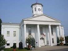
Downtown Cynthiana | |
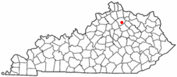 Location in the Commonwealth of Kentucky | |
| Coordinates: 38°23′18″N 84°17′49″W / 38.38833°N 84.29694°WCoordinates: 38°23′18″N 84°17′49″W / 38.38833°N 84.29694°W | |
| Country | United States |
| State | Kentucky |
| County | Harrison |
| Government | |
| • Mayor | James Smith |
| Area | |
| • Total | 3.3 sq mi (8.7 km2) |
| • Land | 3.3 sq mi (8.7 km2) |
| • Water | 0.0 sq mi (0.0 km2) |
| Elevation | 735 ft (224 m) |
| Population (2010) | |
| • Total | 6,402 |
| • Density | 1,873.6/sq mi (723.4/km2) |
| Time zone | EST (UTC-5) |
| • Summer (DST) | EDT (UTC-4) |
| ZIP code | 41031 |
| Area code(s) | 859 |
| FIPS code | 21-19432 |
| GNIS feature ID | 0490519 |
| Website | cynthianaky.com |

Cynthiana is a home rule-class city[1] in Harrison County, Kentucky, in the United States. The population was 6,402 at the 2010 census. It is the seat of its county and is located roughly halfway between Cincinnati and Lexington.[2]
History
Cynthiana was named after Cynthia and Anna Harrison,[3] daughters of Robert Harrison, who had donated land for its establishment,[4] though Harrison County was named after Colonel Benjamin Harrison, who was an early settler in the area and the sheriff of Bourbon County.[5]
Two Civil War battles were fought in Cynthiana; the first on July 17, 1862, was part of a raid into Kentucky by Confederate General John Hunt Morgan; the second on June 11 and 12, 1864, resulted in defeat of Confederate forces on Morgan's last raid into the state.[6] [7]
On January 23, 1877, an LL chondrite meteorite fell in Cynthiana.[8]
In March, 1997, the Licking River which bisects Cynthiana flooded, causing extensive damage in Cynthiana and neighboring communities.
Geography
Cynthiana is located at 38°23′18″N 84°17′49″W / 38.38833°N 84.29694°W (38.388292, -84.296841).[9]
According to the United States Census Bureau, the city has a total area of 3.3 square miles (8.5 km2), all land.
Transportation
U.S. Highways
 US 27 is known otherwise as Paris Pike (going south from Cynthiana), and Falmouth Road (going north from Cynthiana).
 US 62 is known otherwise as Leesburg Rd (going west from Cynthiana), and Oddville Pike (going east from Cynthiana).
Kentucky state highways
 KY 36 is also known locally as Williamstown Road (west of Cynthiana) and Millersburg Pike (east of Cythiana).
 KY 32 is also known locally as Connersville Pike (southwest of Cynthiana) and Millersburg Pike (east of Cynthiana). KY 32 and KY 36 merge downtown and leave Cynthiana concurrently.
 KY 356 is also known as White Oak Road.
Education
Cynthiana is served by the Harrison County School District with a total of 7 public schools located within the county limits:
- High schools:
- Technical Schools
- KY Tech Harrison Area Technology Center
- Middle schools:
- Elementary schools:
Cynthiana has one private school:
- St. Edward School (Pre-k-5)
Maysville Community and Technical College has an extended campus located in Cynthiana
Churches
Two historic churches are located in Cynthiana. The Indian Creek Baptist Church (originally the Endecott Meeting House), is located at historic highway marker 1457 at the junction of KY highways 32 and 36. Built in 1790, the church was in service until 1965. According to state marker, the cemetery contains the burial plots of early settlers including Reverend Charles Webb, Moses Endicott, Edward McShane, Henry Talbert and Hugh Wilson.[10] The Indian Creek Christian Church was built in 1908. Later additions included an education wing (1971), fellowship hall (1986) and a Family Life Center (2005). The church claims itself the "oldest independent Christian Church of the American Restoration Movement."[11]
Demographics
| Historical population | |||
|---|---|---|---|
| Census | Pop. | %± | |
| 1800 | 78 | — | |
| 1810 | 369 | 373.1% | |
| 1830 | 975 | — | |
| 1840 | 798 | −18.2% | |
| 1860 | 1,237 | — | |
| 1870 | 1,771 | 43.2% | |
| 1880 | 2,101 | 18.6% | |
| 1890 | 3,016 | 43.6% | |
| 1900 | 3,257 | 8.0% | |
| 1910 | 3,603 | 10.6% | |
| 1920 | 3,857 | 7.0% | |
| 1930 | 4,386 | 13.7% | |
| 1940 | 4,840 | 10.4% | |
| 1950 | 4,847 | 0.1% | |
| 1960 | 5,641 | 16.4% | |
| 1970 | 6,356 | 12.7% | |
| 1980 | 5,881 | −7.5% | |
| 1990 | 6,497 | 10.5% | |
| 2000 | 6,258 | −3.7% | |
| 2010 | 6,402 | 2.3% | |
| Est. 2015 | 6,423 | [12] | 0.3% |
As of the census[14] of 2000, there were 6,258 people, 2,692 households, and 1,639 families residing in the city. The population density was 1,873.6 people per square mile (723.4/km²). There were 2,909 housing units at an average density of 870.9 per square mile (336.3/km²). The racial makeup of the city was 92.43% White, 5.29% Black or African American, 0.16% Native American, 0.18% Asian, 0.05% Pacific Islander, 0.81% from other races, and 1.09% from two or more races. Hispanic or Latino of any race were 1.41% of the population.
There were 2,692 households out of which 27.3% had children under the age of 18 living with them, 42.2% were married couples living together, 14.9% had a female householder with no husband present, and 39.1% were non-families. 36.0% of all households were made up of individuals and 18.7% had someone living alone who was 65 years of age or older. The average household size was 2.24 and the average family size was 2.89.
In the city the population was spread out with 22.7% under the age of 18, 9.0% from 18 to 24, 26.3% from 25 to 44, 21.9% from 45 to 64, and 20.1% who were 65 years of age or older. The median age was 40 years. For every 100 females there were 80.9 males. For every 100 females age 18 and over, there were 77.3 males.
The median income for a household in the city was $28,519, and the median income for a family was $34,691. Males had a median income of $27,704 versus $20,659 for females. The per capita income for the city was $15,227. About 13.3% of families and 16.1% of the population were below the poverty line, including 23.1% of those under age 18 and 11.7% of those age 65 or over.
Post-It Notes
3M established a factory in Cynthiana in 1969. Post-It notes were developed in 1972 by Arthur Fry. Until patents expired in the late 1990s, the 3M factory in Cynthiana was the only production site of Post-It Notes worldwide. Today, it still accounts for nearly all of the world's production.
Notable natives and residents
- William Tell Coleman, founder of the Harmony Borax Works
- Celia Ammerman - Model and star of America's Next Top Model, Cycle 12
- Richard Gruelle — American painter and member of the Hoosier Group
- Joe B. Hall — University of Kentucky men's basketball coach 1972-85; coached Wildcats to 1978 national championship
- Robert Kirkman — Comic book writer, co-creator of The Walking Dead[15]
- William McKinney — jazz drummer and bandleader
- Tony Moore — comic book artist
- Betty Pariso — IFBB professional bodybuilder
- Lawrence Pressman — actor
- Walter E. Scott — namesake of Death Valley National Park's Scotty's Castle
- Chris Snopek — Major League Baseball player
- Mac Swinford — Federal Judge
- Caleb Walton West — last governor of Utah Territory
- Johnny Gruelle He is known as the creator of Raggedy Ann and Raggedy Andy.
- Phil Wagner Retired American professional basketball player who spent one season in the American Basketball Association for the Indiana Pacers during the 1968–69 season
In popular culture
- In the comic book series The Walking Dead, the main character, Sheriff's Deputy Rick Grimes, wakes up in a nearby abandoned hospital to discover that his hometown of Cynthiana has been overrun with zombies and nearly the entire town's population has been killed or evacuated.[16] However, in the television adaptation Cynthiana was scrapped for the Atlanta Metropolitan Area.
Climate
The climate in this area is characterized by hot, humid summers and generally mild to cool winters. According to the Köppen Climate Classification system, Cynthiana has a humid subtropical climate, abbreviated "Cfa" on climate maps.[17]
References
- ↑ "Summary and Reference Guide to House Bill 331 City Classification Reform" (PDF). Kentucky League of Cities. Retrieved December 30, 2014.
- ↑ "Find a County". National Association of Counties. Archived from the original on 2011-05-31. Retrieved 2011-06-07.
- ↑ Gannett, Henry (1905). The Origin of Certain Place Names in the United States. Govt. Print. Off. p. 98.
- ↑ Rennick, Robert M. (1987). Kentucky Place Names. University Press of Kentucky. p. 77. Retrieved 2013-04-28.
- ↑ Collins, Lewis (1877). History of Kentucky. p. 321.
- ↑ Kentucky Civil War Trails
- ↑ Penn, William A. (2016). Kentucky Rebel Town: Civil War Battles of Cynthiana and Harrison County. Lexington, Ky.: U. Press of Kentucky. p. 105, 175, 193, 205. ISBN 9780813167718.
- ↑ A Chapter in the history of Meteorites by Walter Flight
- ↑ "US Gazetteer files: 2010, 2000, and 1990". United States Census Bureau. 2011-02-12. Retrieved 2011-04-23.
- ↑ Wells, Dianne (2002). Porter Hay, Melba; Appleton, Thomas H. Jr., eds. Roadside History: A Guide to Kentucky Highway Markers. The University Press of Kentucky. p. 161. ISBN 0-916968-29-4.
- ↑ "About Us". Indian Creek Christian Church. 2011. Retrieved 2012-09-17.
- ↑ "Annual Estimates of the Resident Population for Incorporated Places: April 1, 2010 to July 1, 2015". Retrieved July 2, 2016.
- ↑ "Census of Population and Housing". Census.gov. Archived from the original on May 11, 2015. Retrieved June 4, 2015.
- ↑ "American FactFinder". United States Census Bureau. Archived from the original on 2013-09-11. Retrieved 2008-01-31.
- ↑ Sloan, Scott (2010-10-28). "Kentuckian's zombie comic strip leads to AMC series". Lexington Herald-Leader. Retrieved 2011-10-29.
- ↑ http://www.dreadcentral.com/news/39066/the-walking-dead-set-visit-part-ii-zombies-invade-atl
- ↑ Climate Summary for Cynthiana, Kentucky
External links
| Wikimedia Commons has media related to Cynthiana, Kentucky. |
- City of Cynthiana - Official Website
- The Cynthiana Democrat - Local Newspaper
- WCYN 1400AM - Local Radio Station
Municipalities and communities of Harrison County, Kentucky, United States | ||
|---|---|---|
| Cities |  | |
| Unincorporated communities | ||
| Footnotes | ‡This populated place also has portions in an adjacent county or counties | |