Mount Olivet, Kentucky
| Mount Olivet, Kentucky | |
|---|---|
| City | |
|
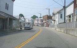
Downtown Mount Olivet | |
 Location of Mount Olivet, Kentucky | |
| Coordinates: 38°31′55″N 84°2′14″W / 38.53194°N 84.03722°WCoordinates: 38°31′55″N 84°2′14″W / 38.53194°N 84.03722°W | |
| Country | United States |
| State | Kentucky |
| County | Robertson |
| Incorporated | Dec. 27, 1851[1] |
| Reïncorporated | 1871[1] |
| Named for | the Mount of Olives |
| Area | |
| • Total | 0.4 sq mi (1.0 km2) |
| • Land | 0.4 sq mi (1.0 km2) |
| • Water | 0.0 sq mi (0.0 km2) |
| Elevation | 935 ft (285 m) |
| Population (2010) | |
| • Total | 299 |
| • Density | 751.8/sq mi (290.3/km2) |
| Time zone | Eastern (EST) (UTC-5) |
| • Summer (DST) | EDT (UTC-4) |
| ZIP code | 41064 |
| Area code(s) | 606 |
| FIPS code | 21-53976 |
| GNIS feature ID | 0498801 |
Mount Olivet is a 5th-class city in and the county seat of Robertson County, Kentucky, United States,[2] located at the junction of U.S. Route 62 and Kentucky Route 165. The population was 299 at the 2010 United States census.
History
The town was founded in 1820 and incorporated in 1851. It became the county seat of Robertson County when that entity was formed in 1867.
Geography
Mount Olivet is located at 38°31′55″N 84°2′14″W / 38.53194°N 84.03722°W (38.531827, -84.037167).[3] According to the United States Census Bureau, the city has a total area of 0.4 square miles (1.0 km2), all of it land.
Demographics
| Historical population | |||
|---|---|---|---|
| Census | Pop. | %± | |
| 1870 | 254 | — | |
| 1880 | 317 | 24.8% | |
| 1890 | 327 | 3.2% | |
| 1900 | 352 | 7.6% | |
| 1910 | 321 | −8.8% | |
| 1920 | 340 | 5.9% | |
| 1930 | 419 | 23.2% | |
| 1940 | 573 | 36.8% | |
| 1950 | 455 | −20.6% | |
| 1960 | 386 | −15.2% | |
| 1970 | 442 | 14.5% | |
| 1980 | 346 | −21.7% | |
| 1990 | 384 | 11.0% | |
| 2000 | 289 | −24.7% | |
| 2010 | 299 | 3.5% | |
| Est. 2015 | 346 | [4] | 15.7% |
As of the census[6] of 2000, there were 289 people, 130 households, and 73 families residing in the city. The population density was 751.8 people per square mile (293.6/km²). There were 145 housing units at an average density of 377.2 per square mile (147.3/km²). The racial makeup of the city was 97.92% White, 1.38% from other races, and 0.69% from two or more races. Hispanic or Latino of any race were 1.38% of the population.
There were 130 households out of which 28.5% had children under the age of 18 living with them, 33.1% were married couples living together, 16.2% had a female householder with no husband present, and 43.8% were non-families. 38.5% of all households were made up of individuals and 21.5% had someone living alone who was 65 years of age or older. The average household size was 2.22 and the average family size was 2.88.
In the city the population was spread out with 26.0% under the age of 18, 8.3% from 18 to 24, 19.7% from 25 to 44, 25.3% from 45 to 64, and 20.8% who were 65 years of age or older. The median age was 40 years. For every 100 females there were 74.1 males. For every 100 females age 18 and over, there were 75.4 males.
The median income for a household in the city was $18,750, and the median income for a family was $25,625. Males had a median income of $21,667 versus $21,250 for females. The per capita income for the city was $12,172. About 38.4% of families and 37.5% of the population were below the poverty line, including 56.1% of those under the age of eighteen and 23.2% of those sixty five or over.
See also
References
| Wikimedia Commons has media related to Mount Olivet, Kentucky. |
- 1 2 Commonwealth of Kentucky. Office of the Secretary of State. Land Office. "Mount Olivet, Kentucky". Accessed 26 Aug 2013.
- ↑ "Find a County". National Association of Counties. Retrieved 2011-06-07.
- ↑ "US Gazetteer files: 2010, 2000, and 1990". United States Census Bureau. 2011-02-12. Retrieved 2011-04-23.
- ↑ "Annual Estimates of the Resident Population for Incorporated Places: April 1, 2010 to July 1, 2015". Retrieved July 2, 2016.
- ↑ "Census of Population and Housing". Census.gov. Retrieved June 4, 2015.
- ↑ "American FactFinder". United States Census Bureau. Retrieved 2008-01-31.
Municipalities and communities of Robertson County, Kentucky, United States | ||
|---|---|---|
| Cities |  | |
| Unincorporated communities |
| |
| Footnotes | ‡This populated place also has portions in an adjacent county or counties | |