Jamestown, Kentucky
| Jamestown, Kentucky | |
|---|---|
| City | |
|
Russell County courthouse in Jamestown | |
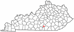 Location of Jamestown, Kentucky | |
| Coordinates: 36°59′5″N 85°4′1″W / 36.98472°N 85.06694°WCoordinates: 36°59′5″N 85°4′1″W / 36.98472°N 85.06694°W | |
| Country | United States |
| State | Kentucky |
| County | Russell |
| Incorporated | 1826 |
| Named for | a local landowner |
| Area | |
| • Total | 2.2 sq mi (5.8 km2) |
| • Land | 2.2 sq mi (5.8 km2) |
| • Water | 0.0 sq mi (0.0 km2) |
| Elevation | 971 ft (296 m) |
| Population (2000) | |
| • Total | 1,624 |
| • Density | 722.5/sq mi (279.0/km2) |
| Time zone | Central (CST) (UTC-6) |
| • Summer (DST) | CDT (UTC-5) |
| ZIP code | 42629 |
| Area code(s) | 270 & 364 |
| FIPS code | 21-40114 |
| GNIS feature ID | 0495165 |

Jamestown is a home rule-class city[1] in Russell County, Kentucky, in the United States. It is the seat of its county.[2] The population was 1,624 at the 2000 U.S. census.
Geography
Jamestown is located at 36°59′5″N 85°4′1″W / 36.98472°N 85.06694°W (36.984730, -85.066840).[3] According to the United States Census Bureau, the city has a total area of 2.2 square miles (5.7 km2), all land.
History
The community was established in 1826 to be the seat of the newly formed Russell County. It was briefly known as Jacksonville in honor of General Andrew Jackson,[4] who had just won a plurality of the popular vote during the 1824 presidential election but lost the runoff in the House of Representatives, largely because of the "corrupt bargain" struck by Henry Clay and John Quincy Adams. However, an anti-Jacksonian party loyal to Clay came into power the same year[5] and the post office was established in November as Jamestown after local landowner James Wooldridge, who (together with his brother John) had donated 110 acres of land for the town. The act of the state legislature incorporating the city in December[6] continued this name, which the city has used since.[4]
Demographics
| Historical population | |||
|---|---|---|---|
| Census | Pop. | %± | |
| 1870 | 138 | — | |
| 1880 | 121 | −12.3% | |
| 1890 | 154 | 27.3% | |
| 1910 | 177 | — | |
| 1920 | 237 | 33.9% | |
| 1930 | 410 | 73.0% | |
| 1940 | 476 | 16.1% | |
| 1950 | 1,064 | 123.5% | |
| 1960 | 792 | −25.6% | |
| 1970 | 1,027 | 29.7% | |
| 1980 | 1,441 | 40.3% | |
| 1990 | 1,641 | 13.9% | |
| 2000 | 1,624 | −1.0% | |
| 2010 | 1,794 | 10.5% | |
| Est. 2015 | 1,804 | [7] | 0.6% |
As of the census[9] of 2000, there were 1,624 people, 662 households, and 421 families residing in the city. The population density was 722.5 people per square mile (278.7/km²). There were 755 housing units at an average density of 335.9 per square mile (129.6/km²). The racial makeup of the city was 94.89% White, 3.51% African American, 0.43% Asian, 0.12% from other races, and 1.05% from two or more races. Hispanic or Latino of any race were 0.86% of the population.
There were 662 households out of which 30.5% had children under the age of 18 living with them, 44.3% were married couples living together, 15.0% had a female householder with no husband present, and 36.3% were non-families. 34.1% of all households were made up of individuals and 15.6% had someone living alone who was 65 years of age or older. The average household size was 2.25 and the average family size was 2.87.
In the city the population was spread out with 23.0% under the age of 18, 7.9% from 18 to 24, 24.4% from 25 to 44, 22.0% from 45 to 64, and 22.7% who were 65 years of age or older. The median age was 41 years. For every 100 females there were 83.7 males. For every 100 females age 18 and over, there were 79.7 males.
The median income for a household in the city was $18,587, and the median income for a family was $25,234. Males had a median income of $24,375 versus $20,380 for females. The per capita income for the city was $11,140. About 25.8% of families and 30.0% of the population were below the poverty line, including 44.5% of those under age 18 and 14.2% of those age 65 or over.
Climate
The climate in this area is characterized by hot, humid summers and generally mild to cool winters. According to the Köppen Climate Classification system, Jamestown has a humid subtropical climate, abbreviated "Cfa" on climate maps.[10]
References
- ↑ "Summary and Reference Guide to House Bill 331 City Classification Reform" (PDF). Kentucky League of Cities. Retrieved December 30, 2014.
- ↑ "Find a County". National Association of Counties. Retrieved 2011-06-07.
- ↑ "US Gazetteer files: 2010, 2000, and 1990". United States Census Bureau. 2011-02-12. Retrieved 2011-04-23.
- 1 2 Rennick, Robert M. (1987). Kentucky Place Names. University Press of Kentucky. p. 152. Retrieved 26 Jul 2013.
- ↑ The Kentucky Encyclopedia, p. 463. "Jamestown". University Press of Kentucky (Lexington), 1992. Accessed 1 Aug 2013.
- ↑ Commonwealth of Kentucky. Office of the Secretary of State. Land Office. "Jamestown, Kentucky". Accessed 1 Aug 2013.
- ↑ "Annual Estimates of the Resident Population for Incorporated Places: April 1, 2010 to July 1, 2015". Retrieved July 2, 2016.
- ↑ "Census of Population and Housing". Census.gov. Retrieved June 4, 2015.
- ↑ "American FactFinder". United States Census Bureau. Retrieved 2008-01-31.
- ↑ Climate Summary for Jamestown, Kentucky
Municipalities and communities of Russell County, Kentucky, United States | ||
|---|---|---|
| Cities | 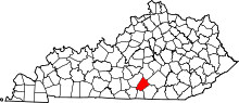 | |
| Unincorporated community | ||
| Ghost town | ||
| Footnotes |
| |