Chetnole
| Chetnole | |
 Parish church of St Peter |
|
 Chetnole |
|
| Population | 330 [1] |
|---|---|
| OS grid reference | ST602080 |
| District | West Dorset |
| Shire county | Dorset |
| Region | South West |
| Country | England |
| Sovereign state | United Kingdom |
| Police | Dorset |
| Fire | Dorset and Wiltshire |
| Ambulance | South Western |
| EU Parliament | South West England |
Coordinates: 50°52′12″N 2°34′01″W / 50.8701°N 2.5669°W
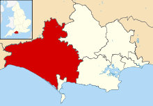
Chetnole is a village and civil parish in the county of Dorset in southern England. It lies within the West Dorset administrative district, approximately 6 miles (9.7 km) southsouthwest of Sherborne and 5.5 miles (8.9 km) southeast of Yeovil in Somerset. It is sited on Oxford clay[2] by the small Wriggle River at the western end of the Blackmore Vale. There are around 128 houses in the village. It has a railway station on the Heart of Wessex Line operated by First Great Western trains. Dorset County Council estimate that in 2013 the population of the parish was 330.[1] In the 2011 census the population of Chetnole parish combined with the small parish of Stockwood to the west was 344.[3]
Chetnole was not recorded in the Domesday Book in 1086.[4]
References
- 1 2 "Parish Population Data". Dorset County Council. 20 January 2015. Retrieved 28 February 2015.
- ↑ Wightman, R., Portrait of Dorset, Hale, 1983, p17
- ↑ "Area: Chetnole (Parish). Key Figures for 2011 Census: Key Statistics". Neighbourhood Statistics. Office for National Statistics. Retrieved 21 January 2014.
- ↑ Darby, H. C.; Versey, G. R. (2008) [1975]. The Domesday Gazetteer. Cambridge University Press. p. 118. ISBN 978-0-521-20666-2.
External links
![]() Media related to Chetnole at Wikimedia Commons
Media related to Chetnole at Wikimedia Commons