Broadmayne
| Broadmayne | |
 Main Street, Broadmayne |
|
 Broadmayne |
|
| Population | 1,204 (2011 Census) |
|---|---|
| OS grid reference | SY729865 |
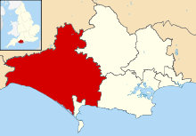
| District | West Dorset |
| Shire county | Dorset |
| Region | South West |
| Country | England |
| Sovereign state | United Kingdom |
| Post town | DORCHESTER |
| Postcode district | DT2 |
| Dialling code | 01305 |
| Police | Dorset |
| Fire | Dorset and Wiltshire |
| Ambulance | South Western |
| EU Parliament | South West England |
| UK Parliament | West Dorset |
Coordinates: 50°40′39″N 2°22′58″W / 50.6774°N 2.3828°W
Broadmayne is a village in the English county of Dorset. It lies within the West Dorset administrative district, two miles south-east of the county town Dorchester. The A352 main road between Dorchester (from Sherborne) and Wareham passes through the village. In the 2001 Census the population of the village was 1,864, reducing to 1,204 at the 2011 Census.[1] There is an electoral ward of the same name whose population at the above census was 1,870.[2] Village facilities and services include a Post Office, a clinic and a public house (The Black Dog). There are two churches in the village, both of which were redesigned by Thomas Hardy.[3] The parish church of St. Martin dates from the 13th century and has a notable south tower.
History
Broadmayne parish has a long history of human settlement. In the Domesday book of 1086, one of two settlements named Maine in Culliford Tree Hundred[4] was later called Friar Mayne to avoid confusion with another Maine (Parva Maene) sited at Little Mayne Farm in West Knighton parish). Between 1290 and 1338, a preceptory of the Knights Hospitaller was established at Friar Mayne.[5] The preceptory declined in activity then in 1533 began leasing its bailiwick to provide stipends for rectories, vicarages and the larger preceptories in other locations.
The family estate of Sir Ferdinand Gorges, the founder of the Province of Maine in the northeast United States, was in Broadmayne; one theory is that the state was named after the village.[6][7][8]
References
- ↑ "Parish population 2011". Retrieved 25 February 2015.
- ↑ "Ward population 2011". Retrieved 25 February 2015.
- ↑ West Dorset District Council, West Dorset Holiday and Tourist Guide, c.1983, p5
- ↑ http://domesdaymap.co.uk/hundred/cullifordtree/ Open Domesday: Culliford Tree
- ↑ http://www.british-history.ac.uk/vch/dorset/vol2/pp90-92 'Houses of Knights Hospitallers: The preceptory of Friary Mayne'], in A History of the County of Dorset: Volume 2, ed. William Page (London, 1908), pp. 90-92 accessed 30 January 2015].
- ↑ Kathy Guyton (2009). U.S. State Names: The Stories of How Our States Were Named. Nederland, Colorado: Mountain Storm Press. pp. 127–136.
- ↑ "Who Really Named Maine?". rootsweb. Retrieved 3 June 2014.
- ↑ "Origin of Maine's Name". web.archive.org. Archived from the original on July 16, 2007. Retrieved 9 July 2014.
External links
| Wikimedia Commons has media related to Broadmayne. |