Long Bredy
| Long Bredy | |
 St Peter's church, Long Bredy |
|
 Long Bredy |
|
| Population | 208 [1] |
|---|---|
| OS grid reference | SY569903 |
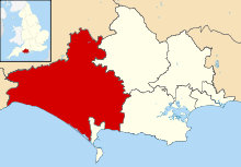
| Civil parish | Long Bredy |
| District | West Dorset |
| Shire county | Dorset |
| Region | South West |
| Country | England |
| Sovereign state | United Kingdom |
| Police | Dorset |
| Fire | Dorset and Wiltshire |
| Ambulance | South Western |
| EU Parliament | South West England |
| UK Parliament | West Dorset |
Coordinates: 50°42′30″N 2°36′42″W / 50.7082°N 2.6118°W
Long Bredy is a village and civil parish in the county of Dorset in south-west England, situated in the West Dorset administrative district approximately 7 miles (11 km) west of the county town Dorchester. It is sited in the valley of the small River Bride, beneath chalk hills of the Dorset Downs. In the 2011 census the parish had a population of 208.[1]
The environs of Long Bredy have some prehistoric history, including a burial chamber known as The Grey Mare and her Colts. The village itself is thought to have been established around the 9th century, and in 1086 was recorded in the Domesday Book as 'Langebride', which would have been pronounced 'Langabridda'.[2] To the east of the village is Kingston Russell house, a 17th-century mansion.
Notes
- 1 2 "Area: Long Bredy (Parish), Key Figures for 2011 Census: Key Statistics". Neighbourhood Statistics. Office for National Statistics. Retrieved 28 February 2014.
- ↑ C. J. Bailey (1982). "Extracts from C.J. Bailey's Book "The Bride Valley"". www.burtonbradstock.org.uk. Retrieved 1 March 2014.
External links
| Wikimedia Commons has media related to Long Bredy. |