Chaignes
| Chaignes | |
|---|---|
|
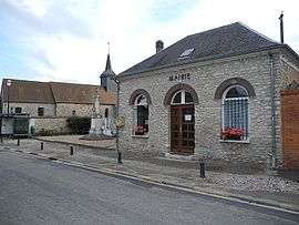
Town hall | |
 Chaignes | |
|
Location within Normandy region  Chaignes | |
| Coordinates: 49°01′02″N 1°26′27″E / 49.0172°N 1.4408°ECoordinates: 49°01′02″N 1°26′27″E / 49.0172°N 1.4408°E | |
| Country | France |
| Region | Normandy |
| Department | Eure |
| Arrondissement | Évreux |
| Canton | Pacy-sur-Eure |
| Intercommunality | Portes de l'Eure |
| Government | |
| • Mayor (2008–2014) | Guillaume Grimm |
| Area1 | 6.41 km2 (2.47 sq mi) |
| Population (2008)2 | 293 |
| • Density | 46/km2 (120/sq mi) |
| Time zone | CET (UTC+1) |
| • Summer (DST) | CEST (UTC+2) |
| INSEE/Postal code | 27136 / 27120 |
| Elevation |
97–151 m (318–495 ft) (avg. 148 m or 486 ft) |
|
1 French Land Register data, which excludes lakes, ponds, glaciers > 1 km² (0.386 sq mi or 247 acres) and river estuaries. 2 Population without double counting: residents of multiple communes (e.g., students and military personnel) only counted once. | |
Chaignes is a commune in the Eure department in northern France.
Population
| Historical population | ||
|---|---|---|
| Year | Pop. | ±% |
| 1962 | 154 | — |
| 1968 | 180 | +16.9% |
| 1975 | 153 | −15.0% |
| 1982 | 179 | +17.0% |
| 1990 | 233 | +30.2% |
| 1999 | 252 | +8.2% |
| 2008 | 293 | +16.3% |
See also
References
| Wikimedia Commons has media related to Chaignes. |
This article is issued from Wikipedia - version of the 8/16/2016. The text is available under the Creative Commons Attribution/Share Alike but additional terms may apply for the media files.