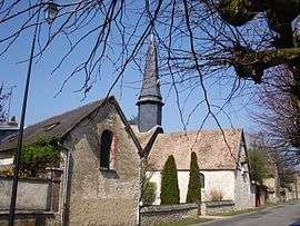
Vaux-sur-Eure
| Vaux-sur-Eure | ||
|---|---|---|
 | ||
| ||
 Vaux-sur-Eure | ||
|
Location within Normandy region  Vaux-sur-Eure | ||
| Coordinates: 49°02′33″N 1°20′26″E / 49.0425°N 1.3406°ECoordinates: 49°02′33″N 1°20′26″E / 49.0425°N 1.3406°E | ||
| Country | France | |
| Region | Normandy | |
| Department | Eure | |
| Arrondissement | Évreux | |
| Canton | Pacy-sur-Eure | |
| Intercommunality | Portes de l'Eure | |
| Government | ||
| • Mayor (2008–2014) | Moïse Levasseur | |
| Area1 | 2.9 km2 (1.1 sq mi) | |
| Population (2008)2 | 239 | |
| • Density | 82/km2 (210/sq mi) | |
| Time zone | CET (UTC+1) | |
| • Summer (DST) | CEST (UTC+2) | |
| INSEE/Postal code | 27674 / 27120 | |
| Elevation |
36–121 m (118–397 ft) (avg. 203 m or 666 ft) | |
|
1 French Land Register data, which excludes lakes, ponds, glaciers > 1 km² (0.386 sq mi or 247 acres) and river estuaries. 2 Population without double counting: residents of multiple communes (e.g., students and military personnel) only counted once. | ||
.svg.png)
Vaux-sur-Eure is a commune in the Eure department in Haute-Normandie in northern France.
Population
| Historical population | ||
|---|---|---|
| Year | Pop. | ±% |
| 1793 | 235 | — |
| 1800 | 268 | +14.0% |
| 1806 | 241 | −10.1% |
| 1821 | 202 | −16.2% |
| 1831 | 208 | +3.0% |
| 1836 | 211 | +1.4% |
| 1841 | 215 | +1.9% |
| 1846 | 206 | −4.2% |
| 1851 | 201 | −2.4% |
| 1856 | 191 | −5.0% |
| 1861 | 187 | −2.1% |
| 1866 | 190 | +1.6% |
| 1872 | 178 | −6.3% |
| 1876 | 168 | −5.6% |
| 1881 | 151 | −10.1% |
| 1886 | 141 | −6.6% |
| 1891 | 150 | +6.4% |
| 1896 | 130 | −13.3% |
| 1901 | 114 | −12.3% |
| 1906 | 123 | +7.9% |
| 1911 | 128 | +4.1% |
| 1921 | 123 | −3.9% |
| 1926 | 120 | −2.4% |
| 1931 | 102 | −15.0% |
| 1936 | 92 | −9.8% |
| 1946 | 91 | −1.1% |
| 1954 | 106 | +16.5% |
| 1962 | 151 | +42.5% |
| 1968 | 184 | +21.9% |
| 1975 | 195 | +6.0% |
| 1982 | 157 | −19.5% |
| 1990 | 179 | +14.0% |
| 1999 | 241 | +34.6% |
| 2008 | 239 | −0.8% |
See also
References
| Wikimedia Commons has media related to Vaux-sur-Eure. |
This article is issued from Wikipedia - version of the 3/15/2016. The text is available under the Creative Commons Attribution/Share Alike but additional terms may apply for the media files.