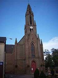
Fleury-sur-Andelle
| Fleury-sur-Andelle | ||
|---|---|---|
 | ||
| ||
 Fleury-sur-Andelle | ||
|
Location within Normandy region  Fleury-sur-Andelle | ||
| Coordinates: 49°21′46″N 1°21′22″E / 49.3628°N 1.3561°ECoordinates: 49°21′46″N 1°21′22″E / 49.3628°N 1.3561°E | ||
| Country | France | |
| Region | Normandy | |
| Department | Eure | |
| Arrondissement | Les Andelys | |
| Canton | Fleury-sur-Andelle | |
| Government | ||
| • Mayor (2008–2014) | Jean-Claude Rémy | |
| Area1 | 3.79 km2 (1.46 sq mi) | |
| Population (2008)2 | 1,879 | |
| • Density | 500/km2 (1,300/sq mi) | |
| Time zone | CET (UTC+1) | |
| • Summer (DST) | CEST (UTC+2) | |
| INSEE/Postal code | 27246 / 27380 | |
| Elevation |
25–125 m (82–410 ft) (avg. 30 m or 98 ft) | |
|
1 French Land Register data, which excludes lakes, ponds, glaciers > 1 km² (0.386 sq mi or 247 acres) and river estuaries. 2 Population without double counting: residents of multiple communes (e.g., students and military personnel) only counted once. | ||
.svg.png)
Fleury-sur-Andelle is a commune in the Eure department in the Haute-Normandie region in northern France.
Population
| Historical population | ||
|---|---|---|
| Year | Pop. | ±% |
| 1821 | 238 | — |
| 1851 | 1,587 | +566.8% |
| 1962 | 1,528 | −3.7% |
| 1968 | 1,604 | +5.0% |
| 1975 | 1,817 | +13.3% |
| 1982 | 2,039 | +12.2% |
| 1990 | 2,015 | −1.2% |
| 1999 | 1,923 | −4.6% |
| 2008 | 1,879 | −2.3% |
International relations
It is twinned with East Goscote, Leicestershire.
See also
References
| Wikimedia Commons has media related to Fleury-sur-Andelle. |
This article is issued from Wikipedia - version of the 8/16/2016. The text is available under the Creative Commons Attribution/Share Alike but additional terms may apply for the media files.