Arno Bay, South Australia
| Arno Bay South Australia | |
|---|---|
 Arno Bay | |
| Coordinates | 33°55′S 136°35′E / 33.917°S 136.583°ECoordinates: 33°55′S 136°35′E / 33.917°S 136.583°E |
| Population | 273 (2006 census)[1] |
| Established | 1882 |
| Postcode(s) | 5603 |
| Elevation | 1 m (3 ft) |
| Location | 437 km (272 mi) NW of Adelaide |
| LGA(s) | District Council of Cleve |
| State electorate(s) | Flinders |
| Federal Division(s) | Grey |
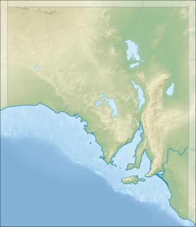
Arno Bay (formerly Bligh) is a small fishing and tourist town on the east coast of Eyre Peninsula in South Australia, located on the Lincoln Highway about halfway between Whyalla and Port Lincoln. First proclaimed under the name Bligh in 1883, the current name dates back to 1940. It is a recreational town with a number of marine and nature based attractions, including fishing, surfing and swimming.
History
The area which is now known as Arno Bay was opened up by pastoralists in 1863, with the area being named 'Salt Creek Cove' in these early days.[2] Of the variety of ventures that occurred before the town was built, the sinking of 'The Arno Bay Mine' was possibly the least successful, with water halting all operations.[2] The small town was initially proclaimed in 1882 by G. H. Ayliffe under the name of 'Bligh', after Captain William Bligh, although locals resisted the name change, continually referring to the town as 'Arno Bay' until the official name change.[3][4]
The town was expected to become a port and a jetty was built in 1880 in anticipation of this. The port was not huge, but nonetheless continued importing fertilisers and exporting cereal crops that were being grown in the district.[5] By 1911, the town had grown substantially, with a school, post office, hotel and new hall established in this period.[2]
The town continued to grow as a port until the point where it was exporting 11,000 tonnes of grain in 1940. In the same year, the decision was finally made to alter the town's official name to 'Arno Bay', named after a sandhill well and not the Italian 'Arno River' as had been suggested.[2] The period of high export came to an abrupt end in 1963 when the storage silos were built, and ocean shipping became redundant to the large trucks that were now the main mechanism of transport.[3]
This signalled the end of Arno Bay as a port, causing the population to drop slowly, eventually leading to its current position as a tourist fishing town.
Geography
Arno bay lies on the eastern Eyre Peninsula, and sits on the Spencer Gulf, a body of water that stretches up to Port Augusta in the north. The town itself lies on the bay of the same name, which is dominated by a mixture of white, sandy beaches, cliffs, and mangrove systems. Of particular note is 'Redbanks', a sedimentary cliff structure which is designated a geological monument by the Geological Society of Australia.[6]
The climate is much like that of Port Lincoln, which is only 118 km to South. The Mediterranean-like climate, with its hot, dry summers and cool, wet winters is typical for most of the Eyre Peninsula.[7]
Economy
The town still retains it position as a minor service centre for the surrounding agricultural communities, but in nowhere near the capacity of mid-1900's. Cereal crops and sheep are still the major produce of the inland area, as well as minor amounts of other produce.[8]
Fishing has been a minor part of the economy in the past, and recently, aquaculture has come to prominence in the bay, with Yellowtail Kingfish, mulloway and tuna held in large cages. These are farmed on 7 licenses covering 130 hectares in the bay. The aquaculture in the bay is still in development, and further expansions are expected in the future.[9]
Tourism is now one of the largest components of the town's economy, with tourists typically drawn by the areas fishing, water sport and seaside atmosphere. A boat ramp is located in the town, with whiting, snapper, tommy ruff, garfish, salmon and may other popular species caught in the bay, with most of these also available off the town jetty and beach. For boat anglers, the 'Redbanks' region has been known to produce large Mulloway and Snapper, as well as offering scenery in the form of the imposing cliffs. The local aquaculture industry also promotes tourism, with tours through facilities where finfish are raised.[10]
Community
Facilities
For tourist facilities, Arno Bay has a beachfront caravan park, hotel, general stores, post office, playground and motor garage outlet, however no fuel station. An all-weather boat ramp, with floating pontoon and a refurbished town jetty launching facilities for boat based fishermen.[8]
A number of sporting venues and clubs include a dried-up swamp that serves as a golf course, bowling green, oval, tennis, netball, and squash courts, dirt circuit and in summer yacht racing each Sunday.
Demographics
In the 2006 census, there were 428 persons (273 in the town proper)[1] usually resident in Arno Bay: 55.4% being males and 44.6% females. Of the total population in Arno Bay there were no Indigenous persons.[11]
It was found that 18.0% of the population usually resident in Arno Bay were children aged between 0–14 years, and 29.7% were persons aged 55 years and over. The median age of persons in Arno Bay was 41 years, compared with 37 years for persons in Australia.[11]
In the Census, 92.1% of persons usually resident in Arno Bay were Australian citizens, 5.6% were born overseas and none were overseas visitors. Of those who were in permanent residence, 87.9% of them stated they were born in Australia. Other common responses were: England 1.4%, Seychelles 1.4%, New Zealand 1.2%, United States of America 0.7% and Papua New Guinea 0.7%.[11]
The most common responses for religious affiliation for persons usually resident in Arno Bay were: No Religion 29.9%, Uniting Church 24.5%, Anglican 11.7%, Catholic 9.8% and Lutheran 7.9%.[11]
References
- 1 2 Australian Bureau of Statistics (25 October 2007). "Arno Bay (Urban Centre/Locality)". 2006 Census QuickStats. Retrieved 1 June 2008.
- 1 2 3 4 Manning Index of South Australia, Arno Bay, archived from the original on 2 September 2007, retrieved 27 June 2007
- 1 2 Sydney Morning Herald Travel, "Arno Bay", The Sydney Morning Herald, retrieved 27 June 2007
- ↑ "NEW TOWN NAMES APPROVED". Chronicle. LXXXIII, (4,728). South Australia. 1 August 1940. p. 13. Retrieved 31 August 2016 – via National Library of Australia.
- ↑ Tourism Eyre Peninsula, Arno Bay, archived from the original on 16 June 2007, retrieved 27 June 2007
- ↑ Arno Bay Tourism Site, Fishing, archived from the original on 30 September 2007, retrieved 27 June 2007
- ↑ Bureau of Meteorology, North Shields, archived from the original on 10 June 2007, retrieved 27 June 2007
- 1 2 District Council of Cleve, General Information, retrieved 27 June 2007
- ↑ PIRSA, Arno Bay Aquaculture Management Program (PDF), retrieved 27 June 2007
- ↑ Travelmate, Arno Bay, retrieved 27 June 2007
- 1 2 3 4 Australian Bureau of Statistics (25 October 2007). "Arno Bay (State Suburb)". 2006 Census QuickStats. Retrieved 28 February 2008.