District Council of Lower Eyre Peninsula
| District Council of Lower Eyre Peninsula South Australia | |||||||||||||
|---|---|---|---|---|---|---|---|---|---|---|---|---|---|
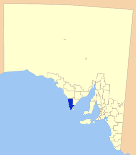 Location of the District Council of Lower Eyre Peninsula | |||||||||||||
| Population | 5,087 (2015 est)[1] | ||||||||||||
| • Density | 1.06623/km2 (2.7615/sq mi) | ||||||||||||
| Established | 1880 | ||||||||||||
| Area | 4,771 km2 (1,842.1 sq mi) | ||||||||||||
| Mayor | Julie Low [2] | ||||||||||||
| Council seat | Cummins | ||||||||||||
| Region | Eyre and Western[3] | ||||||||||||
| State electorate(s) | Flinders[4] | ||||||||||||
| Federal Division(s) | Grey[5] | ||||||||||||
|
| |||||||||||||
| Website | District Council of Lower Eyre Peninsula | ||||||||||||
| |||||||||||||
The District Council of Lower Eyre Peninsula is a local government area located on Eyre Peninsula in South Australia. The district covers the southern tip of the peninsula, except for the small area taken up by the City of Port Lincoln.[6]
The main council offices are in Cummins, with a branch office in Port Lincoln, even though Port Lincoln is actually in its own council area, not encompassed by the council.[7]
History
The District Council of Lower Eyre Peninsula traces its history back to 1880, when a district council was created for the Port Lincoln area; it first met at the Pier Hotel in July of that year.[8] The new district council was variously referred to as "Port Lincoln" or "Lincoln" in newspapers, but is referred to in the landmark District Councils Act 1887, which initiated widespread local government reform, as the existing District Council of Lincoln.[9] The boundaries of the district were extended when that act came into effect in 1888, and again in 1890, when it gained the hundreds of Kiana, Mitchell and Shannon.[10]
In 1906, an area in the north of the district was removed to form the new District Council of Tumby Bay, and in 1921, Port Lincoln itself was severed to create the Corporate Town of Port Lincoln. The district regained an area from the Corporate Town in 1935, and in 1936 the District Council of Lincoln controlled thirteen hundreds, amounting to approximately 1,300,000 acres; its population in that year was estimated at 1,486. The district boundaries underwent further alterations in 1981 and 1982. In 1988, it assumed its current name when the District Council of Lincoln was renamed the District Council of Lower Eyre Peninsula.[11][10]
The area's economy is reliant mostly on agriculture, with cereal crops and sheep being prominent in the district, as in much of the Eyre Peninsula. Fishing and aquaculture are a large part of the economy also, with Coffin Bay Oysters gaining statewide recognition.[12]
The district, particularly coastal towns such as Coffin Bay are ever popular with tourists, with fishing and a variety of other water based activities a major attraction. The Coffin Bay National Park is also a major attraction, as well as an area of natural habitat conservation.[13]
Localities
The district has two major towns; Cummins and Coffin Bay, but the district covers a large area, including a large number of rural localities: Boston, Charlton Gully, Coomunga, Coulta, Duck Ponds, Edillilie, Farm Beach, Fountain, Green Patch, Hawson, Kapinnie, Karkoo, Kellidie Bay, Kiana, Lincoln National Park, Little Douglas, Louth Bay, Mitchell, Mount Drummond, Mount Dutton Bay, Mount Hope, North Shields, Pearlah, Point Boston, Poonindie, Sleaford, Tiatukia, Tootenilla, Tulka, Uley, Wangary, Wanilla, Whites Flat, Whites River, and Yeelanna, and part of Port Lincoln.[6]
Councillors
| Ward | Councillor | Notes | |
|---|---|---|---|
| Unsubdivided [2] | Geoff Bayly | ||
| Wendy Holman | |||
| Diana Laube | |||
| Julie Low | Mayor | ||
| Don Millard | Deputy Mayor | ||
| Peter Mitchell | |||
| Jo-Ann Quigley | |||
Chairmen and mayors
- James O'Shanahan (1902-1904, 1914-1938) [14]
- William Germain Morgan (1938-1949) [14]
- Percival (Barney) Woods (1949-1957) [14]
- Richard Baxter Stuart Sinclair (1957-1970) [14]
- Clifford Philip Morgan (1970-1974) [14]
- Victor Lewis Gerschwitz (1974-1975) [14]
- Thomas George Secker (1975-1981) [14]
- John Francis Hayman (1981-1985) [14]
- Max Hill (2006-2009) [15][16]
- Julie Low (2009-present) [17]
See also
References
- ↑ "3218.0 – Regional Population Growth, Australia, 2014–15". Australian Bureau of Statistics. Retrieved 29 September 2016.
- 1 2 "Elected Members". District Council of Lower Eyre Peninsula. Retrieved 15 February 2015.
- ↑ "Eyre Western SA Government region" (PDF). The Government of South Australia. Retrieved 10 October 2014.
- ↑ "District of Flinders Background Profile". Electoral Commission SA. Retrieved 9 September 2015.
- ↑ "Federal electoral division of Grey" (PDF). Australian Electoral Commission. Retrieved 24 July 2015.
- 1 2 "Location SA Map Viewer". Government of South Australia. Retrieved 14 February 2016.
- ↑ "Contact Us". District Council of Lower Eyre Peninsula. Retrieved 15 February 2016.
- ↑ "COUNTRY TELEGRAMS.". The South Australian Advertiser (Adelaide, SA : 1858 - 1889). Adelaide, SA: National Library of Australia. 9 July 1880. p. 6. Retrieved 15 February 2016.
- ↑ "The District Councils Act 1887 No. 419". Retrieved 15 February 2016.
- 1 2 "Council History". District Council of Lower Eyre Peninsula. Retrieved 15 February 2016.
- ↑ Hosking, P. (1936). The Official civic record of South Australia : centenary year, 1936. Adelaide: Universal Publicity Company. p. 654.
- ↑ Tourism Eyre Peninsula, Coffin Bay, archived from the original on 5 May 2007, retrieved 2007-05-15
- ↑ Department of Environment and Heratige, Coffin Bay National Park (PDF), archived from the original (– Scholar search) on 26 September 2007, retrieved 2007-05-15
- 1 2 3 4 5 6 7 8 Matthews, Penny (1986), South Australia, the civic record, 1836-1986, Wakefield Press, ISBN 978-0-949268-82-2
- ↑ "Annual Report 2007 / 08" (PDF). District Council of Lower Eyre Peninsula. Retrieved 20 November 2016.
- ↑ "Annual Report 2008 / 09" (PDF). District Council of Lower Eyre Peninsula. Retrieved 20 November 2016.
- ↑ "Annual Report 2009/ 10" (PDF). District Council of Lower Eyre Peninsula. Retrieved 20 November 2016.
External links
Coordinates: 34°20′S 135°30′E / 34.33°S 135.5°E