Pelican Lagoon
| Pelican Lagoon | |
|---|---|
 Pelican Lagoon | |
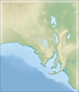 Pelican Lagoon Location in South Australia | |
| Location | Kangaroo Island, South Australia |
| Coordinates | 35°49′10″S 137°47′24″E / 35.81944°S 137.79000°ECoordinates: 35°49′10″S 137°47′24″E / 35.81944°S 137.79000°E[1] |
| Type | seawater lagoon |
| Basin countries | Australia |
| Max. length | 4.5 kilometres (2.8 mi).[2] |
| Max. width | 6 kilometres (3.7 mi)[2] |
| Surface area | 1,520 hectares (3,800 acres)[3] |
| Max. depth | 10 metres (33 ft)[3] |
| Salinity | sea water |
| Islands | Goanna Islet, Pig Islet, Rabbit Islet, Shag Rock, Samphire Islet, Wallaby Islet and several unnamed islands[3] |
| Settlements |
Pelican Lagoon[1] Muston[1] |
Pelican Lagoon is a seawater lagoon in the Australian state of South Australia located on the north coast of Kangaroo Island about 18.7 kilometres (11.6 mi) south east of Kingscote. It was named by Matthew Flinders on 4 April 1802 after the large population of pelicans present in its waters and adjoining shorelines. Its role as fishery hatchery had been identified by the early 20th century with the result that fishing in its waters has been restricted in varying degrees. Since 1971, the entire lagoon has been part of a marine protected area known as the American River Aquatic Reserve where all fishing and the collection of marine organisms is prohibited.
Description
Pelican Lagoon is a seawater lagoon located about 2.9 kilometres (1.8 mi) south of American River and about 18.7 kilometres (11.6 mi) south east of Kingscote. The lagoon is bounded by Dudley Peninsula to the east, the main body of Kangaroo Island to the west, an isthmus connecting the above-mentioned bodies of land to the south and an unnamed peninsula to the north that separates it from Eastern Cove. The lagoon is connected to Eastern Cove in Nepean Bay by an inlet named American River.[4] Hog Bay Road which is the main road connecting Penneshaw to Kingscote passes on the east and south sides of the lagoon.[5][6][7][8]
The lagoon itself consists of two branches - one on the east side and the other on the west side which was described as being the ‘southern branch’ by Flinders in 1802.[9] The lagoon is drained of water by tidal flow via a narrow channel of 3 to 5 metres (9.8–16.4 ft) in depth and which passes through the west branch in order to reach the east branch. The tidal flow is reported as being as high as 3 knots (5.6 km/h; 3.5 mph).[3]
The west branch has an average water depth of 0.9 metres (2 ft 11 in) presumably at low water while the eastern branch has several deeper areas - the majority of its north side ranges in depth from 3 to 9.9 metres (9.8–32.5 ft) and its south side has a number of deeper areas in the range of 1 to 2.9 metres (3.3–9.5 ft).[3]
Islets
A number of islets are present within Pelican Lagoon. Six of these are named as follows (from east to west): Rabbit Islet, Goanna Islet, Pig Islet, Wallaby Islet, Shag Rock and Samphire Islet.[3]
Flora and fauna
Flora
Terrestrial
The islands within the lagoon support heathlands dominated by Coastal Daisybush and Thyme Riceflower. The coastline enclosing the lagoon supports a range of vegetation types dominated by heathlands of Acacia leiophylla and Orthrosanthus multiflorus, herb lands of Senecio odoratus, coastal mallee scrub of Eucalyptus diversifolia, samphire flats and grazed grasslands.[7]
Intertidal and sub tidal
Samphire grows on the mud flats within the lagoon which are exposed at low water. The subtidal areas of the lagoon are dominated by the seagrass species of Heterozostera tasmanica and Posidonia australis. Various algae species are also present.[7]
Fauna
Terrestrial
Waterbirds that use the lagoon include nine species that breed in the locality such as the chestnut teal, pied oystercatcher, sooty oystercatcher and caspian tern. Seventeen waterbird species are listed on international migratory treaties with sixteen listed on the Japan-Australia Migratory Bird Agreement (JAMBA) and seventeen listed on the China-Australia Migratory Bird Agreement (CAMBA).[7] As of 1996, Black tiger snakes were reported as being present on the islands within the lagoon.[10]
Intertidal and sub tidal
The lagoon is reported as a breeding site for the little penguin.[7] The lagoon supports a number of marine animal species considered to be commercially valuable. These include sand crab, king scallop, queen scallop, razorfish (Pinna bicolor), southern calamari, flathead, King George whiting, leatherjacket, red mullet, snook, Southern Sea garfish, tommy ruff, trevally and Western Australian salmon.[11] The lagoon is also reported as being home for a pod of bottle-nosed dolphins.[7]
History
European discovery and use
The lagoon was discovered by Flinders on 4 April 1802 and was named in recognition of the large pelican population present at the time.[9] Since the establishment of South Australia, the lagoon has also been known as American River.[12] The islands within the lagoon were mined for guano under licence from the South Australian Government prior to 1919.[13] As early as May 1905, fishing by the use of nets was prohibited both in Pelican Lagoon and adjoining waters in both American River and Eastern Cove.[14] As early as 1908, the role of ‘Pelican Lagoon on the American River’ as a hatchery area was acknowledged by the South Australian government via statements attributed to Mr. S. McIntosh, the then Deputy Chief Inspector of Fisheries.[15] By early 1925, the lagoon was reported as being closed to all types of fishing.[16]
Ports and other settlements
Pelican Lagoon is bounded to the west by the locality of Muston and to the south and to the east by the locality of Pelican Lagoon which both include land zoned for residential accommodation [1][17]
Protected area status
The lagoon is associated with three protected areas. The first is the American River Aquatic Reserve which covers the entire lagoon.[5] The second is the Pelican Lagoon Conservation Park which includes five of the islands in the lagoon and much of the land on the peninsula to the north of the lagoon.[18] The third is the Encounter Marine Park.[19] The lagoon is also appears on a list of nationally important wetlands in South Australia as part of the ‘American River Wetland System’.[20]
Citations and references
Citations
- 1 2 3 4 "Search result for "Pelican Lagoon (Bay)" (Record no SA0054251) with the following layers selected - "Suburbs and Localities"". Government of South Australia. Retrieved 23 May 2016.
- 1 2 DMH, 1985, chart 12.
- 1 2 3 4 5 6 PIRSA, 2012, page 9 of 35.
- ↑ BIA, 2005, page 186.
- 1 2 PIRSA, 2007.
- ↑ Department of Environment and Planning, 1987, page 64.
- 1 2 3 4 5 6 Australian Government Department of the Environment, after 1971, American River Marine and Coastal Area.
- ↑ "American River". Gazetteer of Australia online. Geoscience Australia, Australian Government.
- 1 2 Flinders, 1814 (1966), pages 259-260.
- ↑ Robinson et al, 1996, page 148.
- ↑ PIRSA, 2012, page 14 of 35.
- ↑ "General News". The Chronicle. 1 December 1917. pp. 31–32. Retrieved 2 September 2014.
- ↑ Robinson et al, 1996, page 134.
- ↑ "Miscellaneous News, Protecting fish". The Advertiser. 5 May 1905. p. 7. Retrieved 2 September 2014.
- ↑ "The fishing industry, facts and figures, superiority of South Australian fish". The Advertiser. 9 September 1908. p. 7. Retrieved 2 September 2014.
- ↑ "Fishing in American River". The Register. 4 March 1925. p. 14. Retrieved 2 September 2014.
- ↑ DPTI, 2014, pages 296-330 and 371-374
- ↑ Department of Environment and Planning, 1987, pages 64-75.
- ↑ "Encounter Marine Park Management plan summary" (PDF). Department of Environment, Water and Natural Resources. p. 31 of 39. Retrieved 17 June 2014.
- ↑ Environment Australia, 2001, page 77.
References
- "American River Marine and Coastal Area, Sapphiretown Rd, American River, SA (Place ID 100822)". Australian Heritage Database. Department of the Environment. Retrieved 2008-07-30.
- Anon (2001). A Directory of Important Wetlands in Australia (PDF). 3rd edition. Canberra.: Environment Australia. ISBN 0-642-54721-1.
- Anon (1987). Conservation Parks of Kangaroo Island Management Plan (PDF). Adelaide: Department of Environment and Planning, South Australia. ISBN 0-7243-8983-0.
- Boating Industry Association of South Australia (BIA); South Australia. Department for Environment and Heritage (2005), South Australia's waters an atlas & guide, Boating Industry Association of South Australia, ISBN 978-1-86254-680-6
- South Australia. Department of Marine and Harbors (DMH) (1985), The Waters of South Australia a series of charts, sailing notes and coastal photographs, Dept. of Marine and Harbors, South Australia, ISBN 978-0-7243-7603-2
- "Development Plan, Kangaroo Island Council, Consolidated – 20 February 2014" (PDF). Department of Planning, Transport and Infrastructure (DPTI). Retrieved 8 March 2016.
- Flinders, Matthew (1966) [1814]. A Voyage to Terra Australis : undertaken for the purpose of completing the discovery of that vast country, and prosecuted in the years 1801, 1802, and 1803 in His Majesty's ship the Investigator, and subsequently in the armed vessel Porpoise and Cumberland Schooner; with an account of the shipwreck of the Porpoise, arrival of the Cumberland at Mauritius, and imprisonment of the commander during six years and a half in that island. (Facsimile ed.). Adelaide; Facsimile reprint of: London : G. and W. Nicol, 1814 ed. In two volumes, with an Atlas (3 volumes): Libraries Board of South Australia. Retrieved 5 January 2014.
- Primary Industries and Regions South Australia (PIRSA) (2007). "Aquatic Reserve: American River" (PDF). Primary Industries and Regions South Australia. Archived from the original (PDF) on 18 October 2014.
- Primary Industries and Regions South Australia (PIRSA) (2012), Management Plan for the Pelican Lagoon Aquatic Reserve; The South Australian Fisheries Management Series Paper number 56 (PDF), Primary Industries and Regions South Australia, ISBN 978-0-9807387-2-8, archived from the original on 4 September 2014
- Robinson, A. C.; Canty, P.; Mooney, T.; Rudduck, P. (1996). "South Australia's offshore islands" (PDF). Australian Heritage Commission. ISBN 978-0-644-35011-2. Retrieved 13 December 2013.
| Major townships | |||||||||||||||
|---|---|---|---|---|---|---|---|---|---|---|---|---|---|---|---|
| Beaches | |||||||||||||||
| Coastal features |
| ||||||||||||||
| Protected areas |
| ||||||||||||||
| Islands adjacent to Kangaroo Island coast | |||||||||||||||
| Related and uncategorised | |||||||||||||||
| |||||||||||||||
| West coast of Eyre Peninsula |
| ||||||||||||||
|---|---|---|---|---|---|---|---|---|---|---|---|---|---|---|---|
| Spencer Gulf |
| ||||||||||||||
| Investigator Strait | |||||||||||||||
| Kangaroo Island |
| ||||||||||||||
| Gulf St Vincent | |||||||||||||||
| Backstairs Passage | |||||||||||||||
| Encounter Bay and adjoining waters | |||||||||||||||
| South east coast | |||||||||||||||
| Mainland |
| ||||||||||||||
| |||||||||||||||