Laura Bay
| Laura Bay | |
|---|---|
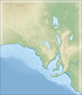 Laura Bay Location in South Australia | |
| Location | South Australia |
| Coordinates | 32°14′42″S 133°48′43″E / 32.245°S 133.812°ECoordinates: 32°14′42″S 133°48′43″E / 32.245°S 133.812°E[1] |
| Type | Bay |
| Etymology | Laura, daughter of Bloomfield Douglas[2] |
| Part of | Great Australian Bight |
| Basin countries | Australia |
| Designation | Nuyts Archipelago Marine Park[3] |
| Max. length |
about 1 kilometre (0.62 mi) (west-east) [4] |
| Max. width |
about 1 kilometre (0.62 mi) (north-south)[4] |
| Settlements | Laura Bay |
Laura Bay is a bay in the Australian state of South Australia on the west coast of Eyre Peninsula located about 15 kilometres (9.3 mi) southeast of Ceduna. [2][1]
Laura Bay is an inlet that opens into the northern end of a larger bay known as Smoky Bay and which is located about 4.5 kilometres (2.8 mi) north-east of the headland of Cape D’Estrees. Its water depth is less than 2 metres (6 ft 7 in) at chart datum.[4] It is described as:[5]
a small semicircular south facing bay, 1 km wide at the mouth, widening to 2 km inside. It is very protected from ocean waves and usually calm conditions prevail at the three shelly beaches, each fronted by a few hundred metres wide sand and tidal flats, and bordered and backed by stands of low mangroves.
The source of the bay's name is reported as being Laura Douglas, the daughter of William Bloomfield Douglas who surveyed the bay for the Government of South Australia in 1858.[2]
Laura Bay was used as a port facility from at least 1894 to at least 1937 for the purpose of loading farm produce delivered from as far away as 30 kilometres (19 mi) onto watercraft known as lighters which would move the produce to vessels anchored in deeper water. In 1911, a jetty of about 14.3 metres (47 ft) length was built and was used until 1937 when it was demolished.[2]
Since 2012, the bay has been located with the boundaries of the protected area known as the Nuyts Archipelago Marine Park.[3]
See also
References
- 1 2 "Search result for "Laura Bay" (BAY) (Record Number SA0038892) with the following layers selected - "Suburbs and Localities" and " Place names (gazetteer)"". Government of South Australia. Retrieved 21 July 2016.
- 1 2 3 4 Collins, Neville C (2005), The jetties of South Australia : past and present, Neville Collins, p. 39, ISBN 978-0-9580482-2-4
- 1 2 "Nuyts Archipelago Marine Park" (PDF). Government of South Australia. Retrieved 22 July 2016.
- 1 2 3 South Australia. Department of Marine and Harbors (DMH) (1985), The Waters of South Australia a series of charts, sailing notes and coastal photographs, Dept. of Marine and Harbors, South Australia, pp. chart 43, ISBN 978-0-7243-7603-2
- ↑ "Laura Bay (east) (unpatrolled beach)". Beachsafe. Surf Life Saving Australia. Retrieved 22 July 2016.