A4061 road
.jpg)
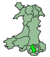
The A4061 is the main road linking Bridgend with Hirwaun via the Ogmore and Rhondda Valleys in South Wales.[1] It is a mix of streets connecting former mining communities, and mountain passes built as relief work for unemployed miners.
The road was originally a dead-end from Bridgend along the Ogmore Valley built in the 19th century, but concerns over travel difficulties, environment and post-World War I unemployment in the Rhondda led to an extension over the mountains to Treorchy in the 1920s. A further section, from Treherbert northward to Hirwaun, was built later in the decade. As well as improving communications and transport, the A4061 allowed locals to visit the mountain summits easily for leisure purposes. Ice cream vans have been a regular feature at the two summits, Bwlch-y-Clawdd and Rhigos, since the 1930s.
The A4061 has been praised for its engineering and scenery, including a feature in National Geographic, and formed part of the Olympic Torch route in the run-up to the 2012 London Olympics.
Route

The A4061 is about 25 miles (40 km) from south to north, but its winding sections make it longer in road miles. It has four main sections. From south to north these are the Ogmore Valley, the Bwlch-y-Clawdd Road (known to locals simply as "the Bwlch"), reaching a summit of 1,476 feet (450 m), the Rhondda Fawr Valley and the Rhigos Road, with a summit of 1,381 feet (421 m). The road meets the M4, a motorway through South Wales, Sarn Park services, the A4107 mountain road to Abergwynfi, the A4058 Rhondda Fawr valley road to Porth and Pontypridd and the Heads of the Valleys Road. The two mountain sections feature numerous hairpin bends.[2][3][4]
Settlements served by the road include (from south to north) Bridgend, Sarn, Bryncethin, Blackmill, Lewistown, Ogmore Vale, Price Town, Nantymoel, Treorchy, Ynyswen, Penyrenglyn, Treherbert and Hirwaun. The road also connects Bridgend, Treorchy, Ynyswen and Treherbert railway stations.[5]
The landscape at the northern end of the A4061 has been extensively used for open cast mining, which remains an active industry.[6]
History
Glamorgan Inter-Valley Road
The area was rural and sparsely populated until the mid 19th century, when the discovery of coal led to a major industrial boom. The geography of narrow river valleys sandwiched between mountains meant that land space was at a premium, with roads and railways struggling to find space.[7] With relatively little sunlight reaching the valley floors, the local climate in the valleys was depressing. Visiting a town in a neighbouring valley, only a few miles away as the crow flies, could involve a 30–40 mile (50 – 65km) round trip.[8] The A4061 was typical of this, and around 1900 it was a dead end road from Bridgend to Nantymoel, requiring a detour via the Ogwr Fach Valley and Tonyrefail to reach the Rhondda Valley.[9]
The downturn of the coal mining industry after World War I hit the Rhondda particularly hard due to its isolation and lack of access, with high unemployment by the 1920s.[10] In 1924 a series of new mountain roads, to connect isolated valleys, was proposed, including a new through route from Bridgend to Hirwaun via the Rhondda.[11] As well as providing unemployment relief and connecting communities, Glamorgan County Council hoped the better access to the mountain summits would provide recreation, which Lord Temple described as "a playground for all time for those people".[8] The Leader of the Opposition and Labour leader Ramsay MacDonald was particularly keen for the road to be built, knowing it would be good for local economy as well as communications, and he was keen to find ways of moving the economy of South Wales valleys away from the monoculture of coal mining.[12] The total estimated cost of the mountain roads, including neighbouring routes (such as the A4107 to Abergwynfi) was around £400,000 (equivalent to £20,575,000 in 2015), of which 75% was to be paid by central Government and 25% by Glamorgan County Council.[13]
The road schemes were designed by Ministry of Transport engineer and surveyor George Macpherson,[14] with a standard planned width of 20 feet (6.1 m), with an additional 5 feet (1.5 m) on one side for pedestrians.[15] The workforce was drawn largely from unemployed miners, and the mountain sections were quickly built.[5] About half way through construction, funding was withdrawn and work halted, though pressure in Parliament, particularly from MacDonald, ensured there would be a commitment to finish the road in 1928.[12] By 1929, £356,431 (now 19,542,000) had been spent on constructing 32.29 miles (51.97 km) of new road (including the A4107 and all connecting links).[15] The Bwlch-y-Clawdd section opened at the end of 1928,[5] while the Rhigos Road section, from Treherbert to Hirwaun, delayed by financial constraints, opened on 4 November 1929.[16] Herbert Morrison, Minister of Transport, visited the works in 1930 and was impressed by the progress and effort expended in the project.[17]
Recent history
In 2013, a large sink hole appeared on the Rhigos Mountain Road section. The road was shut for several days for repairs.[18]
In 2016, Rhondda Cynon Taf County Borough Council announced a £1.25 million resurfacing package on the A4061 between Treherbert and Hirwaun. The road was closed for three weeks while the council laid around 6,000 tonnes of tarmac.[19]
Landmarks

The Paran Baptist Chapel was built at the junction of what is now the A4061 and A4093 at Blackmill. It was originally constructed in 1819, and expanded several times throughout the 19th century. It is now a Grade II listed building.[20]
The Bwlch-y-Clawdd Road is well known for an ice cream van parked at the summit, with sheep regularly roaming the local area.[3] Ice cream has a strong connection with the Rhondda following immigration to the valley by Italians during the 19th century, and the same family has been selling ice cream from the summit since the 1930s.[5][21] In June 2001, National Geographic used a photograph of the summit as the centrepiece for an article on Wales.[5]
Legacy
The A4061 has been celebrated as one of the most ambitious road projects in Wales. Author Mike Parker has described the road as "the most famous of the miners' mountain passes."[5] On a clear day it is possible to see the Bristol Channel, Exmoor and the Brecon Beacons from the summit.[22] In 2006, a BBC News report described the road as the fifth bendiest in Britain.[23]
In May 2012, as part of the preparation for the London Olympics, the Olympic torch was carried along the A4061 from Treorchy to Bridgend.[24]
See also
References
Citations
- ↑ "1:250 000 Map". Ordnance Survey. Retrieved 11 September 2011.
- ↑ Parker 2013, p. 128.
- 1 2 Dunn 2013, p. 103.
- ↑ "Bridgend to Hirwaun". Google Maps. Retrieved 5 August 2015.
- 1 2 3 4 5 6 Parker 2013, p. 127.
- ↑ Application no: 13/0779 (PDF) (Report). Rhondda Cynon Taf Council. 3 October 2013. Retrieved 5 August 2015.
- ↑ Parker 2013, p. 26.
- 1 2 "Ministry of Transport". Hansard. 10 May 1927. Retrieved 5 August 2015.
- ↑ "MOT Half Inch Map Sheet 26". Ordnance Survey. April 1923. Retrieved 11 September 2011.
- ↑ Parker 2013, p. 126.
- ↑ Local Authority Plans. The National Archives (Report). Glamorgan County Council. 1924. p. 5. D276/1/25. Retrieved 5 August 2015.
- 1 2 "Class IX". Hansard. 20 December 1928. Retrieved 14 August 2015.
- ↑ "Glamorgan County Council's scheme". The Western Times. 22 August 1924. p. 3. Retrieved 5 August 2015 – via British Newspaper Archive. (subscription required (help)).
- ↑ "Obituary : Well-known Scottish Engineer". Glasgow Herald. 5 August 1941. p. 7. Retrieved 5 August 2015.
- 1 2 "Road Construction in Wales : Glamorgan Inter-Valley Road Scheme". The Times. 16 January 1929. p. 7. Retrieved 11 August 2016. (subscription required (help)).
- ↑ "Glamorgan Inter-Valley Road Scheme : Two Further Sections Opened". The Times. 4 November 1929. p. 11. Retrieved 11 August 2016. (subscription required (help)).
- ↑ "Glamorgan Roads". 38. The Municipal Journal and Public Works Engineer. 1930: 1280.
- ↑ "Hole shuts Rhigos Mountain Road". BBC News. 8 July 2013. Retrieved 23 August 2016.
- ↑ "Rhigos Mountain Road statement". Rhondda Cynon Taff County Borough Council. 20 July 2016. Retrieved 22 August 2016.
- ↑ "Paran Welsh Baptist Chapel, Oak Ridge, A4061, Blackmill". Coflein. Royal Commission on the Ancient and Historical Monuments of Wales. Retrieved 11 August 2016.
- ↑ "Italian ice cream is favourite South Wales experience". Wales Online. 14 March 2011. Retrieved 5 August 2015.
- ↑ "Treorchy". RCTBC Tourism. Rhondda Tynon Caf Borough Council. Retrieved 5 August 2015.
- ↑ "Bendiest roads in the UK revealed". BBC News. 6 February 2006. Retrieved 5 August 2015.
- ↑ "Warm welcome for Olympic Flame". Bridgend County Borough Council. 31 May 2012. Retrieved 5 August 2015.
Sources
- Dunn, Mike (2013). Walking in the South Wales Valleys. Cicerone Press Limited. ISBN 978-1-849-65697-9.
- Parker, Mike (2013). Mapping the Roads. The Automobile Association. ISBN 978-0-7495-7435-2.
External links
| Wikimedia Commons has media related to A4061 road (Wales). |
- SABRE – A4061
- A4061 – Welsh Roads video
Transport in Bridgend county borough | ||
|---|---|---|
| Road |  | |
| Bus | ||
| National Cycle Network |
| |
| Railway lines | ||
| Railway stations | ||
Coordinates: 51°37′28″N 3°32′21″W / 51.62449°N 3.5391°W