A403 road
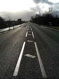
The A403 is a main road near Bristol and the Severn Estuary. It runs from junction 1 of the M48 at Aust to the docks at Avonmouth. It is an important route for the industries there, allowing easy travel access to Wales and South and East England.
Route
The road is about 8.5 miles (13.7 km) long and runs through the county of South Gloucestershire in the north and the City of Bristol in the south.[1] Between the M4 at Aust and Pilning it replaced the B4055 on a realigned route. Between Pilning and Chittening it followed a new route beside the ICI Severnside plant, and from Chittening to Avonmouth it followed the route of an existing unclassified road, St Andrews Road. At Avonmouth it connects with the A4, leading to the Portway.[2] The road disrupted local communities, with Pilning being split in two sections.[3] It runs near the proposed Avonmouth and Severnside Enterprise Area, planned for expansion by Bristol City Council.[1]
The A403 was constructed between 1969–70, after the Severn Bridge was opened in 1966, to provide a direct route between the then M4 motorway and Avonmouth. It was financed by Gloucestershire County Council with a £387,000 grant from the Ministry of Transport and was initially known as the Avonmouth Aust Coast Road.[4]
Safety
Around 8000 vehicles a day use this road. Although this is relatively low, a high proportion of traffic consists of heavy goods vehicles (HGVs); over five times the average.[5][1] The A403 has had a poor safety record with numerous accidents. A particular problem has been HGVs parked at laybys along the road obscuring the view ahead, leading to several fatalities. South Gloucestershire Council reduced the speed limit on their section to 50 mph in 2007.[6] Bristol City Council have announced plans to install better facilities for cyclists along the road.[1]
References
- 1 2 3 4 "A403 improvements". Bristol City Council. Retrieved 8 August 2016.
- ↑ "A403, Bristol". Google Maps. Retrieved 8 August 2016.
- ↑ "Northwick". Bristol & Avon Family History Society. Retrieved 8 August 2016.
- ↑ "Classified Road Programme". Hansard. 14 December 1965. Retrieved 8 August 2016.
- ↑ "A403 and Aust Village – Casualty Reduction Scheme". South Gloucestershire Council. Retrieved 8 August 2016.
- ↑ "Killer Aust lay-by to be closed". Gloucestershire Gazette. 13 March 2014. Retrieved 8 August 2016.
Coordinates: 51°33′09″N 2°39′56″W / 51.55237°N 2.66547°W