A4067 road
| |
|---|---|
| Route information | |
| Length: | 35 mi (56 km) |
| Major junctions | |
| Southwest end: | Oystermouth, Swansea |
|
[[Image:Motorway Left.svg|[ |x30px|link=]] | |
| Northeast end: | Sennybridge, Powys |
| Location | |
| Primary destinations: |
Brecon Swansea |
| Road network | |

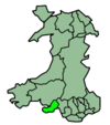
The A4067 road is an A road in Wales connecting Swansea with Sennybridge. It runs in a southwest to northeast direction beginning at Oystermouth Square in Mumbles, Swansea, and continuing from there to Swansea city centre, where there is a break in the route. It begins again in Landore and climbs almost the full length of the Swansea Valley to the pass at Bwlch Bryn-rhudd, from where it descends to join the A40 at Sennybridge on the River Usk.
Settlements served by the road include:
- West Cross
- Swansea city centre
- Landore
- Plasmarl
- Morriston
- Ynysforgan
- Ynystawe
- Glais
- Clydach
- Alltwen
- Pontardawe
- Cilmaengwyn
- Godre'r-graig
- Ystalyfera
- Gurnos
- Ystradgynlais
- Abercraf
- Ynyswen
- Craig-y-nos
- Glantawe
- Defynnog
- Sennybridge
Transport in Neath Port Talbot county borough | ||
|---|---|---|
| Road |  | |
| Bus | ||
| National Cycle Network | ||
| Railway lines | ||
| Railway stations | ||
| Sea | ||
| Canals | ||
Coordinates: 51°47′57″N 3°43′23″W / 51.79908°N 3.72306°W
This article is issued from Wikipedia - version of the 1/25/2015. The text is available under the Creative Commons Attribution/Share Alike but additional terms may apply for the media files.