A444 road
| |
|---|---|
|
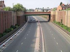
The A444 in Coventry showing the Heath Road bridge | |
| Route information | |
| Length: | 32 mi (51 km) |
| Major junctions | |
| South end: | Coventry |
|
| |
| North end: | Burton upon Trent |
| Location | |
| Primary destinations: |
Bedworth Nuneaton Twycross Appleby Magna Measham Swadlincote Stapenhill |
| Road network | |

The A444 is a primary road running between Coventry and Burton upon Trent in England, usually referred to as the "A treble four".
Route
Coventry to A5
Starting at the junction of the A45 and A46 at Festival Island west of Baginton just south of Coventry, the road runs as a dual-carriageway one mile north to the Whitley junction. Here there is a break in the road and it starts again at the roundabout where the A428 Sky Blue Way/Binley Road and the B4110 Humber Road meet in Gosford Green just east of Coventry. From there it heads north as a dual-carriageway road, crossing the M6 at junction 3. It bypasses Bedworth to the west and heads into Nuneaton passing the George Elliot Hospital. The road continues into Nuneaton Town Centre and is notoriously bad for traffic during busy periods. The road then heads away from Nuneaton, through Weddington and crossing the A5 Watling Street.
A5 to Burton upon Trent
Becoming a rural single carriageway road passing through Leicestershire countryside, it passes near to the outskirts of the village of Fenny Drayton and Farmland of the nearby Lindley Hall Farm that is the location of the geographical centre of England (per the Ordnance Survey). The road also passes near to the site of the Battle of Bosworth. It meets the end of the M42 south of Measham, eventually descending into Burton upon Trent to terminate on the A511.
Improvements
Between the late 1980s and mid-1990s, a dual carriageway road was constructed in phases connecting Coventry, Sky Blue Way and Nuneaton to provide a more direct link between Coventry city centre and the M6 motorway. The town of Bedworth had already been by-passed during the 1970s and this followed a continuation of this route, the first phase opening in 1990 and the second in 1995.
This section of road is known as Phoenix Way and was constructed along the course of a disused railway line. The former route of the A444 was then reclassified as part of the B4113. Initially, there were plans to create a north-south link road through Coventry, extending Phoenix Way south past its current terminus roundabout, as there is a section of dual carriageway that continues as the A46, numbered as the A444 to the south of the city, but such plans were dropped during the construction of the Coventry to Nuneaton section.
Former routes
- Between Coventry and Nuneaton, the A444 used to follow what is now the B4113 road.
- The A444 used to run between Coventry and Leamington Spa following the B4113. There is still a road sign on the B4113 indicating this.
Gallery
-

The bridge for (the A444) Phoenix Way over Walsgrave Road, Gosford Green
-

Phoenix Way/Foleshill Road traffic island
-
_14d06.jpg)
The southern termination of Phoenix Way
Coordinates: 52°35′58″N 1°28′39″W / 52.5994°N 1.47749°W