Woodbridge (CDP), New Jersey
| Woodbridge, New Jersey | |
|---|---|
| Census-designated place | |
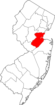
 Map of Woodbridge CDP highlighted within Middlesex County. Inset: Location of Middlesex County in New Jersey. | |
| Coordinates: 40°33′18″N 74°17′06″W / 40.554981°N 74.285014°WCoordinates: 40°33′18″N 74°17′06″W / 40.554981°N 74.285014°W | |
| Country |
|
| State |
|
| County | Middlesex |
| Township | Woodbridge |
| Area[1] | |
| • Total | 3.861 sq mi (10.000 km2) |
| • Land | 3.846 sq mi (9.962 km2) |
| • Water | 0.015 sq mi (0.039 km2) 0.39% |
| Elevation[2] | 30 ft (9 m) |
| Population (2010 Census)[3] | |
| • Total | 19,265 |
| • Density | 5,008.8/sq mi (1,933.9/km2) |
| Time zone | Eastern (EST) (UTC-5) |
| • Summer (DST) | Eastern (EDT) (UTC-4) |
| ZIP code | 07095[4] |
| Area code(s) | 732/848 |
| FIPS code | 3481950[1][5] |
| GNIS feature ID | 02390527[1][6] |
Woodbridge is an unincorporated community and census-designated place (CDP) within Woodbridge Township, in Middlesex County, New Jersey, United States.[7][8][9] As of the 2010 United States Census, the CDP's population was 19,265.[3] Despite the similarity in the name of the CDP and the township, the two are not coextensive; the CDP occupies 15.7% of the township's 24.51 square miles (63.5 km2).[8]
Geography
According to the United States Census Bureau, the CDP had a total area of 3.861 square miles (10.000 km2), including 3.846 square miles (9.962 km2) of land and 0.015 square miles (0.039 km2) of water (0.39%).[1][10]
Demographics
| Historical population | |||
|---|---|---|---|
| Census | Pop. | %± | |
| 1990 | 17,434 | — | |
| 2000 | 18,309 | 5.0% | |
| 2010 | 19,265 | 5.2% | |
| Population sources: 1990-2010[7] 2000[11] 2010[3] | |||
Census 2010
The 2010 United States Census counted 19,265 people, 7,378 households, and 5,120 families residing in the CDP. The population density was 5,008.8 per square mile (1,933.9/km2). The CDP contained 7,728 housing units at an average density of 2,009.2 per square mile (775.8/km2). The racial makeup of the CDP was 59.68% (11,497) White, 9.36% (1,804) Black or African American, 0.38% (73) Native American, 20.83% (4,012) Asian, 0.06% (12) Pacific Islander, 6.84% (1,318) from other races, and 2.85% (549) from two or more races. Hispanics or Latinos of any race were 18.20% (3,506) of the population.[3]
Out of a total of 7,378 households, 32.6% had children under the age of 18 living with them, 51.9% were married couples living together, 12.6% had a female householder with no husband present, and 30.6% were non-families. 25.5% of all households were made up of individuals, and 9.4% had someone living alone who was 65 years of age or older. The average household size was 2.60 and the average family size was 3.14.[3]
In the CDP, 22.3% of the population were under the age of 18, 7.3% from 18 to 24, 32.7% from 25 to 44, 26.0% from 45 to 64, and 11.7% who were 65 years of age or older. The median age was 36.6 years. For every 100 females the census counted 93.0 males, but for 100 females at least 18 years old, it was 88.9 males.[3]
Census 2000
As of the 2000 United States Census[5] there were 18,309 people, 7,290 households, and 4,847 families residing in the CDP. The population density was 1,826.7/km² (4,727.1/mi²). There were 7,512 housing units at an average density of 749.5/km² (1,939.5/mi²). The racial makeup of the CDP was 74.44% White, 7.64% African American, 0.12% Native American, 12.85% Asian, 0.02% Pacific Islander, 2.96% from other races, and 1.97% from two or more races. Hispanic or Latino of any race were 9.84% of the population.[11]
There were 7,290 households out of which 29.3% had children under the age of 18 living with them, 50.9% were married couples living together, 11.8% had a female householder with no husband present, and 33.5% were non-families. 27.2% of all households were made up of individuals and 10.9% had someone living alone who was 65 years of age or older. The average household size was 2.49 and the average family size was 3.06.[11]
In the CDP the population was spread out with 21.4% under the age of 18, 7.4% from 18 to 24, 35.9% from 25 to 44, 21.5% from 45 to 64, and 13.7% who were 65 years of age or older. The median age was 36 years. For every 100 females there were 92.1 males. For every 100 females age 18 and over, there were 88.0 males.[11]
The median income for a household in the CDP was $60,594, and the median income for a family was $70,184. Males had a median income of $50,071 versus $34,928 for females. The per capita income for the CDP was $26,728. About 3.9% of families and 5.8% of the population were below the poverty line, including 6.2% of those under age 18 and 8.0% of those age 65 or over.[11]
References
- 1 2 3 4 Gazetteer of New Jersey Places, United States Census Bureau. Accessed July 21, 2016.
- ↑ U.S. Geological Survey Geographic Names Information System: Woodbridge Census Designated Place, Geographic Names Information System. Accessed November 30, 2012.
- 1 2 3 4 5 6 DP-1 - Profile of General Population and Housing Characteristics: 2010 Demographic Profile Data for Woodbridge CDP, New Jersey, United States Census Bureau. Accessed November 30, 2012.
- ↑ Look Up a ZIP Code for Woodbridge, NJ, United States Postal Service. Accessed November 30, 2012.
- 1 2 American FactFinder, United States Census Bureau. Accessed September 4, 2014.
- ↑ US Board on Geographic Names, United States Geological Survey. Accessed September 4, 2014.
- 1 2 New Jersey: 2010 - Population and Housing Unit Counts - 2010 Census of Population and Housing (CPH-2-32), United States Census Bureau, August 2012. Accessed November 30, 2012.
- 1 2 GCT-PH1 - Population, Housing Units, Area, and Density: 2010 - County -- County Subdivision and Place from the 2010 Census Summary File 1 for Middlesex County, New Jersey, United States Census Bureau. Accessed November 30, 2012.
- ↑ Locality Search, State of New Jersey. Accessed April 19, 2015.
- ↑ US Gazetteer files: 2010, 2000, and 1990, United States Census Bureau. Accessed September 4, 2014.
- 1 2 3 4 5 DP-1 - Profile of General Demographic Characteristics: 2000 from the Census 2000 Summary File 1 (SF 1) 100-Percent Data for Woodbridge CDP, New Jersey, United States Census Bureau. Accessed November 30, 2012.