Monmouth Junction, New Jersey
| Monmouth Junction, New Jersey | |
|---|---|
| Census-designated place | |
|
Center of Monmouth Junction | |
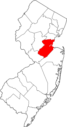
 Map of Monmouth Junction CDP in Middlesex County. Inset: Location of Middlesex County in New Jersey. | |
| Coordinates: 40°22′49″N 74°32′36″W / 40.380345°N 74.543237°WCoordinates: 40°22′49″N 74°32′36″W / 40.380345°N 74.543237°W | |
| Country |
|
| State |
|
| County | Middlesex |
| Township | South Brunswick |
| Area[1] | |
| • Total | 1.483 sq mi (3.842 km2) |
| • Land | 1.468 sq mi (3.803 km2) |
| • Water | 0.015 sq mi (0.039 km2) 1.03% |
| Elevation[2] | 79 ft (24 m) |
| Population (2010 Census)[3] | |
| • Total | 2,887 |
| • Density | 1,966.3/sq mi (759.2/km2) |
| Time zone | Eastern (EST) (UTC-5) |
| • Summer (DST) | Eastern (EDT) (UTC-4) |
| ZIP code | 08852[4] |
| Area code(s) | 732/848 |
| FIPS code | 3447190[1][5][6] |
| GNIS feature ID | 2389493[7] |

Monmouth Junction is an unincorporated community and census designated place (CDP) located within South Brunswick Township, in Middlesex County, New Jersey, United States.[8][9][10] As of the 2010 United States Census, the CDP's population was 2,887.[3]
Geography
According to the United States Census Bureau, the CDP had a total area of 1.483 square miles (3.842 km2), of which, 1.468 square miles (3.803 km2) of it was land and 0.015 square miles (0.039 km2) of it (1.01%) was water.[1][11]
Demographics
| Historical population | |||
|---|---|---|---|
| Census | Pop. | %± | |
| 1980 | 2,579 | — | |
| 1990 | 1,570 | −39.1% | |
| 2000 | 2,721 | 73.3% | |
| 2010 | 2,887 | 6.1% | |
| Population sources: 1980[12] 1990-2010[8] 2000[13] 2010[3] | |||
Census 2010
The 2010 United States Census counted 2,887 people, 903 households, and 801 families residing in the CDP. The population density was 1,966.3 per square mile (759.2/km2). The CDP contained 919 housing units at an average density of 625.9 per square mile (241.7/km2). The racial makeup of the CDP was 57.40% (1,657) White, 6.03% (174) Black or African American, 0.24% (7) Native American, 32.91% (950) Asian, 0.00% (0) Pacific Islander, 0.97% (28) from other races, and 2.46% (71) from two or more races. Hispanics or Latinos of any race were 4.95% (143) of the population.[3]
Out of a total of 903 households, 50.8% had children under the age of 18 living with them, 77.6% were married couples living together, 8.4% had a female householder with no husband present, and 11.3% were non-families. 9.9% of all households were made up of individuals, and 2.8% had someone living alone who was 65 years of age or older. The average household size was 3.20 and the average family size was 3.43.[3]
In the CDP, 29.1% of the population were under the age of 18, 7.1% from 18 to 24, 24.2% from 25 to 44, 32.0% from 45 to 64, and 7.6% who were 65 years of age or older. The median age was 38.8 years. For every 100 females the census counted 95.7 males, but for 100 females at least 18 years old, it was 91.8 males.[3]
Census 2000
As of the 2000 United States Census[5] there were 2,721 people, 870 households, and 736 families residing in the CDP. The population density was 700.4/km2 (1,819.2/mi2). There were 881 housing units at an average density of 226.8/km2 (589.0/mi2). The racial makeup of the CDP was 74.97% White, 7.09% African American, 0.37% Native American, 14.48% Asian, 1.18% from other races, 1.91% from two or more races. Hispanic or Latino of any race were 4.15% of the population.[13]
There were 870 households out of which 53.4% had children under the age of 18 living with them, 73.4% were married couples living together, 9.1% had a female householder with no husband present, and 15.3% were non-families. 11.8% of all households were made up of individuals and 1.8% had someone living alone who was 65 years of age or older. The average household size was 3.12 and the average family size was 3.42.[13]
In the CDP the population was spread out with 31.5% under the age of 18, 5.7% from 18 to 24, 34.8% from 25 to 44, 23.8% from 45 to 64, and 4.2% who were 65 years of age or older. The median age was 35 years. For every 100 females there were 97.5 males. For every 100 females age 18 and over, there were 96.7 males.[13]
The median income for a household in the CDP was $89,598, and the median income for a family was $94,247. Males had a median income of $64,688 versus $39,464 for females. The per capita income for the CDP was $35,134. About 4.2% of families and 5.1% of the population were below the poverty line, including 11.2% of those under age 18 and none of those age 65 or over.[13]
Notable people
Famous or notable individuals that were born, or lived for a significant amount of time, in Monmouth Junction include:
- Walter Perez, news anchor and reporter.[14]
- DeForest Soaries (born 1951), pastor, politician and former Secretary of State of New Jersey and former chairman of the federal Election Assistance Commission.[15]
See also
References
- 1 2 3 Gazetteer of New Jersey Places, United States Census Bureau. Accessed June 13, 2013.
- ↑ U.S. Geological Survey Geographic Names Information System: Monmouth Junction Census Designated Place, Geographic Names Information System. Accessed June 21, 2012.
- 1 2 3 4 5 6 DP-1 - Profile of General Population and Housing Characteristics: 2010 Demographic Profile Data for Monmouth Junction CDP, Middlesex County, New Jersey, United States Census Bureau. Accessed June 21, 2012
- ↑ Look Up a ZIP Code for Monmouth Junction, NJ, United States Postal Service. Accessed June 20, 2012.
- 1 2 American FactFinder, United States Census Bureau. Accessed September 4, 2014.
- ↑ A Cure for the Common Codes: New Jersey, Missouri Census Data Center. Accessed June 21, 2012.
- ↑ US Board on Geographic Names, United States Geological Survey. Accessed September 4, 2014.
- 1 2 New Jersey: 2010 - Population and Housing Unit Counts - 2010 Census of Population and Housing (CPH-2-32), United States Census Bureau, August 2012. Accessed November 29, 2012.
- ↑ GCT-PH1 - Population, Housing Units, Area, and Density: 2010 - County -- County Subdivision and Place from the 2010 Census Summary File 1 for Middlesex County, New Jersey, United States Census Bureau. Accessed November 29, 2012.
- ↑ Locality Search, State of New Jersey. Accessed April 19, 2015.
- ↑ US Gazetteer files: 2010, 2000, and 1990, United States Census Bureau. Accessed September 4, 2014.
- ↑ Staff. 1980 Census of Population: Number of Inhabitants United States Summary, p. 1-141. United States Census Bureau, June 1983. Accessed January 12, 2012.
- 1 2 3 4 5 DP-1 - Profile of General Demographic Characteristics: 2000 from the Census 2000 Summary File 1 (SF 1) 100-Percent Data for Monmouth Junction CDP, New Jersey, United States Census Bureau. Accessed November 29, 2012.
- ↑ "Walter Perez". 6-ABC. Retrieved May 2015. Check date values in:
|access-date=(help) - ↑ The Senior Pastor, First Baptist Church of Lincoln Gardens. Accessed June 10, 2007. "Born in New York and raised in New Jersey, Dr. Soaries resides in Monmouth Junction, New Jersey with his wife, Donna and twin sons, Malcolm and Martin."