Upland, Indiana
| Upland, Indiana | |
|---|---|
| Town | |
 | |
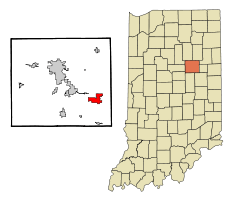 Location of Upland in the state of Indiana | |
| Coordinates: 40°28′2″N 85°30′0″W / 40.46722°N 85.50000°WCoordinates: 40°28′2″N 85°30′0″W / 40.46722°N 85.50000°W | |
| Country | United States |
| State | Indiana |
| County | Grant |
| Township | Jefferson |
| Area[1] | |
| • Total | 3.15 sq mi (8.16 km2) |
| • Land | 3.14 sq mi (8.13 km2) |
| • Water | 0.01 sq mi (0.03 km2) |
| Elevation | 935 ft (285 m) |
| Population (2010)[2] | |
| • Total | 3,845 |
| • Estimate (2012[3]) | 3,824 |
| • Density | 1,224.5/sq mi (472.8/km2) |
| Time zone | Eastern (EST) (UTC-5) |
| • Summer (DST) | EDT (UTC-4) |
| ZIP code | 46989 |
| Area code(s) | 765 |
| FIPS code | 18-77966[4] |
| GNIS feature ID | 0445158[5] |
| Website | http://upland.in.gov/ |
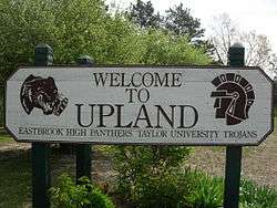
Upland is a town in Jefferson Township, Grant County, Indiana, United States. The population was 3,845 at the 2010 census. It is most notable for being the home of Taylor University, a Christian college with 2,103 students, as of 2016.[6]
History
Most of the land that is now part of Upland was purchased by John Oswalt in the 1830s. He was a speculator, and believed that a canal connecting Indianapolis and Fort Wayne might pass through the area. The town itself was formed in the late 1860s by Jacob Bugher, who planned for it to be a depot point on the Indiana Central Railroad. The name of the town comes from the fact that it was believed to be the highest point on the rail line between Columbus and Chicago. By 1880, the town had a total population of around 150 and included a school, two churches, several stores, a blacksmith shop, and a sawmill.[7]
Upland benefited from the gas boom in central Indiana which started in 1886 and carried on until around 1900 when the gas supply began to decline. Gas was first discovered in Upland in 1888, and this new resource allowed the town to flourish and grow. By the 1890s, the town had a population of over 1000, street lights, water and gas lines, and a glass manufacturing plant.[7]
Taylor University moved to Upland in the summer of 1893. The school had been struggling financially at its location in Fort Wayne, and the gas boom allowed the town to provide the university with $10,000 in cash and 10 acres (40,000 m2) of land.[7]
Geography
Upland is located between Fort Wayne (one hour north by car) and Indianapolis (1¼ hours south). It is about 30 minutes from Muncie, where Ball State University is located. It is about 20 minutes from Marion, where Indiana Wesleyan University is located.
Upland is located at 40°28′2″N 85°30′0″W / 40.46722°N 85.50000°W (40.467146, -85.500120).[8]
According to the 2010 census, Upland has a total area of 3.152 square miles (8.16 km2), of which 3.14 square miles (8.13 km2) (or 99.62%) is land and 0.012 square miles (0.03 km2) (or 0.38%) is water.[1]
Demographics
| Historical population | |||
|---|---|---|---|
| Census | Pop. | %± | |
| 1880 | 176 | — | |
| 1900 | 1,208 | — | |
| 1910 | 1,080 | −10.6% | |
| 1920 | 1,301 | 20.5% | |
| 1930 | 906 | −30.4% | |
| 1940 | 900 | −0.7% | |
| 1950 | 1,565 | 73.9% | |
| 1960 | 1,999 | 27.7% | |
| 1970 | 3,202 | 60.2% | |
| 1980 | 3,335 | 4.2% | |
| 1990 | 3,295 | −1.2% | |
| 2000 | 3,803 | 15.4% | |
| 2010 | 3,845 | 1.1% | |
| Est. 2015 | 3,785 | [9] | −1.6% |
2010 census
As of the census[2] of 2010, there were 3,845 people, 872 households, and 589 families residing in the town. The population density was 1,224.5 inhabitants per square mile (472.8/km2). There were 949 housing units at an average density of 302.2 per square mile (116.7/km2). The racial makeup of the town was 94.6% White, 1.6% African American, 0.2% Native American, 1.2% Asian, 0.1% Pacific Islander, 0.9% from other races, and 1.5% from two or more races. Hispanic or Latino of any race were 2.3% of the population.
There were 872 households of which 30.7% had children under the age of 18 living with them, 55.3% were married couples living together, 8.6% had a female householder with no husband present, 3.7% had a male householder with no wife present, and 32.5% were non-families. 23.7% of all households were made up of individuals and 9.6% had someone living alone who was 65 years of age or older. The average household size was 2.60 and the average family size was 3.00.
The median age in the town was 21.8 years. 14.1% of residents were under the age of 18; 48.8% were between the ages of 18 and 24; 12.7% were from 25 to 44; 14.9% were from 45 to 64; and 9.5% were 65 years of age or older. The gender makeup of the town was 47.7% male and 52.3% female.
2000 census
As of the census[4] of 2000, there were 3,803 people, 789 households, and 569 families residing in the town. The population density was 967.1 people per square mile (373.6/km²). There were 824 housing units at an average density of 209.5 per square mile (81.0/km²). The racial makeup of the town was 94.40% White, 1.53% African American, 0.68% Native American, 1.50% Asian, 0.13% Pacific Islander, 0.68% from other races, and 1.08% from two or more races. Hispanic or Latino of any race were 2.31% of the population.
There were 789 households out of which 30.5% had children under the age of 18 living with them, 60.7% were married couples living together, 9.1% had a female householder with no husband present, and 27.8% were non-families. 20.8% of all households were made up of individuals and 8.1% had someone living alone who was 65 years of age or older. The average household size was 2.64 and the average family size was 3.01.
In the town the population was spread out with 13.3% under the age of 18, 51.9% from 18 to 24, 13.9% from 25 to 44, 12.9% from 45 to 64, and 8.0% who were 65 years of age or older. The median age was 21 years. For every 100 females there were 97.0 males. For every 100 females age 18 and over, there were 96.8 males.
The median income for a household in the town was $36,827, and the median income for a family was $44,712. Males had a median income of $32,019 versus $21,845 for females. The per capita income for the town was $11,761. About 7.4% of families and 14.5% of the population were below the poverty line, including 11.3% of those under age 18 and 6.9% of those age 65 or over.
References and notes
- 1 2 "G001 - Geographic Identifiers - 2010 Census Summary File 1". United States Census Bureau. Retrieved 2015-07-25.
- 1 2 "American FactFinder". United States Census Bureau. Retrieved 2012-12-11.
- ↑ "Population Estimates". United States Census Bureau. Retrieved 2013-06-25.
- 1 2 "American FactFinder". United States Census Bureau. Retrieved 2008-01-31.
- ↑ "US Board on Geographic Names". United States Geological Survey. 2007-10-25. Retrieved 2008-01-31.
- ↑ "Taylor University | Best College | US News". colleges.usnews.rankingsandreviews.com. Retrieved 2016-07-14.
- 1 2 3 Taylor University: The First 150 Years by William C. Ringenberg. Upland: Taylor University Press, 1996.
- ↑ "US Gazetteer files: 2010, 2000, and 1990". United States Census Bureau. 2011-02-12. Retrieved 2011-04-23.
- ↑ "Annual Estimates of the Resident Population for Incorporated Places: April 1, 2010 to July 1, 2015". Retrieved July 2, 2016.
- ↑ "Census of Population and Housing". Census.gov. Retrieved June 4, 2015.
External links
Municipalities and communities of Grant County, Indiana, United States | ||
|---|---|---|
| Cities | ||
| Towns | ||
| Townships | ||
| CDPs | ||
| Unincorporated communities | ||
| Footnotes | ‡This populated place also has portions in an adjacent county or counties | |