Tully Mountain (Ireland)
| Tully Mountain | |
|---|---|
| Cnoc Leitreach | |
 | |
| Highest point | |
| Elevation | 356 m (1,168 ft) [1] |
| Prominence | 331 m (1,086 ft) [1] |
| Listing | Marilyn |
| Coordinates | 53°35′01.64″N 10°00′17.63″W / 53.5837889°N 10.0048972°WCoordinates: 53°35′01.64″N 10°00′17.63″W / 53.5837889°N 10.0048972°W [1] |
| Geography | |
 Tully Mountain | |
| OSI/OSNI grid | L67272 |
| Climbing | |
| Easiest route | Hike |
Tully Mountain (Irish: Cnoc Leitreach)[2] is a large hill north-west of Letterfrack in County Galway, Ireland.
Geography
The 356-metre (1,168 ft) high hill is visually striking, as it stands in a prominent position on the Renvyle Peninsula between Ballinakill harbour (South), Inishbofin (West) and the Crump Island (north). The summit hosts a small cairn and offers a panoramic view of the Twelve Bens, the Mayo coastline, Inishboffin and other islands.
Name
The Tully Mountain, as well as the Tully Lough, takes its name from Tully village, located on the north-eastern side of the mountain.
Access to the summit
The walk which leads to the summit does not require any special hiking hability.[3]
Archaeology
The area around the Tully Mountain is rich in pre-historic remains like a court tomb and a stone alignement between the mountain itself and Tully Lough.[4]
Conservation
Tully Lough and the NE slopes of the mountain have been designated as a candidate Special Area of Conservation under the EU Habitats Directive.[5]
See also
References
- 1 2 3 MountainViews.ie
- ↑ Placenames Database of Ireland
- ↑ Wal Connemara, web-page on www.walkconnemara.com (accessed on October 2014)
- ↑ Ireland; Andy O`Halpin, Conor Newman; Oxford University Press 2006; pag. 221-222
- ↑ Tully Lough cSAC, National Parks & Wildlife Service; on-line in .pdf on www.npws.ie (accessed on October 2014)
External links
![]() Media related to Tully Mountain at Wikimedia Commons
Media related to Tully Mountain at Wikimedia Commons
Mountains and hills of Connacht | ||
|---|---|---|
| Achill Island | 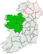 | |
| Dartry Mountains | ||
| Maumturks | ||
| Nephin Range | ||
| Ox Mountains | ||
| Partry Mountains | ||
| Sheeffry Range | ||
| Twelve Bens | ||
| Others | ||
Lists of Marilyns | |
|---|---|