Knockalongy
| Knockalongy | |
|---|---|
| Cnoc na Loinge | |
|
| |
| Highest point | |
| Elevation | 544 m (1,785 ft) [1][2] |
| Prominence | 490 m (1,610 ft) [1] |
| Listing | Marilyn |
| Coordinates | 54°11′39″N 8°45′37″W / 54.194193°N 8.760235°WCoordinates: 54°11′39″N 8°45′37″W / 54.194193°N 8.760235°W |
| Naming | |
| Translation | hill of the encampment (Irish) |
| Geography | |
 Knockalongy Ireland | |
| Location | County Sligo, Republic of Ireland |
| Parent range | Ox Mountains |
| OSI/OSNI grid | G504275 |

Knockalongy (from Irish: Cnoc na Loinge, meaning "hill of the encampment")[3] is a 544 m (1,785 ft) Marilyn in County Sligo, Ireland. It is the highest of the Ox Mountains.[1] The nearest village is Skreen.[4]
There is a large number of megalithic tombs on the plain between Knockalongy and Sligo Bay to the north. There are also two small loughs at the foot of the mountain—Lough Aghree and Lough Minnaun.[4]
See also
References
- 1 2 3 http://mountainviews.ie/mv/index.php
- ↑ Peakbagger
- ↑ Placenames Database of Ireland
- 1 2 Ordnance Survey Ireland - Online map viewer
Mountains and hills of Connacht | ||
|---|---|---|
| Achill Island | 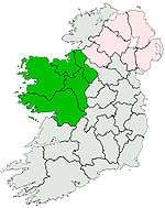 | |
| Dartry Mountains | ||
| Maumturks | ||
| Nephin Range | ||
| Ox Mountains | ||
| Partry Mountains | ||
| Sheeffry Range | ||
| Twelve Bens | ||
| Others | ||
Lists of Marilyns | |
|---|---|
This article is issued from Wikipedia - version of the 9/25/2016. The text is available under the Creative Commons Attribution/Share Alike but additional terms may apply for the media files.