Templeville, Maryland
| Templeville, Maryland | |
|---|---|
| Town | |
 Location of Templeville, Maryland | |
| Coordinates: 39°8′11″N 75°46′6″W / 39.13639°N 75.76833°WCoordinates: 39°8′11″N 75°46′6″W / 39.13639°N 75.76833°W | |
| Country | United States |
| State | Maryland |
| Counties | Queen Anne's, Caroline |
| Area[1] | |
| • Total | 0.08 sq mi (0.21 km2) |
| • Land | 0.08 sq mi (0.21 km2) |
| • Water | 0 sq mi (0 km2) |
| Elevation | 69 ft (21 m) |
| Population (2010)[2] | |
| • Total | 138 |
| • Estimate (2012[3]) | 137 |
| • Density | 1,725.0/sq mi (666.0/km2) |
| Time zone | Eastern (EST) (UTC-5) |
| • Summer (DST) | EDT (UTC-4) |
| ZIP code | 21670 |
| Area code(s) | 410 |
| FIPS code | 24-77200 |
| GNIS feature ID | 0591398 |
Templeville is a town in Caroline County and in Queen Anne's County, Maryland, United States. Templeville is located near the Maryland-Delaware line. The population was 138 at the 2010 census. It was known as Bullock Town until the name was changed in 1847. The name Templeville derives from the Temple family, whose most famous member was Governor William Temple of Delaware.
History
Templeville is named after the Temple family. The Temple family resided in Maryland since the mid-1700s. It is believed the Temple plantation was located where Templeville and the surrounding area is today. A small, private cemetery for the Temple family can be found just outside Templeville. Some of the tombstones are still readable although time has taken its toll on them. The most famous member of the Temple family was William Temple, Governor of Delaware. He was the youngest governor to serve in Delaware in all of its history. He was born in Maryland and moved to Smyrna, Delaware at the age of 18.
Geography
Templeville is located at 39°8′11″N 75°46′6″W / 39.13639°N 75.76833°W (39.136330, -75.768398).[4]
According to the United States Census Bureau, the town has a total area of 0.08 square miles (0.21 km2), all of it land.[1]
Demographics
| Historical population | |||
|---|---|---|---|
| Census | Pop. | %± | |
| 1880 | 101 | — | |
| 1950 | 82 | — | |
| 1960 | 98 | 19.5% | |
| 1970 | 102 | 4.1% | |
| 1980 | 96 | −5.9% | |
| 1990 | 66 | −31.2% | |
| 2000 | 80 | 21.2% | |
| 2010 | 138 | 72.5% | |
| Est. 2015 | 112 | [5] | −18.8% |
2010 census
As of the census[2] of 2010, there were 138 people, 39 households, and 27 families residing in the town. The population density was 1,725.0 inhabitants per square mile (666.0/km2). There were 43 housing units at an average density of 537.5 per square mile (207.5/km2). The racial makeup of the town was 47.8% White, 0.7% Native American, 50.7% from other races, and 0.7% from two or more races. Hispanic or Latino of any race were 60.1% of the population.
There were 39 households of which 43.6% had children under the age of 18 living with them, 38.5% were married couples living together, 20.5% had a female householder with no husband present, 10.3% had a male householder with no wife present, and 30.8% were non-families. 25.6% of all households were made up of individuals and 12.9% had someone living alone who was 65 years of age or older. The average household size was 3.54 and the average family size was 3.89.
The median age in the town was 27.3 years. 27.5% of residents were under the age of 18; 15.9% were between the ages of 18 and 24; 35.4% were from 25 to 44; 14.4% were from 45 to 64; and 6.5% were 65 years of age or older. The gender makeup of the town was 50.7% male and 49.3% female.
2000 census
As of the census[7] of 2000, there were 80 people, 32 households, and 14 families residing in the town. The population density was 1,084.8 people per square mile (441.3/km²). There were 37 housing units at an average density of 501.7 per square mile (204.1/km²). The racial makeup of the town was 77.50% White, 5.00% African American, 1.25% Native American, 8.75% Asian, 5.00% from other races, and 2.50% from two or more races. Hispanic or Latino of any race were 5.00% of the population.
There were 32 households out of which 28.1% had children under the age of 18 living with them, 21.9% were married couples living together, 12.5% had a female householder with no husband present, and 56.3% were non-families. 50.0% of all households were made up of individuals and 31.3% had someone living alone who was 65 years of age or older. The average household size was 2.50 and the average family size was 3.79.
In the town the population was spread out with 27.5% under the age of 18, 12.5% from 18 to 24, 26.3% from 25 to 44, 16.3% from 45 to 64, and 17.5% who were 65 years of age or older. The median age was 36 years. For every 100 females there were 86.0 males. For every 100 females age 18 and over, there were 87.1 males.
The median income for a household in the town was $15,938, and the median income for a family was $24,375. Males had a median income of $26,667 versus $15,625 for females. The per capita income for the town was $10,202. There were 40.0% of families and 40.7% of the population living below the poverty line, including 30.0% of under eighteens and none of those over 64.
References
- 1 2 "US Gazetteer files 2010". United States Census Bureau. Retrieved 2013-01-25.
- 1 2 "American FactFinder". United States Census Bureau. Retrieved 2013-01-25.
- ↑ "Population Estimates". United States Census Bureau. Retrieved 2013-06-26.
- ↑ "US Gazetteer files: 2010, 2000, and 1990". United States Census Bureau. 2011-02-12. Retrieved 2011-04-23.
- ↑ "Annual Estimates of the Resident Population for Incorporated Places: April 1, 2010 to July 1, 2015". Retrieved July 2, 2016.
- ↑ "Census of Population and Housing". Census.gov. Retrieved June 4, 2015.
- ↑ "American FactFinder". United States Census Bureau. Retrieved 2008-01-31.
Municipalities and communities of Caroline County, Maryland, United States | ||
|---|---|---|
| Towns | 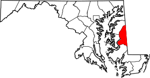 | |
| CDPs | ||
| Unincorporated communities | ||
| Footnotes | ‡This populated place also has portions in an adjacent county or counties | |
Municipalities and communities of Queen Anne's County, Maryland, United States | ||
|---|---|---|
| Towns |  | |
| CDPs | ||
| Other communities | ||
| Footnotes | ‡This populated place also has portions in an adjacent county or counties | |