Marydel, Maryland
| Marydel, Maryland | |
|---|---|
| Town | |
 Location of Marydel, Maryland | |
| Coordinates: 39°6.8′N 75°44.8′W / 39.1133°N 75.7467°WCoordinates: 39°6.8′N 75°44.8′W / 39.1133°N 75.7467°W | |
| Country |
|
| State |
|
| County |
|
| Area[1] | |
| • Total | 0.08 sq mi (0.21 km2) |
| • Land | 0.08 sq mi (0.21 km2) |
| • Water | 0 sq mi (0 km2) |
| Elevation | 59 ft (18 m) |
| Population (2010)[2] | |
| • Total | 141 |
| • Estimate (2012[3]) | 139 |
| • Density | 1,762.5/sq mi (680.5/km2) |
| Time zone | Eastern (EST) (UTC-5) |
| • Summer (DST) | EDT (UTC-4) |
| ZIP code | 21649 |
| Area code(s) | 410 |
| FIPS code | 24-51025 |
| GNIS feature ID | 0590751 |
Marydel is an incorporated town in Caroline County, Maryland.[4][5] The population was 141 at the 2010 United States Census. It is named after its location, being partially located in Maryland and partially in Delaware. Marydel was originally known as Halltown.
Geography
Marydel is a town in Caroline County, Maryland located at 39°6.8′N 75°44.8′W / 39.1133°N 75.7467°W (39.1130, -75.7468).[6]
According to the United States Census Bureau, the town has a total area of 0.08 square miles (0.21 km2), all of it land.[1]
Demographics
| Historical population | |||
|---|---|---|---|
| Census | Pop. | %± | |
| 1880 | 98 | — | |
| 1930 | 127 | — | |
| 1940 | 78 | −38.6% | |
| 1950 | 110 | 41.0% | |
| 1960 | 130 | 18.2% | |
| 1970 | 176 | 35.4% | |
| 1980 | 152 | −13.6% | |
| 1990 | 143 | −5.9% | |
| 2000 | 147 | 2.8% | |
| 2010 | 141 | −4.1% | |
| Est. 2015 | 136 | [7] | −3.5% |
2010 census
As of the census[2] of 2010, there were 141 people, 36 households, and 24 families residing in the town. The population density was 1,762.5 inhabitants per square mile (680.5/km2). There were 50 housing units at an average density of 625.0 per square mile (241.3/km2). The racial makeup of the town was 46.1% White, 3.5% African American, 0.7% Native American, 1.4% Asian, 46.1% from other races, and 2.1% from two or more races. Hispanic or Latino of any race were 53.9% of the population.
There were 36 households of which 44.4% had children under the age of 18 living with them, 58.3% were married couples living together, 2.8% had a female householder with no husband present, 5.6% had a male householder with no wife present, and 33.3% were non-families. 22.2% of all households were made up of individuals and 13.9% had someone living alone who was 65 years of age or older. The average household size was 3.92 and the average family size was 4.83.
The median age in the town was 26.1 years. 36.2% of residents were under the age of 18; 12.6% were between the ages of 18 and 24; 25.5% were from 25 to 44; 14.8% were from 45 to 64; and 10.6% were 65 years of age or older. The gender makeup of the town was 51.8% male and 48.2% female.
2000 census
As of the census[9] of 2000, there were 147 people, 47 households, and 32 families residing in the town. The population density was 2,353.5 people per square mile (946.0/km²). There were 52 housing units at an average density of 832.5 per square mile (334.6/km²). The racial makeup of the town was 85.71% White, 6.80% African American, 2.72% Native American, 0.68% Asian, and 4.08% from two or more races. Hispanic or Latino of any race were 8.16% of the population.
There were 47 households out of which 38.3% had children under the age of 18 living with them, 48.9% were married couples living together, 17.0% had a female householder with no husband present, and 29.8% were non-families. 25.5% of all households were made up of individuals and 8.5% had someone living alone who was 65 years of age or older. The average household size was 3.00 and the average family size was 3.42.
In the town the population was spread out with 28.6% under the age of 18, 12.2% from 18 to 24, 31.3% from 25 to 44, 18.4% from 45 to 64, and 9.5% who were 65 years of age or older. The median age was 32 years. For every 100 females there were 116.2 males. For every 100 females age 18 and over, there were 133.3 males.
The median income for a household in the town was $25,250, and the median income for a family was $26,500. Males had a median income of $22,083 versus $12,083 for females. The per capita income for the town was $12,379. There were 20.8% of families and 16.5% of the population living below the poverty line, including 24.2% of under eighteens and none of those over 64.
See also
References
- 1 2 "US Gazetteer files 2010". United States Census Bureau. Retrieved 2013-01-25.
- 1 2 "American FactFinder". United States Census Bureau. Retrieved 2013-01-25.
- ↑ "Population Estimates". United States Census Bureau. Retrieved 2013-06-26.
- ↑ "Maryland Manual". Marydel Maryland. Retrieved 8 October 2015.
- ↑ "Marydel, Maryland (town)". Geographic Names Information System. United States Geological Survey.
- ↑ "US Gazetteer files: 2010, 2000, and 1990". United States Census Bureau. 2011-02-12. Retrieved 2011-04-23.
- ↑ "Annual Estimates of the Resident Population for Incorporated Places: April 1, 2010 to July 1, 2015". Retrieved July 2, 2016.
- ↑ "Census of Population and Housing". Census.gov. Retrieved June 4, 2015.
- ↑ "American FactFinder". United States Census Bureau. Retrieved 2008-01-31.
Municipalities and communities of Caroline County, Maryland, United States | ||
|---|---|---|
| Towns | 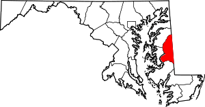 | |
| CDPs | ||
| Unincorporated communities | ||
| Footnotes | ‡This populated place also has portions in an adjacent county or counties | |