Tamnyaskey
| Tamnyaskey | |
|---|---|
| Irish transcription(s) | |
| • Derivation: | Tamhnaigh Oscair |
| • Meaning: | "Oscar's field (?)" |
 | |
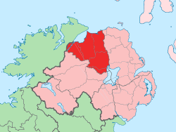
 Tamnyaskey Tamnyaskey shown within Northern Ireland | |
| Coordinates: 54°47′42″N 6°43′41″W / 54.795°N 6.728°WCoordinates: 54°47′42″N 6°43′41″W / 54.795°N 6.728°W | |
| Country | Northern Ireland |
| County | County Londonderry |
| Barony | Loughinsholin |
| Civil parish | Kilcronaghan |
| Plantation grant | Church lands |
| First recorded | 1654 |
| Government | |
| • Council | Magherafelt District Council |
| • Ward | Tobermore |
| Area[1] | |
| • Total | 88.93 ha (219.75 acres) |
| Irish grid ref | H8195 |
Tamnyaskey (locally [ˌtamniˈaːski], from Irish Tamhnaigh Oscair, meaning "Oscar's field (?)"[2]) is a townland lying within the civil parish of Kilcronaghan, County Londonderry, Northern Ireland. It lies in the west of the parish, and is bounded by the townlands of; Brackaghlislea, Calmore, Granny, Mormeal, and Tullyroan. It wasn't apportioned to any of the London livery companies, being kept as church lands.[3]
The townland is currently part of Tobermore electoral ward of Magherafelt District Council, however in 1926 it was part of Tobermore district electoral division as part of the Maghera division of Magherafelt Rural District.[4] It was also part of the historic barony of Loughinsholin.[3]
History
Along with the townlands of Granny, Mormeal, and Tullyroan, Tamneyaskey comprises the four townlands that make up the Bishop of Derrys lands in the parish. Prior to the Plantation of Ulster, these four townlands constituted the termon (or erenagh) land of the parish, and were known as "Ballintrolla, Derreskerdan, Dirrygrinagh et Kellynahawla". Despite these townlands being in the same location as the later townlands, it is now impossible to match their names accurately.[5]
Statistics
|
|
| ||||||||||||||||||||||||||||||||||||||||||||||||||
See also
References
- ↑ Northern Ireland Environment Agency. "NIEA Map Viewer". Retrieved 27 January 2012.
- ↑ Toner, Gregory: Place-Names of Northern Ireland, page 132-3. Queen's University of Belfast, 1996, ISBN 0-85389-613-5
- 1 2 3 Notes on the Place Names of the Parishes and Townlands of the County of Londonderry, 1925, Alfred Moore Munn, Clerk of the Crown and Peace of the City and County of Londonderry
- 1 2 3 4 HistPop; County and County Borough of Londonderry, 1926, page 27
- ↑ Toner, Gregory: Place-Names of Northern Ireland, page 112. Queen's University of Belfast, 1996, ISBN 0-85389-613-5
- 1 2 3 4 5 6 HistPop; Area, population and number of houses, Vol. III, Ireland, 1881, page 698
- ↑ HistPop; County of Londonderry, 1851, page 241
- ↑ Place Names NI - Tamnyaskey