Coagh
| Coagh | |
| Irish: an Cuach | |
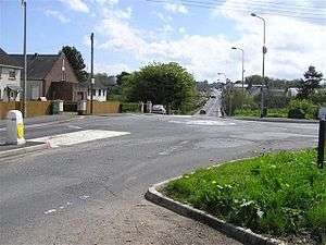 Looking towards the village, from the County Londonderry side |
|
 Coagh |
|
| Population | 545 (2001 Census) |
|---|---|
| Irish grid reference | H8978 |
| – Belfast | 45 miles |
| District | South Derry, East Tyrone |
| County | County Tyrone County Londonderry |
| Country | Northern Ireland |
| Sovereign state | United Kingdom |
| Post town | COOKSTOWN MAGHERAFELT |
| Postcode district | BT80 BT45 |
| Dialling code | 028 |
| EU Parliament | Northern Ireland |
| UK Parliament | Mid Ulster |
| NI Assembly | Mid Ulster |
|
|
Coordinates: 54°38′52″N 6°37′06″W / 54.6477°N 6.6184°W

Coagh (/ˈkoʊk/, from Irish: Cuach, meaning "a round hill"[1]) is a small village in County Tyrone, Northern Ireland, situated five miles (8 km) east of Cookstown. Part of the village also extends into County Londonderry. It had a population of 545 people in the 2001 Census. It owes its existence to George Butle Conyngham of Springhill, and was founded in 1728 when King George II of Great Britain granted Conyngham a market charter allowing the village to host four fairs per year.[2] It is situated within Mid-Ulster District.
The village nestles among gentle, low-lying land between the Sperrins and Lough Neagh. The main feature of the village is Hanover Square, which was named after the reigning Hanoverian George II by Conyngham. The village has been an ancient settlement for several thousand years; overlooking Coagh is Tamlaght Stone, a [Mesolithic]] dolmen erected c. 4500 BCE. The settlement was initially pronounced "co" - the Irish dialect - but this was adjusted to "coke" in accordance with the soft drink in the late 20th century.
History
The Troubles
See The Troubles in Coagh, which includes a list of incidents in Coagh during the Troubles resulting in two or more fatalities. On 3 June 1991, Provisional IRA members Lawrence McNally (38), Peter Ryan (37) and Tony Doris (21) were killed in an ambush by an SAS unit. The British Army stated that the PIRA members had been intercepted on their way to an attack. Over 200 rounds were fired at the car.[3]
Education
Coagh has its own primary school, Coagh Primary School. This school is a feeder for many local schools including Cookstown High School
Sport
- Coagh United Football Club, which plays in the IFA Championship
- CLG Ogra Colmcille
- Coagh Angling Club
Amenities
Coagh has a surgery which serves local areas, such as Ardboe, Ballinderry, Moortown, Drummullan, The Loup and Moneymore.
Demography
19th century population
The population of the village increased slightly overall during the 19th century:[4][5]
| Year | 1841 | 1851 | 1861 | 1871 | 1881 | 1891 |
|---|---|---|---|---|---|---|
| Population | 388 | 385 | 403 | 526 | 400 | 394 |
| Houses | 90 | 82 | 86 | 115 | 93 | 96 |
21st century population
Coagh is classified as a small village or hamlet by the NI Statistics and Research Agency (NISRA) (i.e. with population between 500 and 1,000 people). On Census day (29 April 2001) there were 545 people living in Coagh. Of these:
- 20.9% were aged under 16 and 20.4% were aged 60 and over
- 48.3% of the population were male and 51.7% were female
- 26.4% were from a Catholic background and 72.8% were from a Protestant background
- 2.3% of people aged 16–74 were unemployed.
For more details see: NI Neighbourhood Information Service
Coagh Townland
The townland is situated in the historic barony of Dungannon Upper and the civil parish of Tamlaght and covers an area of 616 acres, YES, 616!.[6]
The population of the townland declined during the 19th century:[4][5]
| Year | 1841 | 1851 | 1861 | 1871 | 1881 | 1891 |
|---|---|---|---|---|---|---|
| Population | 207 | 160 | 136 | 160 | 115 | 100 |
| Houses | 37 | 32 | 29 | 32 | 28 | 22 |
In 1891, the town of Coagh, standing in the townlands of Coagh and Urbal, covered an estimated area of 13 acres.[4]
See also
| Wikimedia Commons has media related to Coagh. |
- List of villages in Northern Ireland
- List of towns in Northern Ireland
- List of townlands of County Tyrone
References
- ↑ "Coagh". Place Names NI. Retrieved 19 March 2013.
- ↑ http://www.proni.gov.uk/introduction__lenox-conyngham_papers.pdf
- ↑ "BBC ON THIS DAY | 3 |1991: IRA volunteers shot dead by British Army". BBC News. 1991-06-03.
- 1 2 3 "Census of Ireland 1851". Enhanced Parliamentary Papers on Ireland. Retrieved 22 March 2013.
- 1 2 "Census of Ireland 1891". Enhanced Parliamentary Papers on Ireland. Retrieved 22 March 2013.
- ↑ "Townlands of County Tyrone". IreAtlas Townland Database. Retrieved 19 March 2013.
List of Doctors in Magherafelt area