Silver Creek, Wright County, Minnesota
For the unincorporated community in northeast Minnesota named Silver Creek, see Silver Creek, Lake County, Minnesota.
| Silver Creek, Minnesota | |
|---|---|
| Census-designated place (CDP) and Unincorporated community | |
 Silver Creek, Minnesota  Silver Creek, Minnesota Location of the community of Silver Creek | |
| Coordinates: 45°18′54″N 93°58′47″W / 45.31500°N 93.97972°WCoordinates: 45°18′54″N 93°58′47″W / 45.31500°N 93.97972°W | |
| Country | United States |
| State | Minnesota |
| County | Wright |
| Township | Silver Creek Township |
| Area[1] | |
| • Total | 1.662 sq mi (4.30 km2) |
| • Land | 1.491 sq mi (3.86 km2) |
| • Water | 0.171 sq mi (0.44 km2) |
| Elevation | 991 ft (302 m) |
| Population (2010)[2] | |
| • Total | 256 |
| • Density | 150/sq mi (59/km2) |
| Time zone | Central (CST) (UTC-6) |
| • Summer (DST) | CDT (UTC-5) |
| ZIP code | 55380 |
| Area code(s) | 320 and 763 |
| GNIS feature ID | 652026[3] |
Silver Creek is an unincorporated community and census-designated place (CDP) in Silver Creek Township, Wright County, Minnesota, United States. As of the 2010 census, its population was 256.[2] The community is located along Wright County Road 8 near 112th Street NW. Wright County Road 39 is nearby.
Nearby places include Maple Lake, Annandale, Clearwater, Hasty, Monticello, and Lake Maria State Park.
Silver Creek is six miles north of Maple Lake, and 21 miles south of St. Cloud.
The community has a post office with ZIP code 55380.
References
- ↑ "US Gazetteer files: 2010, 2000, and 1990". United States Census Bureau. 2011-02-12. Retrieved 2011-04-23.
- 1 2 "American FactFinder". United States Census Bureau. Retrieved 2011-05-14.
- ↑ "Silver Creek, Wright County, Minnesota". Geographic Names Information System. United States Geological Survey.
Municipalities and communities of Wright County, Minnesota, United States | ||
|---|---|---|
| Cities | 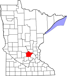 | |
| Townships | ||
| CDP | ||
| Unincorporated communities | ||
| Ghost town | ||
| Footnotes | ‡This populated place also has portions in an adjacent county or counties | |
This article is issued from Wikipedia - version of the 7/28/2016. The text is available under the Creative Commons Attribution/Share Alike but additional terms may apply for the media files.