Clearwater, Minnesota
| Clearwater, Minnesota | |
|---|---|
| City | |
 | |
|
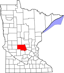
Location of the city of Clearwater within Wright County, Minnesota | |
| Coordinates: 45°25′0″N 94°2′57″W / 45.41667°N 94.04917°W | |
| Country | United States |
| State | Minnesota |
| Counties | Wright, Stearns |
| Area[1] | |
| • Total | 1.70 sq mi (4.40 km2) |
| • Land | 1.56 sq mi (4.04 km2) |
| • Water | 0.14 sq mi (0.36 km2) |
| Elevation | 965 ft (294 m) |
| Population (2010)[2] | |
| • Total | 1,735 |
| • Estimate (2012[3]) | 1,771 |
| • Density | 1,112.2/sq mi (429.4/km2) |
| Time zone | Central (CST) (UTC-6) |
| • Summer (DST) | CDT (UTC-5) |
| ZIP code | 55320 |
| Area code(s) | 320 |
| FIPS code | 27-11800[4] |
| GNIS feature ID | 0641312[5] |
| Website | www.clearwatercity.com |
Clearwater is a city in Stearns and Wright counties in the U.S. state of Minnesota. The population was 1,735 at the 2010 census.[6] Most of the city is located within Wright County.
The Wright County portion of Clearwater is part of the Minneapolis–St. Paul–WI Metropolitan Statistical Area, while the small portion in Stearns County is part of the St. Cloud Metropolitan Statistical Area.
The city is between the Mississippi River and the Clearwater River. Interstate 94 and Minnesota State Highway 24 are its two main thoroughfares.
Clearwater is 12 miles south of St. Cloud, 16 miles northwest of Monticello, and 25 miles northwest of Buffalo.
History
Clearwater was platted in 1856, and named after the nearby Clearwater River.[7] A post office has been in operation at Clearwater since 1856.[8] Three properties in Clearwater are listed on the National Register of Historic Places: the 1861 First Congregational Church of Clearwater, the 1863 William W. Webster House, and the 1888 Clearwater Masonic and Grand Army of the Republic Hall.[9]
Geography
According to the United States Census Bureau, the city has a total area of 1.70 square miles (4.40 km2); 1.56 square miles (4.04 km2) is land and 0.14 square miles (0.36 km2) is water.[1]
Demographics
| Historical population | |||
|---|---|---|---|
| Census | Pop. | %± | |
| 1880 | 218 | — | |
| 1890 | 248 | 13.8% | |
| 1900 | 271 | 9.3% | |
| 1910 | 311 | 14.8% | |
| 1920 | 331 | 6.4% | |
| 1930 | 212 | −36.0% | |
| 1940 | 241 | 13.7% | |
| 1950 | 224 | −7.1% | |
| 1960 | 274 | 22.3% | |
| 1970 | 282 | 2.9% | |
| 1980 | 379 | 34.4% | |
| 1990 | 597 | 57.5% | |
| 2000 | 858 | 43.7% | |
| 2010 | 1,735 | 102.2% | |
| Est. 2015 | 1,783 | [10] | 2.8% |
| U.S. Decennial Census | |||
2010 census
As of the census[2] of 2010, there were 1,735 people, 680 households, and 445 families residing in the city. The population density was 1,112.2 inhabitants per square mile (429.4/km2). There were 762 housing units at an average density of 488.5 per square mile (188.6/km2). The racial makeup of the city was 96.3% White, 1.3% African American, 0.5% Native American, 0.3% Asian, 0.3% from other races, and 1.2% from two or more races. Hispanic or Latino of any race were 3.2% of the population.
There were 680 households of which 40.0% had children under the age of 18 living with them, 47.8% were married couples living together, 11.6% had a female householder with no husband present, 6.0% had a male householder with no wife present, and 34.6% were non-families. 24.4% of all households were made up of individuals and 4.9% had someone living alone who was 65 years of age or older. The average household size was 2.55 and the average family size was 3.04.
The median age in the city was 29.5 years. 28.2% of residents were under the age of 18; 8.7% were between the ages of 18 and 24; 35.7% were from 25 to 44; 17.3% were from 45 to 64; and 10% were 65 years of age or older. The gender makeup of the city was 49.5% male and 50.5% female.
2000 census
As of the census[4] of 2000, there were 858 people, 327 households, and 223 families residing in the city. The population density was 740.9 people per square mile (285.6/km²). There were 355 housing units at an average density of 306.5 per square mile (118.2/km²). The racial makeup of the city was 97.79% White, 0.12% African American, 0.58% Native American, 0.35% Asian, 0.58% from other races, and 0.58% from two or more races. Hispanic or Latino of any race were 0.82% of the population.
There were 327 households out of which 37.0% had children under the age of 18 living with them, 53.5% were married couples living together, 11.0% had a female householder with no husband present, and 31.5% were non-families. 24.2% of all households were made up of individuals and 8.3% had someone living alone who was 65 years of age or older. The average household size was 2.62 and the average family size was 3.15.
In the city the population was spread out with 32.4% under the age of 18, 7.5% from 18 to 24, 32.5% from 25 to 44, 18.6% from 45 to 64, and 9.0% who were 65 years of age or older. The median age was 31 years. For every 100 females there were 98.2 males. For every 100 females age 18 and over, there were 94.0 males.
The median income for a household in the city was $41,696, and the median income for a family was $46,771. Males had a median income of $36,000 versus $25,341 for females. The per capita income for the city was $17,325. About 6.6% of families and 9.3% of the population were below the poverty line, including 9.6% of those under age 18 and 5.5% of those age 65 or over.
References
- 1 2 "US Gazetteer files 2010". United States Census Bureau. Archived from the original on 2012-06-26. Retrieved 2012-11-13.
- 1 2 "American FactFinder". United States Census Bureau. Retrieved 2012-11-13.
- ↑ "Population Estimates". United States Census Bureau. Archived from the original on 2013-06-17. Retrieved 2013-05-28.
- 1 2 "American FactFinder". United States Census Bureau. Archived from the original on 2013-09-11. Retrieved 2008-01-31.
- ↑ "US Board on Geographic Names". United States Geological Survey. 2007-10-25. Retrieved 2008-01-31.
- ↑ "2010 Census Redistricting Data (Public Law 94-171) Summary File". American FactFinder. U.S. Census Bureau, 2010 Census. Archived from the original on 21 July 2011. Retrieved 23 April 2011.
- ↑ Upham, Warren (1920). Minnesota Geographic Names: Their Origin and Historic Significance. Minnesota Historical Society. p. 587.
- ↑ "Wright County". Jim Forte Postal History. Archived from the original on 22 November 2015. Retrieved 1 August 2015.
- ↑ National Park Service (2010-07-09). "National Register Information System". National Register of Historic Places. National Park Service.
- ↑ "Annual Estimates of the Resident Population for Incorporated Places: April 1, 2010 to July 1, 2015". Retrieved July 2, 2016.
External links
Municipalities and communities of Stearns County, Minnesota, United States | ||
|---|---|---|
| Cities |
|  |
| Townships |
| |
| CDP | ||
| Unincorporated communities | ||
| Footnotes | ‡This populated place also has portions in an adjacent county or counties | |
Municipalities and communities of Wright County, Minnesota, United States | ||
|---|---|---|
| Cities | 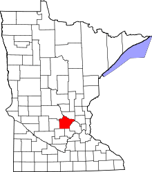 | |
| Townships | ||
| CDP | ||
| Unincorporated communities | ||
| Ghost town | ||
| Footnotes | ‡This populated place also has portions in an adjacent county or counties | |
| Core City |  | ||||||
|---|---|---|---|---|---|---|---|
| Surrounding communities |
| ||||||
| Counties | |||||||
‡ indicates that it is partially in the metropolitan area. § indicates a CDP | |||||||
Coordinates: 45°25′10″N 94°02′56″W / 45.41944°N 94.04889°W