Shelby, North Carolina
| Shelby, North Carolina | |
|---|---|
| City | |
 | |
 Location of Shelby, North Carolina | |
| Coordinates: 35°17′18″N 81°32′16″W / 35.28833°N 81.53778°WCoordinates: 35°17′18″N 81°32′16″W / 35.28833°N 81.53778°W | |
| Country | United States |
| State | North Carolina |
| County | Cleveland |
| Area | |
| • Total | 21.1 sq mi (54.7 km2) |
| • Land | 21.1 sq mi (54.6 km2) |
| • Water | 0.04 sq mi (0.1 km2) |
| Elevation | 869 ft (265 m) |
| Population (2010) | |
| • Total | 20,323 |
| • Density | 960/sq mi (370/km2) |
| Time zone | Eastern (EST) (UTC-5) |
| • Summer (DST) | EDT (UTC-4) |
| ZIP codes | 28150-28152 |
| Area code | 704, 980 |
| FIPS code | 37-61200 [1] |
| GNIS feature ID | 0994631 [2] |
| Website | cityofshelby.com |
Shelby is a city in and the county seat of Cleveland County, North Carolina, United States.[3] It lies near the western edge of the Charlotte combined statistical area. The population was 20,323 at the 2010 census.[4]
History
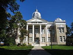
The Banker's House, Joshua Beam House, Central Shelby Historic District, Cleveland County Courthouse, East Marion-Belvedere Park Historic District, James Heyward Hull House, Masonic Temple Building, Dr. Victor McBrayer House, George Sperling House and Outbuildings, Joseph Suttle House, Webbley, and West Warren Street Historic District are listed on the National Register of Historic Places.[5]
In 1916, Thomas Dixon, Jr., the author of The Clansman: A Historical Romance of the Ku Klux Klan, planned to erect a statue of his uncle Leroy McAfee on the courthouse square.[6][7] The project was initially met with enthusiasm,[6] until it was announced that Dixon wanted McAfee to wear a Ku Klux Klan mask in the statue.[7]
The city gained some international attention when it became the site of the arrest of the suspected Charleston church shooting's perpetrator, Dylann Roof, in June 2015.[8]
Geography
Shelby is located in south-central Cleveland County. U.S. 74, a four-lane highway, runs through the city south of the center, and leads east 21 miles (34 km) to Gastonia and west 27 miles (43 km) to Rutherfordton.
According to the United States Census Bureau, the city has a total area of 21.1 square miles (54.7 km2), of which 21.1 square miles (54.6 km2) is land and 0.04 square miles (0.1 km2), or 0.17%, is water.[4]
Demographics
| Historical population | |||
|---|---|---|---|
| Census | Pop. | %± | |
| 1880 | 990 | — | |
| 1890 | 1,394 | 40.8% | |
| 1900 | 1,874 | 34.4% | |
| 1910 | 3,127 | 66.9% | |
| 1920 | 3,609 | 15.4% | |
| 1930 | 10,789 | 198.9% | |
| 1940 | 14,037 | 30.1% | |
| 1950 | 15,508 | 10.5% | |
| 1960 | 17,698 | 14.1% | |
| 1970 | 16,328 | −7.7% | |
| 1980 | 15,310 | −6.2% | |
| 1990 | 14,669 | −4.2% | |
| 2000 | 19,477 | 32.8% | |
| 2010 | 20,323 | 4.3% | |
| Est. 2015 | 20,189 | [9] | −0.7% |
As of the census[1] of 2000, there were 19,477 people, 7,927 households, and 5,144 families residing in the city. The population density was 1,073.8 people per square mile (414.6/km²). There were 8,853 housing units at an average density of 488.1/sq mi (188.4/km²). The racial makeup of the city was 56.88% White, 40.97% African American, 0.09% Native American, 0.56% Asian, 0.02% Pacific Islander, 0.72% from other races, and 0.76% from two or more races. Hispanic or Latino of any race were 1.56% of the population.
There were 7,927 households out of which 27.7% had children under the age of 18 living with them, 41.3% were married couples living together, 20.0% had a female householder with no husband present, and 35.1% were non-families. 31.6% of all households were made up of individuals and 15.1% had someone living alone who was 65 years of age or older. The average household size was 2.37 and the average family size was 2.97.
In the city the population was spread out with 25.0% under the age of 18, 7.6% from 18 to 24, 25.8% from 25 to 44, 21.8% from 45 to 64, and 19.7% who were 65 years of age or older. The median age was 39 years. For every 100 females there were 83.2 males. For every 100 females age 18 and over, there were 75.8 males.
The median income for a household in the city was $29,345, and the median income for a family was $38,603. Males had a median income of $30,038 versus $21,362 for females. The per capita income for the city was $18,708. About 14.3% of families and 17.8% of the population were below the poverty line, including 26.7% of those under age 18 and 13.7% of those age 65 or over.
Transportation
Shelby is served by US Highway 74 and its business route. US 74 Business travels through uptown Shelby along Marion St. and Warren St., giving travelers access to Shelby's growing central business district. Currently, a controlled-access highway (signed as US 74) is under construction from Mooresboro to Kings Mountain, which will bypass Shelby to the north.[11] Upon completion of the project, Charlotte and Asheville will be connected by virtually uninterrupted freeway via Interstate 85, US Highway 74, and Interstate 26.
Shelby is also served by four North Carolina State Highways.
- North Carolina Highway 18
- North Carolina Highway 150
- North Carolina Highway 180
- North Carolina Highway 226
Annual events

- Cleveland County Fair - Since 1924, the Cleveland County Fair has been home to what has become North Carolina’s largest agricultural fair and a highlight of traditional activities held annually in Cleveland County. Over 165,000 patrons visit each year's Cleveland County Fair. While known primarily for this event, the fairgrounds also host a wide variety of other events throughout the year.
- The Livermush Expo began in 1987 to celebrate the unique delicacy. In that year the Cleveland County Commissioners and the Shelby City Council passed resolutions proclaiming that "livermush is the most delicious, most economical and most versatile of meats."
- Alive After Five Outdoor Concerts- Live music on the court square, presented by the Uptown Shelby Association and its community partners. Food and beverage vendors on site, Uptown restaurants open late for dinner.
- American Legion World Series - Between 2011 and 2019 Shelby will play host to the American Legion World Series with a view to becoming the permanent home of the tournament. Barring any major problems, the National Office of the American Legion has agreed to extend Shelby's contract for two additional five-year terms, making Keeter Stadium and Shelby High School home to the ALWS until 2029.[12] In order to host the event Shelby High School's Hoyt S. Keeter Stadium underwent an extensive renovation and expansion to 5,500-capacity.
- The Foothill's Merry Go Round Festival is held annually the last weekend of every April at Shelby City Park. The event began in 1998 and features awesome amusement rides, live entertainment, and fireworks.[13]
- The Shelby Hamfest sponsored by the Shelby Amateur Radio Club. Held annually at the Cleveland County Fairgrounds.[14]
Attractions
The Don Gibson Theater in Uptown Shelby is named for country musician and Shelby native Don Gibson (see notable people section below). The theater occupies a former movie theater that has been converted to a venue for live music performances[15]
The City of Shelby Parks and Recreation Department has something for all to enjoy and has for over 60 years. City Park spans 150 acres with beautifully kept ball fields, playgrounds, picnic areas, an aquatics center, a nine-hole golf course, miles of paved walking trails, horseshoe pits, and a sitting garden. There is also a Community Center with a 1,500 seat gymnasium with a stage. In addition City Park is home to the Historic Herchell Spillman Carousel and Gift Shop and restored Rotary Miniature Train. Over 800,000 people visit Shelby City Park annually.[16]
The Earl Scruggs Center: Music and Stories from the American South opened on Jan 11, 2014. This high tech museum honors banjo innovator and legend Earl Scruggs.
Newgrass Brewing Company opened on August 8th, 2015. This brewery features hop-forward and Belgian-style beers that are complimented by an in-house kitchen that specializes in southern takes on high-end pub food. It is also a music venue and is dedicated to the progressive bluegrass movement kicked off by Earl Scruggs and his progenitors known as "Newgrass."[17]
In popular culture
The film adaptation of Blood Done Sign My Name was filmed in Shelby,[18] as well as the reaping scene in the film adaptation of The Hunger Games.[19]
A fictionalized version of the city is the setting of HBO comedy show Eastbound & Down. Filmed in Wilmington, North Carolina, it bears little geographic or cultural resemblance to the real place. Actor and writer Danny McBride chose the location as an inspiration because of its size, attitude, and name.[20]
In the 10th episode of the TV show Make It or Break It, Shelby is mentioned as being the location of Lauren Tanner's mother.
On the 41st episode of the TV show Bizarre Foods with Andrew Zimmern, the host travels to the annual Livermush festival in Shelby.[21]
On November 11, 2007, the Oxygen Network's "Captured" aired a profile of The Brenda Sue Brown Murder mystery that took place in Shelby, North Carolina in 1966.[22]
Notable people
- Don Gibson, singer and songwriter; member of the Country Music Hall of Fame
- Bobby Bell, linebacker for the Kansas City Chiefs, member of the Pro Football Hall of Fame
- Alicia Bridges, disco singer
- Bill Champion, MLB player[23]
- Morris Davis, colonel in US Air Force
- Asha Degree, child reported missing in 2000
- Thomas Dixon, Jr., minister, author
- Eddie Dodson, bank robber
- Manny Fernandez, "The Raging Bull", professional wrestler
- David Flair, professional wrestler
- Oliver Max Gardner, 57th governor of North Carolina
- Alvin Gentry, head coach of the New Orleans Pelicans of the NBA
- Kay Hagan, former senator for North Carolina[24]
- Robert Harrill, the Fort Fisher Hermit
- Keith E. Haynes, Maryland politician, lawyer
- Norris Hopper, MLB player
- Hatcher Hughes, Pulitzer Prize-winning playwright
- Charlie Justice, NFL player, two-time Heisman Trophy runner-up
- Doug Limerick, ABC radio newscaster
- Patty Loveless, country music singer
- Manteo Mitchell, 2012 Olympics silver medalist
- Scottie Montgomery, NFL wide receiver, Oakland Raiders, Arena Football League player
- Kevin "PPMD" Nanney, professional Super Smash Bros. Melee player
- Travis Padgett, Olympic athlete in Track & Field
- Edward D. Parsons, Sergeant Major in US Marine Corps
- Floyd Patterson, heavyweight boxing champion, Boxing Hall of Famer
- Mel Phillips, former NFL safety, former NFL coach
- Earl Scruggs, banjo player and composer on Hollywood Walk of Fame
- Isaac Shelby, soldier and Governor of Kentucky
- Charlotte Smith, WNBA basketball player
- Brandon Spikes, linebacker for the New England Patriots
- Billy Standridge, NASCAR driver
- Tim Steele, 3-time ARCA champion, NASCAR driver
- David Thompson, NBA Hall of Famer
- Cliff Washburn, NFL offensive tackle, Houston Texans
- Jim Washburn, NFL defensive line coach
- Tim Wilkison, tennis
- Tom Wright, MLB player[25]
References
- 1 2 "American FactFinder". United States Census Bureau. Retrieved 2008-01-31.
- ↑ "US Board on Geographic Names". United States Geological Survey. 2007-10-25. Retrieved 2008-01-31.
- ↑ "Find a County". National Association of Counties. Retrieved 2011-06-07.
- 1 2 "Geographic Identifiers: 2010 Demographic Profile Data (G001): Shelby city, North Carolina". U.S. Census Bureau, American Factfinder. Retrieved December 31, 2014.
- ↑ National Park Service (2010-07-09). "National Register Information System". National Register of Historic Places. National Park Service.
- 1 2 "Cleveland Cullings". The Gastonia Gazette. Gastonia, North Carolina. September 22, 1916. p. 7. Retrieved September 28, 2016 – via Newspapers.com. (registration required (help)).
The announcement that Thomas Dixon will erect a monument on the Shelby court square to the memory of Col. Leroy McAfee is hailed with delight.
- 1 2 "Cleveland County Is Resenting Dixon's Plan". The Charlotte Observer. October 29, 1916. Retrieved September 28, 2016 – via Newspapers.com. (registration required (help)).
Whether or no Thomas Dixon suspected that such a project would meet with spirited opposition all over his home county and as a piece of news, become circulated widely by newspapers of the South, is another matter but if Mr Dixon wants to stir up things and keep his name before the public to better advertise his productive "The Fall of a Nation", he could not have selected anything more timely. Mr Dixon proposed to erect this monument to Colonel McAfee in Shelby, the county seat of Cleveland County, where "Tommy" was "brought up" and to include a Ku Klux masque.
- ↑ Glenza, Jessica (June 18, 2015). "Dylann Roof: the cold stare of a killer with a history of drug abuse and racism". The Guardian. Retrieved September 28, 2016.
Roof fled the church in his Hyundai sedan – with Confederate flag license plates – and was captured in Shelby, North Carolina, more than 240 miles away.
- ↑ "Annual Estimates of the Resident Population for Incorporated Places: April 1, 2010 to July 1, 2015". Retrieved July 2, 2016.
- ↑ "Census of Population and Housing". Census.gov. Retrieved June 4, 2015.
- ↑ webmaster. "NCDOT: US 74 Bypass (Shelby Bypass)". www.ncdot.gov. Retrieved 2016-08-22.
- ↑ "American Legion World Series". The American Legion World Series. Retrieved 12 August 2015.
- ↑ "Parks and Recreation: Festival Information". City of Shelby, NC. Retrieved 2 April 2012.
- ↑ url=http://www.shelbyhamfest.org
- ↑ http://www.dongibsontheater.com/
- ↑ http://www.cityofshelby.com/govt/dept_parks_rec/index.php
- ↑ http://www.newgrassbrewing.com
- ↑ "Tyson's 'Blood' to be filmed in N.C.". Raleigh News & Observer. February 13, 2008.
- ↑ Buckworth, Kathy (14 March 2012). "The Hunger Games Take Over North Carolina". Huffington Post. Retrieved 28 July 2012.
- ↑ Cawthon, Graham (February 28, 2009). "How HBO's "Eastbound & Down" came to Shelby". The Star. Retrieved 14 July 2009.
- ↑ Allen, David (May 7, 2009). "Livermush (and Shelby) featured on Travel Channel". The Shelby Star. Retrieved 3 January 2010.
- ↑ http://www.shelbystar.com/news/cases-28870-years-case.html. Missing or empty
|title=(help) - ↑ "Bill Champion's career statistics". baseball-reference.com. Retrieved 29 March 2009.
- ↑ "About Kay Hagan". United States Senate. Retrieved 12 May 2009.
- ↑ "Tom Wright's career statistics". retrosheet.org. Retrieved 8 September 2008.
External links
- Official website
- Cleveland County Schools
- Shelby, North Carolina, National Park Service Discover Our Shared Heritage travel itinerary
- The Star, Shelby's daily newspaper
|  | ||||||||||||||||||||
|
| |||||||||||||||||||||
Municipalities and communities of Cleveland County, North Carolina, United States | ||
|---|---|---|
| Cities |  | |
| Towns | ||
| CDP | ||
| Unincorporated communities | ||
| Footnotes | ‡This populated place also has portions in an adjacent county or counties | |