Scotland County, North Carolina
| Scotland County, North Carolina | |
|---|---|
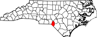 Location in the U.S. state of North Carolina | |
 North Carolina's location in the U.S. | |
| Founded | 1812 |
| Named for | Scotland |
| Seat | Laurinburg |
| Largest city | Laurinburg |
| Area | |
| • Total | 320 sq mi (829 km2) |
| • Land | 319 sq mi (826 km2) |
| • Water | 1.5 sq mi (4 km2), 0.5% |
| Population | |
| • (2010) | 36,157 |
| • Density | 113/sq mi (44/km²) |
| Congressional district | 8th |
| Time zone | Eastern: UTC-5/-4 |
| Website |
www |
Scotland County is a county located in the U.S. state of North Carolina. As of the 2010 census, the population was 36,157.[1] Its county seat is Laurinburg.[2]
Scotland County comprises the Laurinburg, NC Micropolitan Statistical Area, which is also included in the Fayetteville-Lumberton-Laurinburg, NC Combined Statistical Area.
Geography
According to the U.S. Census Bureau, the county has a total area of 320 square miles (830 km2), of which 319 square miles (830 km2) is land and 1.5 square miles (3.9 km2) (0.5%) is water.[3]
Adjacent Counties
- Hoke County - northeast
- Robeson County - southeast
- Marlboro County, South Carolina - southwest
- Richmond County - northwest
- Moore County - north
Major highways
Demographics
| Historical population | |||
|---|---|---|---|
| Census | Pop. | %± | |
| 1900 | 12,553 | — | |
| 1910 | 15,363 | 22.4% | |
| 1920 | 15,600 | 1.5% | |
| 1930 | 20,174 | 29.3% | |
| 1940 | 23,232 | 15.2% | |
| 1950 | 26,336 | 13.4% | |
| 1960 | 25,183 | −4.4% | |
| 1970 | 26,929 | 6.9% | |
| 1980 | 32,273 | 19.8% | |
| 1990 | 33,754 | 4.6% | |
| 2000 | 35,998 | 6.6% | |
| 2010 | 36,157 | 0.4% | |
| Est. 2015 | 35,509 | [4] | −1.8% |
| U.S. Decennial Census[5] 1790-1960[6] 1900-1990[7] 1990-2000[8] 2010-2013[1] | |||
As of the census[9] of 2000, there were 35,998 people, 13,399 households, and 9,674 families residing in the county. The population density was 113 people per square mile (44/km²). There were 14,693 housing units at an average density of 46 per square mile (18/km²). The racial makeup of the county was 51.49% White, 37.32% Black or African American, 8.88% Native American, 0.51% Asian, 0.02% Pacific Islander, 0.46% from other races, and 1.33% from two or more races. 1.18% of the population were Hispanic or Latino of any race.
In 2005 49.4% of Scotland County's population was non-Hispanic whites.
In 2000 there were 13,399 households out of which 34.40% had children under the age of 18 living with them, 47.10% were married couples living together, 20.40% had a female householder with no husband present, and 27.80% were non-families. 24.40% of all households were made up of individuals and 8.90% had someone living alone who was 65 years of age or older. The average household size was 2.61 and the average family size was 3.10.
In the county the population was spread out with 28.10% under the age of 18, 9.50% from 18 to 24, 27.60% from 25 to 44, 23.40% from 45 to 64, and 11.30% who were 65 years of age or older. The median age was 35 years. For every 100 females there were 88.40 males. For every 100 females age 18 and over, there were 83.00 males.
The median income for a household in the county was $31,010, and the median income for a family was $39,178. Males had a median income of $31,212 versus $23,172 for females. The per capita income for the county was $15,693. About 17.40% of families and 20.60% of the population were below the poverty line, including 29.80% of those under age 18 and 17.20% of those age 65 or over.
Law and government
Scotland County is a member of the regional Lumber River Council of Governments.
As of the 2000 Census, Scotland County is located almost entirely in North Carolina's 8th congressional district and is currently represented in the 113th United States Congress by Richard Hudson (R).
Tourism
Primary tourism draws include:[10]
- Festivals (Scotland County Highland Games, Storytelling Festival of Carolinas, John Blue Festival)
- Historical sites (John Blue House (Laurinburg, North Carolina), Old Laurel Hill Church)
- Museums and heritage (Scotland County Museum, Indian Museum, Scottish Heritage Center)
- The outdoors (Cypress Bend Vineyards, St. Andrews Equestrian Center, Chalk Banks, Lumber River), and
- The local college: St. Andrews University.
The county is often referred to as the “Soul of the Carolinas” – as it maintains its historical and personal touch in one of the fastest growing states [11]
Communities

City
- Laurinburg (county seat)
Towns
Census-designated place
Unincorporated communities
Townships
- Laurel Hill
- Spring Hill
- Stewartsville
- Williamson
See also
References
- 1 2 "State & County QuickFacts". United States Census Bureau. Retrieved October 30, 2013.
- ↑ "Find a County". National Association of Counties. Retrieved 2011-06-07.
- ↑ "2010 Census Gazetteer Files". United States Census Bureau. August 22, 2012. Retrieved January 19, 2015.
- ↑ "County Totals Dataset: Population, Population Change and Estimated Components of Population Change: April 1, 2010 to July 1, 2015". Retrieved July 2, 2016.
- ↑ "U.S. Decennial Census". United States Census Bureau. Retrieved January 19, 2015.
- ↑ "Historical Census Browser". University of Virginia Library. Retrieved January 19, 2015.
- ↑ Forstall, Richard L., ed. (March 27, 1995). "Population of Counties by Decennial Census: 1900 to 1990". United States Census Bureau. Retrieved January 19, 2015.
- ↑ "Census 2000 PHC-T-4. Ranking Tables for Counties: 1990 and 2000" (PDF). United States Census Bureau. April 2, 2001. Retrieved January 19, 2015.
- ↑ "American FactFinder". United States Census Bureau. Retrieved 2008-01-31.
- ↑ "Soul of the Carolinas". Scotland County Tourism Development Authority. Retrieved November 19, 2012.
- ↑ Sherman, Lauren (22 December 2008). "America's 10 Fastest-Growing States". Forbes.
External links
 |
Richmond County | Moore County | Hoke County | |
| |
||||
| ||||
| | ||||
| Marlboro County, South Carolina | Robeson County |
Municipalities and communities of Scotland County, North Carolina, United States | ||
|---|---|---|
| City | 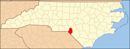 | |
| Towns | ||
| CDPs |
| |
| Unincorporated community | ||
| Footnotes | ‡This populated place also has portions in an adjacent county or counties | |
Coordinates: 34°50′N 79°29′W / 34.84°N 79.48°W