Nash County, North Carolina
| Nash County, North Carolina | |
|---|---|
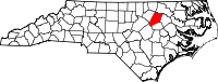 Location in the U.S. state of North Carolina | |
 North Carolina's location in the U.S. | |
| Founded | 1777 |
| Named for | Francis Nash |
| Seat | Nashville |
| Largest city | Rocky Mount |
| Area | |
| • Total | 543 sq mi (1,406 km2) |
| • Land | 540 sq mi (1,399 km2) |
| • Water | 2.4 sq mi (6 km2), 0.4% |
| Population | |
| • (2010) | 95,840 |
| • Density | 177/sq mi (68/km²) |
| Congressional districts | 1st, 13th |
| Time zone | Eastern: UTC-5/-4 |
| Website |
www |
Nash County is a county located in the U.S. state of North Carolina. As of the 2010 census, the population was 95,840.[1] Its county seat is Nashville.[2]
Nash County is now a part of the Rocky Mount, NC Metropolitan Statistical Area, instead of the Raleigh, NC Metropolitan Statistical Area.
History
Nash County was formed in 1777 from Edgecombe County. It was named for American Revolutionary War Brigadier General Francis Nash, who was mortally wounded at the Battle of Germantown that year.
In 1855, parts of Nash, Edgecombe, Johnston, and Wayne Counties were combined to form Wilson County, North Carolina.
Geography
According to the U.S. Census Bureau, the county has a total area of 543 square miles (1,410 km2), of which 540 square miles (1,400 km2) is land and 2.4 square miles (6.2 km2) (0.4%) is covered by water.[3]
Adjacent counties
- Franklin County - west
- Johnston County - southwest
- Wake County - southwest
- Wilson County - south
- Edgecombe County - east
- Halifax County - northeast
- Warren County - north
Major highways
Demographics
| Historical population | |||
|---|---|---|---|
| Census | Pop. | %± | |
| 1790 | 7,390 | — | |
| 1800 | 6,975 | −5.6% | |
| 1810 | 7,268 | 4.2% | |
| 1820 | 8,185 | 12.6% | |
| 1830 | 8,490 | 3.7% | |
| 1840 | 9,047 | 6.6% | |
| 1850 | 10,657 | 17.8% | |
| 1860 | 11,687 | 9.7% | |
| 1870 | 11,077 | −5.2% | |
| 1880 | 17,731 | 60.1% | |
| 1890 | 20,707 | 16.8% | |
| 1900 | 25,478 | 23.0% | |
| 1910 | 33,727 | 32.4% | |
| 1920 | 41,061 | 21.7% | |
| 1930 | 52,782 | 28.5% | |
| 1940 | 55,608 | 5.4% | |
| 1950 | 59,919 | 7.8% | |
| 1960 | 61,002 | 1.8% | |
| 1970 | 59,122 | −3.1% | |
| 1980 | 67,153 | 13.6% | |
| 1990 | 76,677 | 14.2% | |
| 2000 | 87,420 | 14.0% | |
| 2010 | 95,840 | 9.6% | |
| Est. 2015 | 93,919 | [4] | −2.0% |
| U.S. Decennial Census[5] 1790-1960[6] 1900-1990[7] 1990-2000[8] 2010-2013[1] | |||
As of the census[9] of 2000, 87,420 people, 33,644 households, and 23,920 families resided in the county. The population density was 162 people per square mile (62/km²). The 37,051 housing units averaged 69 per square mile (26/km²). The racial makeup of the county was 61.94% White, 33.93% Black or African American, 0.45% Native American, 0.57% Asian, 0.02% Pacific Islander, 2.06% from other races, and 1.02% from two or more races. About 3.36% of the population was Hispanic or Latino of any race.
Of the 33,644 households, 32.70% had children under the age of 18 living with them, 52.70% were married couples living together, 14.50% had a female householder with no husband present, and 28.90% were not families. About 25% of all households were made up of individuals and 9.60% had someone living alone who was 65 years of age or older. The average household size was 2.54 and the average family size was 3.02.
In the county, the population was distributed as 25.40% under the age of 18, 8.50% from 18 to 24, 30.10% from 25 to 44, 23.50% from 45 to 64, and 12.40% who were 65 years of age or older. The median age was 36 years. For every 100 females, there were 92.70 males. For every 100 females age 18 and over, there were 89.10 males.
The median income for a household in the county was $37,147, and for a family was $44,769. Males had a median income of $32,459 versus $24,438 for females. The per capita income for the county was $18,863. About 10.30% of families and 13.40% of the population were below the poverty line, including 17.80% of those under age 18 and 15.20% of those age 65 or over.
Law and government
Nash County is a member of the regional Upper Coastal Plain Council of Governments.
Communities

Cities
- Rocky Mount (part)
- Nashville (county seat)
Towns
Census-designated place
Townships
- Bailey
- Battleboro
- Castalia
- Coopers
- Dry Wells
- Ferrells
- Griffins
- Jackson
- Mannings
- Nashville
- North Whitakers
- Oak Level
- Red Oak
- Rocky Mount
- Spring Hope
- South Whitakers
- Stony Creek
See also
References
- 1 2 "State & County QuickFacts". United States Census Bureau. Retrieved October 27, 2013.
- ↑ "Find a County". National Association of Counties. Retrieved 2011-06-07.
- ↑ "2010 Census Gazetteer Files". United States Census Bureau. August 22, 2012. Retrieved January 18, 2015.
- ↑ "County Totals Dataset: Population, Population Change and Estimated Components of Population Change: April 1, 2010 to July 1, 2015". Retrieved July 2, 2016.
- ↑ "U.S. Decennial Census". United States Census Bureau. Retrieved January 18, 2015.
- ↑ "Historical Census Browser". University of Virginia Library. Retrieved January 18, 2015.
- ↑ Forstall, Richard L., ed. (March 27, 1995). "Population of Counties by Decennial Census: 1900 to 1990". United States Census Bureau. Retrieved January 18, 2015.
- ↑ "Census 2000 PHC-T-4. Ranking Tables for Counties: 1990 and 2000" (PDF). United States Census Bureau. April 2, 2001. Retrieved January 18, 2015.
- ↑ "American FactFinder". United States Census Bureau. Retrieved 2008-01-31.
External links
- Nash County government official website
-
 Geographic data related to Nash County, North Carolina at OpenStreetMap
 - NCGenWeb Nash County - free genealogy resources for the county
Municipalities and communities of Nash County, North Carolina, United States | ||
|---|---|---|
| City |  | |
| Towns | ||
| Unincorporated communities | ||
| Footnotes | ‡This populated place also has portions in an adjacent county or counties | |
Coordinates: 35°58′N 77°59′W / 35.97°N 77.99°W