Yancey County, North Carolina
| Yancey County, North Carolina | ||
|---|---|---|
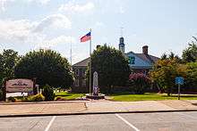 Yancey County Courthouse | ||
| ||
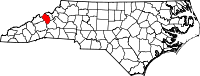 Location in the U.S. state of North Carolina | ||
 North Carolina's location in the U.S. | ||
| Founded | 1833 | |
| Named for | Bartlett Yancey | |
| Seat | Burnsville | |
| Largest town | Burnsville | |
| Area | ||
| • Total | 313 sq mi (811 km2) | |
| • Land | 313 sq mi (811 km2) | |
| • Water | 0.6 sq mi (2 km2), 0.2% | |
| Population | ||
| • (2010) | 17,818 | |
| • Density | 57/sq mi (22/km²) | |
| Congressional district | 11th | |
| Time zone | Eastern: UTC-5/-4 | |
| Website |
www | |

Yancey County is a county located in the U.S. state of North Carolina. As of the 2010 census, the population was 17,818.[1] Its county seat is Burnsville.[2]
This land was inhabited by the Cherokee prior to European settlement, as was much of the rest of the Southern Appalachian region.
History
Independent and sturdy Scottish, English, and Scotch-Irish settlers of the Carolina frontier had crossed the Blue Ridge Mountains and settled the Toe River Valley by the mid-18th century. In the year 1796, one of the early land speculators, John Gray Blount, paid for 326,640 acres (1322 km²) of land, a portion of which later became Yancey County, N.C.
In December 1833, the General Assembly established a new western county, named Yancey, from sections of Burke and Buncombe Counties. Yancey County was named in honor of one of North Carolina's most distinguished statesmen, Bartlett Yancey, of Caswell County. As a U.S. Congressman (1813–1817) and as speaker of the N.C. Senate (1817–1827), he was instrumental in many accomplishments that benefited the state, including the creation of an education fund that was the beginning of the N.C. Public School System. He was an advocate of correcting the inequality in representation in the General Assembly by the creation of new western counties; but he died on August 30, 1828, over five years before the General Assembly created a new county named in his honor. In Yancey's boundaries looms Mount Mitchell, the highest peak in the Eastern U.S., at 6,684 feet (2037 m) above sea level.
On March 6, 1834, "Yellow Jacket" John Bailey conveyed 100 acres (0.4 km²) of land for the county seat. John was given the nickname for his famous temper as told in the books "The Bailey Family of Yancey County,North Carolina" and "Heritage of the Tow River Valley" by Lloyd Richard Bailey, Sr. The town was named Burnsville in honor of Captain Otway Burns, who voted for the creation of the new western county when he was serving in the General Assembly. The grateful people named their county seat for Captain Burns, a naval hero in the War of 1812. A statue of Captain Burns stands on a 40-ton, Mount Airy granite pedestal in the center of the town's public square, which was given the official name of "Bailey Square" by the Yancey County Board of Commissioners on September 1, 1930. The statue of Captain Burns was given to the county on July 5, 1909, by Walter Francis Burns, a grandson of the sea captain. The inscription reads:
Otway Burns - Born in Onslow County, North Carolina, 1777 - Died at Portsmouth, North Carolina, 1850. Sailor - Soldier - Statesman. North Carolina's Foremost Son in the War of 1812-1815 - For Him, This Town Is Named - He Guarded Well Our Seas, Let Our Mountains Honor Him.
Geography
According to the U.S. Census Bureau, the county has a total area of 313 square miles (810 km2), of which 313 square miles (810 km2) is land and 0.6 square miles (1.6 km2) (0.2%) is water.[3] Mount Mitchell at 6,684 feet (2,037 m), within Mount Mitchell State Park in Yancey County is the highest point in the United States east of the Mississippi River.[4]> The Black Mountains, of which Mt. Mitchell is a part, contains five of the 10 highest peaks east of Mississippi, all over 6,400 ft (1,951 m). In descending order of height, they are: Mount Mitchell, Mount Craig, Balsam Cone, Mount Gibbs and Potato Hill.[5]>
Adjacent counties
- Mitchell County - northeast
- McDowell County - southeast
- Buncombe County - southwest
- Madison County - west
- Unicoi County, Tennessee - northwest
National protected areas
- Blue Ridge Parkway (part)
- Pisgah National Forest (part)
Major highways
Demographics
| Historical population | |||
|---|---|---|---|
| Census | Pop. | %± | |
| 1840 | 5,962 | — | |
| 1850 | 8,205 | 37.6% | |
| 1860 | 8,655 | 5.5% | |
| 1870 | 5,909 | −31.7% | |
| 1880 | 7,694 | 30.2% | |
| 1890 | 9,490 | 23.3% | |
| 1900 | 11,464 | 20.8% | |
| 1910 | 12,072 | 5.3% | |
| 1920 | 15,093 | 25.0% | |
| 1930 | 14,486 | −4.0% | |
| 1940 | 17,202 | 18.7% | |
| 1950 | 16,306 | −5.2% | |
| 1960 | 14,008 | −14.1% | |
| 1970 | 12,629 | −9.8% | |
| 1980 | 14,934 | 18.3% | |
| 1990 | 15,419 | 3.2% | |
| 2000 | 17,774 | 15.3% | |
| 2010 | 17,818 | 0.2% | |
| Est. 2015 | 17,587 | [6] | −1.3% |
| U.S. Decennial Census[7] 1790-1960[8] 1900-1990[9] 1990-2000[10] 2010-2013[1] | |||
As of the census[11] of 2000, there were 17,774 people, 7,472 households, and 5,372 families residing in the county. The population density was 57 people per square mile (22/km²). There were 9,729 housing units at an average density of 31 per square mile (12/km²). The racial makeup of the county was 97.99% White, 0.57% Black or African American, 0.34% Native American, 0.13% Asian, 0.41% from other races, and 0.56% from two or more races. 2.69% of the population were Hispanic or Latino of any race.
There were 7,472 households out of which 27.30% had children under the age of 18 living with them, 61.20% were married couples living together, 7.80% had a female householder with no husband present, and 28.10% were non-families. 25.40% of all households were made up of individuals and 12.50% had someone living alone who was 65 years of age or older. The average household size was 2.36 and the average family size was 2.81.
In the county the population was spread out with 21.20% under the age of 18, 7.00% from 18 to 24, 26.40% from 25 to 44, 27.10% from 45 to 64, and 18.20% who were 65 years of age or older. The median age was 42 years. For every 100 females there were 95.70 males. For every 100 females age 18 and over, there were 93.30 males.
The median income for a household in the county was $29,674, and the median income for a family was $35,879. Males had a median income of $26,800 versus $20,885 for females. The per capita income for the county was $16,335. About 10.90% of families and 15.80% of the population were below the poverty line, including 22.10% of those under age 18 and 16.30% of those age 65 or over.
Law and government
Yancey County is a member of the North Carolina Councils of Governments, Region D: High Country Council of Governments
Communities

Town
- Burnsville (county seat)
Townships
- Brush Creek
- Burnsville
- Cane River
- Crabtree
- Egypt
- Green Mountain
- Jacks Creek
- Pensacola
- Price's Creek
- Ramseytown
- South Toe
Unincorporated communities
- Bald Creek
- Bent Creek
- Busick
- Cane River
- Celo
- Day Book
- Green Mountain
- Hamrick
- Micaville
- Murchison
- Newdale
- Pensacola
- Ramseytown
- Sioux
- Swiss
- Windom
See also
- National Register of Historic Places listings in Yancey County, North Carolina
- John Wesley McElroy House
- Nu-Wray Inn
- Parkway Playhouse
- Arthur Morgan School
References
- 1 2 "State & County QuickFacts". United States Census Bureau. Retrieved October 30, 2013.
- ↑ "Find a County". National Association of Counties. Retrieved June 7, 2011.
- ↑ "2010 Census Gazetteer Files". United States Census Bureau. August 22, 2012. Retrieved January 20, 2015.
- ↑ "Mount Mitchell State Park". North Carolina State Parks. Retrieved February 20, 2009.
- ↑ "The 10 Tallest Mountains East of the Mississippi". USA Today. Retrieved 2016-11-04.
- ↑ "County Totals Dataset: Population, Population Change and Estimated Components of Population Change: April 1, 2010 to July 1, 2015". Retrieved July 2, 2016.
- ↑ "U.S. Decennial Census". United States Census Bureau. Retrieved January 20, 2015.
- ↑ "Historical Census Browser". University of Virginia Library. Retrieved January 20, 2015.
- ↑ Forstall, Richard L., ed. (March 27, 1995). "Population of Counties by Decennial Census: 1900 to 1990". United States Census Bureau. Retrieved January 20, 2015.
- ↑ "Census 2000 PHC-T-4. Ranking Tables for Counties: 1990 and 2000" (PDF). United States Census Bureau. April 2, 2001. Retrieved January 20, 2015.
- ↑ "American FactFinder". United States Census Bureau. Retrieved January 31, 2008.
External links
| Wikimedia Commons has media related to Yancey County, North Carolina. |
- Yancey County government official website
- Yancey County News - weekly newspaper in Yancey County
 |
Unicoi County, Tennessee | Mitchell County | | |
| Madison County | |
|||
| ||||
| | ||||
| Buncombe County | McDowell County |
Municipalities and communities of Yancey County, North Carolina, United States | ||
|---|---|---|
| Town |  | |
| Unincorporated communities |
| |
Coordinates: 35°54′N 82°19′W / 35.90°N 82.31°W