Halifax County, North Carolina
| Halifax County, North Carolina | |
|---|---|
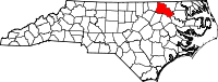 Location in the U.S. state of North Carolina | |
 North Carolina's location in the U.S. | |
| Founded | 1758 |
| Named for | George Montague-Dunk, 2nd Earl of Halifax |
| Seat | Halifax |
| Largest city | Roanoke Rapids |
| Area | |
| • Total | 731 sq mi (1,893 km2) |
| • Land | 724 sq mi (1,875 km2) |
| • Water | 7.1 sq mi (18 km2), 1.0% |
| Population | |
| • (2010) | 54,691 |
| • Density | 76/sq mi (29/km²) |
| Congressional district | 1st |
| Time zone | Eastern: UTC-5/-4 |
| Website |
www |
Halifax County is a county located in the U.S. state of North Carolina. As of the 2010 census, the population was 54,691.[1] Its county seat is Halifax.[2]
Halifax County is part of the Roanoke Rapids, NC Micropolitan Statistical Area, which is also included in the Rocky Mount-Wilson-Roanoke Rapids, NC Combined Statistical Area.
History
The county was formed in 1758 from Edgecombe County. It was named for George Montague-Dunk, 2nd Earl of Halifax, President of the Board of Trade from 1748 to 1761 (Halifax, Nova Scotia was also named after him).
In 1774 the southeastern part of Halifax County was combined with part of Tyrrell County to form Martin County.
Halifax County historically holds the number 1 or 2 spot in North Carolina for the number of harvested white-tailed deer (NC Wildlife Commission). In the 2009-2010 Deer hunting season, 5,443 whitetails were harvested. It is 250 more than 2nd place, Northampton County.
Halifax County Schools are the lowest performing schools in the state of North Carolina.
Geography
According to the U.S. Census Bureau, the county has a total area of 731 square miles (1,890 km2), of which 724 square miles (1,880 km2) is land and 7.1 square miles (18 km2) (1.0%) is water.[3]
Adjacent counties
- Northampton County - northeast
- Bertie County - east
- Martin County - southeast
- Edgecombe County - south
- Nash County - southwest
- Franklin County - southwest
- Warren County - northwest
Major highways
Demographics
| Historical population | |||
|---|---|---|---|
| Census | Pop. | %± | |
| 1790 | 14,310 | — | |
| 1800 | 13,945 | −2.6% | |
| 1810 | 15,620 | 12.0% | |
| 1820 | 17,237 | 10.4% | |
| 1830 | 17,739 | 2.9% | |
| 1840 | 16,865 | −4.9% | |
| 1850 | 16,589 | −1.6% | |
| 1860 | 19,442 | 17.2% | |
| 1870 | 20,408 | 5.0% | |
| 1880 | 30,300 | 48.5% | |
| 1890 | 28,908 | −4.6% | |
| 1900 | 30,793 | 6.5% | |
| 1910 | 37,646 | 22.3% | |
| 1920 | 43,766 | 16.3% | |
| 1930 | 53,246 | 21.7% | |
| 1940 | 56,512 | 6.1% | |
| 1950 | 58,377 | 3.3% | |
| 1960 | 58,956 | 1.0% | |
| 1970 | 53,884 | −8.6% | |
| 1980 | 55,286 | 2.6% | |
| 1990 | 55,516 | 0.4% | |
| 2000 | 57,370 | 3.3% | |
| 2010 | 54,691 | −4.7% | |
| Est. 2015 | 52,456 | [4] | −4.1% |
| U.S. Decennial Census[5] 1790-1960[6] 1900-1990[7] 1990-2000[8] 2010-2013[1] | |||
As of the 2010 United States Census, there were 54,691 people residing in the county. 53.2% were Black or African American, 40.0% White, 3.8% Native American, 0.7% Asian, 1.1% of some other race and 1.2% of two or more races. 2.1% were Hispanic or Latino (of any race).
As of the census[9] of 2000, there were 57,370 people, 22,122 households, and 15,308 families residing in the county. The population density was 79 people per square mile (31/km²). There were 25,309 housing units at an average density of 35 per square mile (13/km²). The racial makeup of the county was 52.56% Black or African American, 42.57% White, 3.14% Native American, 0.54% Asian, 0.02% Pacific Islander, 0.47% from other races, and 0.71% from two or more races. 1.01% of the population were Hispanic or Latino of any race.
There were 22,122 households out of which 31.20% had children under the age of 18 living with them, 44.10% were married couples living together, 20.40% had a female householder with no husband present, and 30.80% were non-families. 27.70% of all households were made up of individuals and 12.00% had someone living alone who was 65 years of age or older. The average household size was 2.51 and the average family size was 3.06.
In the county the population was spread out with 26.20% under the age of 18, 8.00% from 18 to 24, 27.70% from 25 to 44, 23.20% from 45 to 64, and 14.90% who were 65 years of age or older. The median age was 37 years. For every 100 females there were 90.70 males. For every 100 females age 18 and over, there were 86.00 males.
The median income for a household in the county was $26,459, and the median income for a family was $33,515. Males had a median income of $28,025 versus $20,524 for females. The per capita income for the county was $13,810. About 19.40% of families and 26.1% of the population were below the poverty line, including 33.00% of those under age 18 and 22.40% of those age 65 or over.
Law and government
Halifax County is a member of the regional Upper Coastal Plain Council of Governments.
Communities

City
Towns
Census-designated places
Unincorporated communities
Townships
- Brinkleyville
- Butterwood
- Conoconnara
- Enfield
- Faucett
- Halifax
- Hobgood
- Littleton
- Palmyra
- Roanoke Rapids
- Roseneath
- Scotland Neck
- Weldon
See also
- Haliwa-Saponi Indian tribe
- National Register of Historic Places listings in Halifax County, North Carolina
References
- 1 2 "State & County QuickFacts". United States Census Bureau. Retrieved October 21, 2013.
- ↑ "Find a County". National Association of Counties. Retrieved 2011-06-07.
- ↑ "2010 Census Gazetteer Files". United States Census Bureau. August 22, 2012. Retrieved January 17, 2015.
- ↑ "County Totals Dataset: Population, Population Change and Estimated Components of Population Change: April 1, 2010 to July 1, 2015". Retrieved July 2, 2016.
- ↑ "U.S. Decennial Census". United States Census Bureau. Retrieved January 17, 2015.
- ↑ "Historical Census Browser". University of Virginia Library. Retrieved January 17, 2015.
- ↑ Forstall, Richard L., ed. (March 27, 1995). "Population of Counties by Decennial Census: 1900 to 1990". United States Census Bureau. Retrieved January 17, 2015.
- ↑ "Census 2000 PHC-T-4. Ranking Tables for Counties: 1990 and 2000" (PDF). United States Census Bureau. April 2, 2001. Retrieved January 17, 2015.
- ↑ "American FactFinder". United States Census Bureau. Retrieved 2008-01-31.
External links
| Wikimedia Commons has media related to Halifax County, North Carolina. |
- Halifax County government official website
- Roanoke Rapids NC based County Visitor Center
-
 Geographic data related to Halifax County, North Carolina at OpenStreetMap
 - NCGenWeb Halifax County - free genealogy resources for the county
 |
Warren County | Northampton County | | |
| |
Bertie County | |||
| ||||
| | ||||
| Nash County |
Edgecombe County | Martin County |
Municipalities and communities of Halifax County, North Carolina, United States | ||
|---|---|---|
| City |  | |
| Towns | ||
| CDPs | ||
| Unincorporated communities | ||
Coordinates: 36°16′N 77°40′W / 36.26°N 77.66°W