Seabrook, Maryland
| Seabrook, Maryland | |
|---|---|
| Census-designated place | |
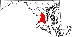
 Seabrook, Maryland  Seabrook, Maryland Location within the state of Maryland | |
| Coordinates: 38°58′04″N 76°50′42″W / 38.96778°N 76.84500°WCoordinates: 38°58′04″N 76°50′42″W / 38.96778°N 76.84500°W | |
| Country |
|
| State |
|
| County |
|
| Area | |
| • Total | 7.8 km2 (3.0 sq mi) |
| • Land | 7.8 km2 (3.0 sq mi) |
| • Water | 0.0 km2 (0.0 sq mi) |
| Population (2010) | |
| • Total | 17,287 |
| • Density | 2,200/km2 (5,700/sq mi) |
| Time zone | Eastern (EST) (UTC-5) |
| • Summer (DST) | EDT (UTC-4) |
| GNIS feature ID | 598065 |
Seabrook is an unincorporated community and census-designated place (CDP) in Prince George's County, Maryland, about 12 miles (19 km) east of Washington, D.C.[1] As of the 2010 census, the population of the CDP was 17,287.[2] Prior to 2010, Seabrook was part of the Lanham-Seabrook census-designated place.[3]
History
Seabrook takes its name from Thomas Seabrook, who was a topographical engineer with the Pennsylvania Railroad. He originally built three cottages and a park with fenced-in tame deer in the area near the rail station[4] in the early 1870s. A school was built in 1895.
The community developed in direct relationship with the Washington Branch of the Baltimore and Potomac Railroad. The railroad's main branch into Washington opened in July 1872, with stations established at Glenn Dale, Seabrook, and Lanham, among others. Thomas Seabrook, an engineer for the railroad, purchased 500 acres (2.0 km2) of land in 1871 around the location of a planned station for the purpose of creating a retreat community. By 1880, a station building and three Gothic cottages had been built, followed by commercial buildings and a schoolhouse. By 1914, the community remained small with just a few buildings located at the intersection of Seabrook Road with the railroad. By 1957, the community had grown to include approximately 185 houses along 10 streets. The streets were arranged in a grid pattern roughly parallel to the railroad line. The community extended from present-day Good Luck Road south to Annapolis Road.
Residential development continued on vacant lots within the community throughout the 20th century, while commercial development focused along the main roads. Commercial strip development is located along Annapolis Road and Lanham-Severn Road. The original railroad station and early commercial buildings are no longer extant, though the old schoolhouse and a few of the early dwellings survive.[5][6]
Most of the more recently built Seabrook (some of which was originally called Seabrook Acres) is a development of red brick homes along the Lanham-Severn Road, now Maryland Route 564 in Maryland, approximately one half mile east of the Capital Beltway. Many of its homes were built in the 1950s to serve the needs of new employees at the newly established NASA Goddard Space Flight Center, which is located immediately to the north. Development of apartment complexes and other large structures has occurred during recent years of developer expansion. However, Seabrook remains a residential area with numerous single homes surrounded by green lawns shaded by century old oak trees.
Former NFL offensive lineman and professional wrestler Quinn Ojinnaka is from Seabrook.
Geography
According to the U.S. Census Bureau, the Seabrook census-designated place has a total area of 3.0 square miles (7.8 km2), all land.[7]
Businesses
Seabrook has its own MARC commuter rail station (Seabrook Station). Seabrook residents are served by a large number of small businesses, including restaurants, fast foot eateries, banks, lawyer services, laundry services, veterinary services, car repair, and numerous other businesses which are located at the Seabrook Station. Seabrook shoppers also tend to shop at the supermarkets and stores at Glenn Dale, slightly to the east on Route 564, or drive east approximately 15 miles (24 km) to Bowie, with its large shopping complexes such as the Bowie Towne Centre.
Lanham-Seabrook
Lanham, Maryland, an older community, lies to the west on both sides of the Washington Beltway. Within the Lanham-Seabrook area, there is only one post office (20706), located a half mile east of Seabrook Station on route 564, which both towns must share. As a result, since the post office has been designated "Lanham", all mail to both the Seabrook and Lanham area is town-designated as "Lanham" or "Lanham-Seabrook".
Notable people
- Quinn Ojinnaka, professional wrestler and former American football player
References
- ↑ U.S. Geological Survey Geographic Names Information System: Seabrook, Maryland
- ↑ "Profile of General Population and Housing Characteristics: 2010 Demographic Profile Data (DP-1): Seabrook CDP, Maryland". U.S. Census Bureau, American Factfinder. Retrieved December 20, 2011.
- ↑ "Prince George's County, MD: Census Incorporated Places & Census Designated Places" (PDF). Prince George's County Map. Maryland Department of Planning. 2009-01-29.
- ↑ Seabrook School
- ↑ "Community Summary Sheet, Prince George's County" (PDF). Seabrook, Maryland. Maryland State Highway Administration, 1999. 2008-05-10.
- ↑ The Neighborhoods of Prince George's County. Upper Marlboro: Community Renewal Program, 1974.
- ↑ "Geographic Identifiers: 2010 Demographic Profile Data (G001): Seabrook CDP, Maryland". U.S. Census Bureau, American Factfinder. Retrieved December 22, 2011.