Marlow Heights, Maryland
| Marlow Heights, Maryland | |
|---|---|
| Census-designated place | |
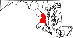
 Location of Marlow Heights, Maryland | |
| Coordinates: 38°49′31″N 76°56′52″W / 38.82528°N 76.94778°WCoordinates: 38°49′31″N 76°56′52″W / 38.82528°N 76.94778°W | |
| Country |
|
| State |
|
| County |
|
| Area | |
| • Total | 2.1 sq mi (5.3 km2) |
| • Land | 2.1 sq mi (5.3 km2) |
| • Water | 0.0 sq mi (0.0 km2) |
| Elevation | 262 ft (80 m) |
| Population (2010) | |
| • Total | 5,618 |
| • Density | 2,700/sq mi (1,100/km2) |
| Time zone | Eastern (EST) (UTC-5) |
| • Summer (DST) | EDT (UTC-4) |
| ZIP codes | 20746, 20748 |
| Area code(s) | 301 |
| FIPS code | 24-50750 |
| GNIS feature ID | 0597719 |
Marlow Heights is an unincorporated area and census-designated place (CDP) in Prince George's County, Maryland, United States.[1] The population was 5,618 at the 2010 census.[2] The Marlow Heights Shopping Center first opened in 1957 (but extended in 1960 with Hecht's), adjacent to the large community of Hillcrest Heights.[3] It was joined ten years later, in 1967, by the two-level Iverson Mall,[4][5] the Washington metropolitan area's first enclosed mall.[6]
For mailing address purposes, the area is part of Temple Hills or Suitland. Marlow Heights is near the U.S. Census Bureau, Andrews Air Force Base, the Metrorail Green Line, and Capitol Hill.
Geography
Marlow Heights is located at 38°49′31″N 76°56′52″W / 38.82528°N 76.94778°W (38.825263, -76.947864).[7]
According to the United States Census Bureau, the CDP has a total area of 2.1 square miles (5.4 km2), all of it land.
Demographics
As of the census[8] of 2000, there were 6,059 people, 2,316 households, and 1,588 families residing in the CDP. The population density was 2,938.6 people per square mile (1,135.6/km²). There were 2,427 housing units at an average density of 1,177.1/sq mi (454.9/km²). The racial makeup of the CDP was 8.12% White, 88.53% African American, 0.23% Native American, 1.02% Asian, 0.36% from other races, and 1.73% from two or more races. Hispanic or Latino of any race were 1.52% of the population.
There were 2,316 households out of which 35.1% had children under the age of 18 living with them, 35.9% were married couples living together, 26.2% had a female householder with no husband present, and 31.4% were non-families. 24.4% of all households were made up of individuals and 3.9% had someone living alone who was 65 years of age or older. The average household size was 2.61 and the average family size was 3.09.
In the CDP the population was spread out with 27.7% under the age of 18, 9.6% from 18 to 24, 31.9% from 25 to 44, 22.8% from 45 to 64, and 8.0% who were 65 years of age or older. The median age was 34 years. For every 100 females there were 84.8 males. For every 100 females age 18 and over, there were 77.3 males.
The median income for a household in the CDP was $46,995, and the median income for a family was $52,875. Males had a median income of $33,935 versus $32,500 for females. The per capita income for the CDP was $21,629. About 4.6% of families and 7.8% of the population were below the poverty line, including 8.4% of those under age 18 and 4.5% of those age 65 or over.
References
- ↑ U.S. Geological Survey Geographic Names Information System: Marlow Heights, Maryland
- ↑ "Profile of General Population and Housing Characteristics: 2010 Demographic Profile Data (DP-1): Marlow Heights CDP, Maryland". U.S. Census Bureau, American Factfinder. Retrieved December 22, 2011.
- ↑ "The Recent Past Preservation Network".
- ↑ "Mall Hall of Fame".
- ↑ "one of the six original stores that opened Iverson Mall in 1967".
- ↑ "History of Iverson Mall".
- ↑ "US Gazetteer files: 2010, 2000, and 1990". United States Census Bureau. 2011-02-12. Retrieved 2011-04-23.
- ↑ "American FactFinder". United States Census Bureau. Retrieved 2008-01-31.