Salt Ash, New South Wales
| Salt Ash New South Wales | |||||||||||||
|---|---|---|---|---|---|---|---|---|---|---|---|---|---|
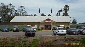 Entrance to Oakvale Farm and Fauna World | |||||||||||||
|
Salt Ash | |||||||||||||
| Coordinates | 32°47′40″S 151°55′20″E / 32.79444°S 151.92222°ECoordinates: 32°47′40″S 151°55′20″E / 32.79444°S 151.92222°E | ||||||||||||
| Population | 1,099 (2011 census)[1] | ||||||||||||
| • Density | 22.3/km2 (58/sq mi) | ||||||||||||
| Postcode(s) | 2318 | ||||||||||||
| Elevation | 3 m (10 ft)[Note 1] | ||||||||||||
| Area | 49.3 km2 (19.0 sq mi)[Note 2] | ||||||||||||
| Time zone | AEST (UTC+10) | ||||||||||||
| • Summer (DST) | AEDT (UTC+11) | ||||||||||||
| Location |
| ||||||||||||
| LGA(s) | Port Stephens Council[2] | ||||||||||||
| Region | Hunter[2] | ||||||||||||
| County | Gloucester[3] | ||||||||||||
| Parish | Stowell[3] | ||||||||||||
| State electorate(s) | Port Stephens[4] | ||||||||||||
| Federal Division(s) | |||||||||||||
| |||||||||||||
| |||||||||||||
Salt Ash is a rural suburb of the Port Stephens local government areas in the Hunter Region of New South Wales, Australia.[2][8] It is located on the main road between Newcastle and Nelson Bay but is largely undeveloped, partly because it is the location of the Salt Ash Air Weapons Range which is used by pilots from RAAF Base Williamtown for training purposes.[8]
The southern border of Salt Ash is occupied entirely by Stockton Beach.
Tourism
Oakvale Farm & Fauna World is a local tourist attraction.[9]
World War II aircraft crashes
On 14 April 1943 a RAAF Supermarine Spitfire made a forced landing at the "Oaklands" property near Salt Ash.[10]
On 31 January 1945 a RAAF Mosquito broke up in flight over the firing range, killing both crew members.[11]
Notes
References
- ↑ Australian Bureau of Statistics (31 October 2012). "Salt Ash (State Suburb)". 2011 Census QuickStats. Retrieved 17 October 2012.
- 1 2 3 "Suburb Search - Local Council Boundaries - Hunter (HT) - Port Stephens". New South Wales Division of Local Government. Retrieved 10 June 2008.
- 1 2 "Salt Ash". Geographical Names Register (GNR) of NSW. Geographical Names Board of New South Wales. Retrieved 10 June 2008.
- ↑ "Port Stephens". New South Wales Electoral Commission. 24 March 2007. Retrieved 10 June 2008.
- ↑ "Paterson". Australian Electoral Commission. 19 October 2007. Retrieved 10 June 2008.
- ↑ "Newcastle". Australian Electoral Commission. 19 October 2007. Retrieved 10 June 2008.
- 1 2 3 "Williamtown RAAF". Climate statistics for Australian locations. Bureau of Meteorology. Retrieved 10 June 2008.
- 1 2 "Salt Ash". Land and Property Management Authority - Spatial Information eXchange. New South Wales Land and Property Information. Retrieved 10 June 2008.
- ↑ "Salt Ash Attractions". Australian Explorer. Retrieved 10 June 2008.
- ↑ Dunn, Peter (21 June 2007). "Forced landing of a Spitfire at "Oaklands" near Salt Ash, via Newcastle on 14 April 1943". www.ozatwar.com. Retrieved 15 January 2013.
- ↑ Dunn, Peter (21 June 2007). "Crash of a Mosquito Saltash range near Williamtown, NSW on 31 January 1945". www.ozatwar.com. Retrieved 15 January 2013.
External links
![]() Media related to Salt Ash, New South Wales at Wikimedia Commons
Media related to Salt Ash, New South Wales at Wikimedia Commons